The bus interchange, as well as the bus terminal, is a busy transiting point for many of us to make our way to work, schools or home everyday.
Those were the days when many waited anxiously for their buses that did not come on time. Some ran after the departing buses. The rest were walking briskly as though time was never enough. Students lined up at the ticket offices to buy bus stamps for their concession passes.
And sometimes, one or two would board the wrong bus and end up at some ulu terminals.
The Bus Companies
Early Bus Services
Hundreds of individual bus operators used to ply their trades in Singapore before the Second World War. When they failed to form the Singapore Omnibus Services (SOS) to operate in the city, they moved their operations in small groups to the rural parts of the country. As many as 10 small Chinese companies provided bus services in places such as Punggol, Changi and Paya Lebar.

During the Japanese Occupation, all buses were seized resulting in almost a halt in bus services. After the war, the Chinese companies regained their possessions and continued operating in their respective districts.  In 1951, two of the companies Soon Lee Bus Company and Ngo Hock Bus Company joined to form the Hock Lee Amalgamated Bus Company Ltd (See Hock Lee Bus Strike of 1955). The fifties, however, were plagued by numerous strikes due to the poor wages and long working hours of bus drivers.
Another major player was the Singapore Traction Company (STC), which had a long history going back to the 1920s as the Singapore Electric Tramways Limited, which operated the electric trams. By the sixties, it was the biggest and oldest bus company in Singapore with a fleet of more than 400 buses that monopolised the routes in the city.

In April 1971, in order to standardise the bus fares, rationalise the routes and minimise the overlapping of operations, the 10 Chinese private bus companies were combined to form three large public bus companies, namely Amalgamated Bus Company (ABC) Ltd, Associated Bus Services Pte (ABS) Ltd and United Bus Company (UBC) Ltd.  The three companies were identified by the colours of blue, red and yellow respectively for their fleets of buses, while STC buses were painted green. In operation wise, ABC ran in the western parts of Singapore, while ABS took charge of the east. UBC was given the northern routes whereas STC continued their operations in southern Singapore.
The Debate
In the late sixties, there were suggestions to construct a rail system in Singapore as the main transport system. Former Minister of Finance Dr Goh Keng Swee was concerned with the cost, estimated to be around $5 billion, an astronomical amount especially for a newly independent nation. He proposed an all-bus system instead, and even invited two professors from Harvard to conduct research.
It was not until May 1982, after more than a decade of extensive studies, that the decision of building a rail-based MRT (Mass Rapid Transit) system was approved.
The Big Merger
 By late 1971, STC could not continue their operations due to massive losses, and had its business taken over by the other three bus companies. Hundreds of buses owned by STC were parked at the National Stadium waiting for collection by ABC, ABS and UBC. The three companies themselves, however, were pushed by the Singapore government for an eventual merger in November 1973 to form the Singapore Bus Services (SBS), which became the dominant bus operator in Singapore. SBS was renamed as SBS Transit in 2001 as it became a bi-modal bus and rail operator, responsible for the Punggol and Sengkang LRT (Light Rail System), the North East Line (NEL) and the upcoming Downtown Line.

Other Bus Services
In a bid to reduce traffic congestion in the city, the Singapore Shuttle Bus (SSB) Pte Ltd, which operated the City Shuttle Bus (CSS), was introduced in a “Park and Ride” scheme by the government in 1975.

The “Park and Ride” scheme of ferrying the commuters from the fringe carparks to the CBD (Central Business District) area, however, was not well received. A year later, CSS was extended to the housing estates, picking up the commuters from Bedok, St. Michael, Queenstown, Bukit Merah and Sin Ming. The service finally stopped in April 2007 due to low ridership.
To provide competition to the local public transport, the Trans-Island Bus Services (TIBS), well-remembered for their yellow-and-orange buses, was introduced in 1982 and given the exclusive right to operate in Yishun, Woodlands and Sembawang (and later extended to Bukit Panjang, Jalan Kayu and Punggol). TIBS acquired the SSB in 1987, but they themselves became a subsidiary of SMRT Corporation in 2001. Three years later, TIBS officially walked into history after a rebranding exercise to SMRT Buses.

Other minor players in the public transport in the seventies and eighties included the Air-Conditioned Coach Service (ACCS), CBD Bus Service, Mini Air-Conditioned Service and Supplementary Public Transport Service. Most of these bus services, like the CSS, were launched to ease the traffic conditions in the city.
 Started in June 1975, the Air-Conditioned Coach Service ran on every morning and evening to pick up commuters, at a dollar each, from large private estates to the CBD. The CBD Bus Service, on the other hand, was introduced in 1978. It charged a flat rate of 50c to ferry commuters from Orchard’s Tomlinson Road to the World Trade Centre. Since 1984, the Mini Air-Conditioned Service operated 26 buses in six bus routes travelling from the private and public housing estates to the CBD during peak hours. The cost per passenger varied between $1.20 and $2.00.
The Bus Terminals
Early Terminals and Depots
The early private bus companies used to have their own bus terminals and depots. Hoi How Road (now defunct) near Beach Road was the bus depot for the red and black buses of Tay Koh Yat Bus Company, while Hock Lee Amalgamated Bus Company used the South Canal Road Bus Terminal to park its fleet.

The Seventies
Smaller-scaled bus terminals were used as the final stop for buses before the building of bus interchanges. They were mostly built and managed by the Public Works Department (PWD) and the Housing and Development Board (HDB) in the early seventies. The private bus companies would then rent these terminals for thousands of dollars per month.
The early bus terminals were bothered by many issues, such as illegal street hawkers plying their trades at the terminals, poor maintenance of buses that dirtied the roads and inefficiency of the bus operators. Also, due to space constraints, many bus terminals functioned without busparks or boarding/alighting bays. The buses had to park along the roads, resulting in traffic congestion on the busier roads. Most of these roadside terminals were later abolished, replaced by the larger regional bus interchanges.
Operation Facelift
By the late seventies, SBS operated almost 200 services with 2,300 buses everyday, at 60 bus terminals, depots and interchanges all over the country. In 1979, SBS kicked off a $2.5 million upgrading program to improve the facilities of the bus terminals that were likely to be used for long term due their strategic locations. Timekeeping offices, canteens, resting areas and toilets were built at these terminals.
The Bus Interchanges
As the new towns were developed in the seventies, the idea of regional bus interchanges taking over the roles of the bus terminals were mulled over in order to improve efficiency and reduce overlapping of bus services.
 In 1978, the Jurong Bus Interchange became Singapore’s first bus interchange. The early bus interchanges were mainly shared by the SBS, TIBS, SSB and Scheme B bus operators. Until the completion of the Woodlands Bus Interchange in 1996 by the Mass Rapid Transit Corporation (MRTC), all the early bus interchanges were designed and built by the Housing and Development Board (HDB), which was also the main architect of bus stops and other facilities for the public transport.
The Future
In the next 10 years, the LTA (Land Transport Authority) will be building integrated interchanges at Choa Chu Kang, Jurong East, Bedok, Joo Koon and Marina South. As of 2012, Ang Mo Kio, Boon Lay, Sengkang, Serangoon, Toa Payoh and Clementi have their Integrated PT (Public Transport) Hubs officially opened.
The List
The old and former bus interchanges and terminals are listed in an alphabetically order below. New bus interchanges such as the Sembawang Bus Interchange (opened in 2005) and Integrated PT Hubs are not included.
Admiralty Road West Bus Terminal (1980s-2005)
The Admiralty Road West Bus Terminal located at the junction of Admiralty Road West and Canberra Road, catering mainly for the workers at Sembawang Shipyard. It was shut down in 2005, with its bus services were relocated to the new Sembawang Bus Interchange.
Alexandra Bus Terminal (1970s-1980s)
The Alexandra Bus Terminal was formerly a roadside bus terminal that stood in front of the Alexandra Hospital.
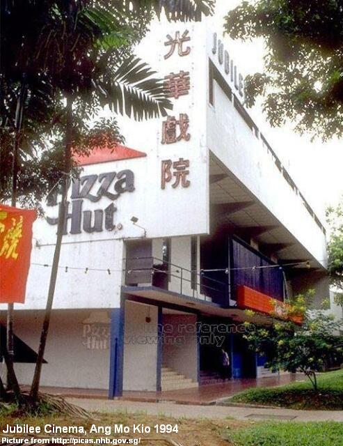
Ang Mo Kio Bus Interchange (Old) (1980-2002)
The old Ang Mo Kio Bus Interchange, located at the junction of Ang Mo Kio Avenue 3 and Avenue 8, was familiar to a generation of Singaporeans living in one of the country’s largest new towns during the eighties and nineties.

The building of the Ang Mo Kio Bus Interchange was initially criticised by the Ang Mo Kio residents, as the limited-sized interchange could not keep up with the growing population of the new town and had to install a string of bus stops along Ang Mo Kio Avenue 3. The overnight parking of buses was also a concern to the nearby flats as a high volume of noise was generated when the bus drivers warmed up their engines in the early mornings.

Considering all factors, the Ang Mo Kio Bus Interchange was given an expansion in 1982, just two years after its completion. An approval by HDB to make use of the extra land beside Block 710 saw its bus bays increased from 35 to 63, while 13 more trunk, feeder and ring services were added. Ang Mo Kio Bus Depot was built at Ang Mo Kio Avenue 9 to cater for the overnight parking of buses. Years later, an underground passenger link was constructed to link the upcoming Ang Mo Kio MRT Station (opened in 1987) to the bus interchange.
 The new interchange reopened in 1983, and continued for almost 20 years before it was shifted to a temporary location near the Ang Mo Kio Library in 2002. The former interchange used to have a fleet of feeder services (Service 26x) that went around the new town. Some services had been terminated, with only four remaining today.
The new Ang Mo Kio Interchange, the third air-conditioned bus interchange in Singapore, is part of Ang Mo Kio Hub that is integrated with the MRT station. Standing at the original site of the old interchange, it currently has a total of 36 bus parking lots and nine berths for boarding and alighting.
Ang Mo Kio Bus Terminal (1970s-1980)
In early 1980, six trunk and feeder services such as 133, 136, 162, 260, 261 and 262 ceased their operations at the Ang Mo Kio Terminal, located along Avenue 6, and were all relocated to the new Ang Mo Kio Bus Interchange.
The same name was used when another bus terminal opened beside Yio Chu Kang MRT Station in the late eighties, before it was changed to be known as Yio Chu Kang Bus Terminal by the early 2000s.
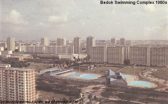
Bedok Bus Interchange (Old) (1979-2011)
Like other old towns such as Ang Mo Kio, Bukit Merah and Clementi, Bedok had its original bus interchange built as part of its town centre, along with other facilities such as hawker centres, libraries and town councils.

Just two years after it was opened in February 1979, the Bedok Bus Interchange was partially demolished to make way for a larger interchange to cope with the increased traffic. At a cost of $2.5 million, the expansion allowed the provided bus services to rise from 15 to 26. An extra 17 bus bays and a 180m-long passenger concourse were built in the additional 0.4 hectares of land given by HDB.

In 1989, the Bedok MRT Station was completed near the bus interchange, providing other alternatives for long-distance travelling commuters. The interchange remained a focal point of more than 30 trunk and feeder services.
In the mid-eighties, Bedok Bus Interchange was bothered by the issue of illegal fruit hawkers. The hawkers would set up makeshift stalls during peak hours, causing an obstruction of traffic. Some commuters also complained after being short-changed by the hawkers. HDB officers had to be deployed daily to curb the problem.

The old Bedok Bus Interchange, having served the residents of Bedok for some 32 years, had its operations finally ceased in November 2011. It is now replaced by a temporary facility. The new air-conditional bus interchange, scheduled to be completed in 2015, will be integrated with Bedok Residences and Bedok Mall. It will also be directly connected to Bedok MRT Station.

Bishan Bus Terminal (1985-1989) & Bus Interchange (1989-Present)
As early as 1983, SBS had planned bus routes to Bishan New Town, which was still in its early development stage. At the beginning, there was only one bus, Service 56, that travelled along Bishan Street 11 and 13 from Toa Payoh Bus Interchange before stopping at Bishan Bus Terminal, a temporary terminal set up since December 1985 at a location where Block 510 is standing today.
At the end of April 1989, Bishan Bus Interchange was finally completed. It was linked to the Bishan MRT Station which was opened two years earlier. Four trunk services were added to the modern bus interchange designed with sheltered passenger concourse, coin-changing machines, information boards and a canteen. With the Junction 8 opened in 1994, Bishan became of the most highly sought after new towns in Singapore.
Boon Lay Bus Interchange (Old) (1990-2006)
Incorporating some of the bus services from Jurong Bus Interchange, the original Boon Lay Bus Interchange was established in 1990 to cater for the rising industrial sectors at Tuas and Pioneer Road. It was also frequently used by the Nanyang Technological University (NTU) students.

The bus interchange was moved to a temporary site between 2006 and 2009 during the construction of the Jurong Point extension, after which a new air-conditioned interchange was opened as part of the Boon Lay Integrated Public Transport Hub.
Boon Lay Bus Terminal (1980s)
Located at the junction of Boon Lay Place and Boon Lay Drive, the former terminal used to provide bus services to the developing industrial estate of Pioneer in the eighties. Single-direction services such as 247A, 249A, 250A and 251A were routed to Jurong Pier Road, Lokyang Industrial Park and Refinery Road each morning and evening, for six days per week, excluding Sundays.

In the early eighties, the workers paid a flat rate of 40c to take the buses to their respective factories. Today, with the bus terminal no longer functioning, its premises have been converted into a large carpark.
Bukit Batok Bus Interchange (1988-Present)
In the mid-eighties, the bus interchange was moved to a temporary site but it received backlash from the public for being over-congested and having slow and irregular bus services.
Bukit Merah Bus Interchange (1981-Present)
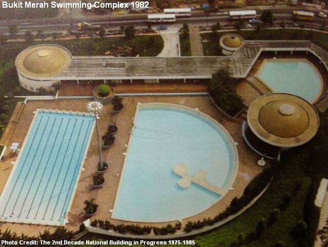
The Bukit Merah Bus Interchange is one of the few bus interchanges in Singapore without a direct link to a MRT Station. It is located beside the Bukit Merah Swimming Complex and provides as many as 15 SBS and SMRT trunk and feeder services.

The bus interchange was officially opened on 14th February 1981 by then-Minister Without Portfolio Lim Chee Onn.

Bukit Panjang Bus Terminal (late 1980s-1999) & Bus Interchange (Old) (1999-2012)
The old Bukit Panjang Terminal was formerly located at the Bukit Panjang Circus, before the circus was replaced by a cross junction in 1982.
The “new” Bukit Panjang Terminal was later established in front of Block 118 along Petir Road in the late eighties. It was a common sight to see buses lined up on both sides of Petir Road every day. In December 1999, the Bukit Panjang residents received a seasonal present when the Bukit Panjang Bus Interchange was opened, replacing the bus terminal and solving the constant traffic jams at Petir Road with its large parking space for buses.
In December 2012, the 13-year-old Bukit Panjang Bus Interchange was shut down to be redeveloped into a fully air-conditioned bus interchange. The new facility is expected to be ready three years later.
Buona Vista Bus Terminal (late 1970s-Present)
It was an interesting scenario at the busy junction of the Commonwealth Avenue and North Buona Vista Road in the late eighties. Three bus terminals co-existed within a distance of 500m from each other, namely the Buona Vista Terminal, Commonwealth Avenue Terminal and Ghim Moh Terminal.
The Commonwealth Avenue Bus Terminal was abolished in the late eighties, while the Buona Vista and Ghim Moh bus terminals operate till today.
Chai Chee Bus Terminal (1975-1985)
The Chai Chee Bus Terminal, located at New Upper Changi Road, was a short term measure provided by the HDB for the residents of Bedok before the completion of the Bedok Bus Interchange in 1979.
There were requests by the Chai Chee residents to retain the bus terminal but it was denied due to Chai Chee Estate being a constituent part of Bedok New Town. Five of its bus services, 13, 20, 40, 158 and 401, were incorporated into Bedok Bus Interchange after its closure in September 1985. The remaining four, one trunk and three feeders, were withdrawn.
Changi Village Bus Terminal (1983-Present)
After the mid-seventies, the lands around Changi Village were cleared and redeveloped in phases due to the construction of the Changi Airport. The residents, shops and workshop operators were relocated to other estates.
The HDB started building low-rise flats at Changi Village after the land clearance, and Changi Village Bus Terminal was added in 1983. The terminal was constructed at the former site of the Changi Cinema.

Today, four bus services (2, 29, 59, 109) ply the routes to Changi Village Bus Terminal.
Choa Chu Kang Bus Interchange (1989-Present)
The Choa Chu Kang Bus Interchange, located at Choa Chu Kang Avenue 4, has little upgrading since its opening in 1989. It is likely to be replaced by an Integrated PT Hub in near future.
Clementi Bus Interchange (Old) (1980-2006)
The Clementi Bus Interchange was officially opened on 16th November 1980 by Senior Parliamentary Secretary (Environment) Chor Yeok Eng. The first bus service to leave the new interchange was Queenstown-bound Service 78.

At the start, the bus interchange was the subject of criticism as it was small, inefficient and often flooded during rainy days. It was also the interchange that served the upcoming Jurong East New Town in the early eighties, before the completion of the Jurong East Bus Interchange in 1985. One such bus service was 76, which could not meet the demands of the increasing population at Jurong East.
Things would slowly improve at the Clementi Bus Interchange, as more services, such as the introduction of feeder service 287 in 1982 to serve Clementi West, were added and more buses to meet the peak hour demand. Additional trunk services were also increased, adding to an initial seven that mainly linked to Ang Mo Kio, Bukit Merah, Shenton Way, Chinatown and Orchard Road.

In October 2006, the Clementi Bus Interchange was officially shut down, with its operations shifted to a temporary site at the junction of Commonwealth Avenue West and Clementi Avenue 3. It took another five years of development before the new Integrated PT Hub of Clementi finally opened in 2011.
Commonwealth Avenue Bus Terminal (early 1970s-1982)
The Commonwealth Avenue Bus Terminal used to be located at the junction of Commonwealth Avenue and North Buona Vista Road.

In 1974, a canteen to serve the bus employees was set up at Commonwealth Avenue Bus Terminal. Run by the Singapore Industrial Labour Organisation, the bus terminal canteen, only the second in Singapore after the one at Toa Payoh Central Bus Terminal, offered soft drinks and light meals at affordable prices. The Singapore Industrial Labour Organisation was the union that represented the bus drivers in the seventies.

In 1976, a major project was launched to extend Commonwealth Avenue. The new road, later known as Commonwealth Avenue West, was catered for the increased traffic due to the rapid development of Clementi New Town, Singapore Polytechnic new campus, Ghim Moh Estate and Ayer Rajah district.
By the late eighties, the Commonwealth Avenue Bus Terminal was abolished and converted into an open carpark.
Crawford Street Bus Terminal (early 1970s-1998)
Crawford Street Bus Terminal used to stand along Crawford Street near the junction to North Bridge Road. When it was shut down at the end of 1998, its bus services were relocated to Geylang Lorong 1 Bus Terminal.
Delta (Circus) Bus Terminal (1979-early 1990s)
A large carpark now known as Delta Circus Fringe Car Park, the former Delta Bus Terminal (or Delta Circus Bus Terminal) was established in 1979 at the junction of Lower Delta Road and Alexandra Road to smoothen the traffic congestion caused by the unsuitable location of the nearby Havelock Road Bus Terminal. Delta Circus Fringe Car Park used to be occupied by the Singapore Steam Laundry in the early seventies.
The bus terminal and fringe carpark were named after Delta Circus, which existed before it was converted into a major cross junction to Alexandra Road, Ganges Avenue, Lower Delta Road, River Valley Road and Havelock Road.
The single-lane Havelock Road, near Beo Crescent, had a fleet of stationary buses parked there every morning since 1971, causing a bottleneck to the traffic. Both SBS and CSS bus services were affected by the shifting of the bus terminal, including Service 1, 5, 32, 51, 139, 192, 193 and 198.
Eunos Bus Terminal (1980s) & Bus Interchange (1989-Present)
Eunos Bus Terminal, along Sim Avenue, was upgraded to a bus interchange in 1989 to link up with the newly opened Eunos MRT Station.
Designed with traditional Malay flavours, the Eunos Bus Interchange provides seven bus services that reach Bedok, Boon Lay and Bukit Batok.
Geylang Lorong 1 Bus Terminal (1975-Present)
The fringe carpark sandwiched between Geylang Road and Kallang Road was orginally planned as a “Park and Ride” bus terminal in 1975, allowing the City Shuttle Service (CSS) buses to pick up motorists who parked their cars at the terminal. Providing regular peak hour services every day excluding Sundays at a rate of 50c, the CSS buses plied their routes to the city and downtown areas such as Shenton Way, Bras Basah Road and Orchard Road.


The timetables and schedules of the bus services were put up on the walls of the terminal offices for the commuters. However, like other CSS bus terminals with low ridership, the “Park and Ride” scheme did not really attract the commuters into participation at the Geylang Lorong 1 Bus Terminal.
In 1988, the bus terminal was handed over to SBS and TIBS.

Ghim Moh Bus Terminal (1970s-Present)
Built in the seventies, the Ghim Moh Bus Terminal is one of the remaining roadside bus terminals left in Singapore. By the early eighties, there were considerations by the SBS to phase out Ghim Moh Bus Terminal, due to the narrow roads and chaotic traffic. Providing dual bus services of 13 and 20, the bus bay in front of Block 9 was then chosen as a “temporary” terminal, which lasts till today, due to limited land space to build a permanent facility to serve the Ghim Moh residents.

In early 2012, six blocks of flats at Ghim Moh Estate were emptied due to the Selective En-Bloc Redevelopment Scheme (SERS). With the decrease in ridership, the operation of Ghim Moh Bus Terminal is likely to be ceased in near future, with the current bus services (92, 100, 111, 563) shifted to the nearby Buona Vista Bus Terminal.

Havelock Road Bus Terminal (1970s)
See Delta (Circus) Bus Terminal.
Hougang South Bus Interchange (1981-2004) & Hougang Central Bus Interchange (1994-Present)
Located at Hougang Street 21, the bus interchange was originally known as Hougang Bus Interchange. After losing its status as the main bus interchange in Hougang, it was renamed as Hougang South Bus Interchange.

The new Hougang Central Bus Interchange was opened in 1994, as the expansion of the new town caused the town centre to be relocated to a location further north along the Upper Serangoon Road. The bus services at the Hougang South Bus Interchange were gradually switched to other interchanges. By 2004, its operation was finally ceased, although it still continued to serve as a boarding and alighting point.
The Hougang South Bus Interchange was renamed again as Kovan Express Bus Terminal in recent years for Malaysian coaches travelling to and fro Genting and Kuala Lumpur.

The Hougang Central Bus Interchange was closed for a period of time in 1999 due to the construction of NEL (North-East Line), and some of its bus services were rerouted to a temporary Hougang Central Bus Terminal nearby.
Jalan Eunos Bus Terminal (1980s)
The Jalan Eunos Bus Terminal was located at the junction of Airport Road and Old Jalan Eunos in the eighties. Old Jalan Eunos was closed and demolished due to urban redevelopment of the area in 1987, leading to the abolition of the bus terminal by the end of the eighties.

The SBS bus services 50 and 51 that previously terminated at Jalan Eunos Bus Terminal were relocated to Eunos Bus Terminal and withdrawn respectively. Service 51 was later reinstated, running between Hougang and Jurong East.
A feeder bus service, 385, was added to cater for the workers at Kaki Bukit.
Jalan Kayu Bus Terminal (early 1980s-2004)
Situated at a convenient location surrounded by the Piccadilly Circus, the Seletar Camp gates, Jalan Kayu village and the Seletar West Farmways, the Jalan Kayu Bus Terminal was able to serve the residents as well as the army personnel.

The bus terminal continued to operate after TPE (Tampines Expressway) was constructed to cut across the roads in 1996. By 2004, with the gates of the Seletar Camp were opened to public access, the bus terminal was abolished and the site converted into a carpark.

The carpark itself was demolished in the late 2000s as the roads were realigned due to the development of the Seletar Aerospace Park.
Jurong Bus Interchange (1978-1990)
Located at the junction of Jalan Ahmad Ibrahim and Jurong Port Rd, the former Jurong Bus Interchange was officially opened in mid-1978 at a construction cost of $1.2 million. The new interchange catered for the residents of Jurong initially received criticism due to its slow feeder services, which took around an hour in their interval timings.

On 1st July 1990, the Jurong Bus Interchange ended its operation and was relocated to Boon Lay Bus Interchange. More than 20 of its trunk and feeder services, such as Service 10, 30, 184, 199, 852 and 951, were re-routed to other interchanges. A number of bus services (188, 206, 241, 450) had their operations ceased.

Before the mid-eighties, the Jurong Railway used to run at the back of the Jurong Bus Interchange.
Jurong East Bus Interchange (Old) (1985-2011)
When it was opened at the end of June 1985, the Jurong East Bus Interchange was the largest bus interchange in Singapore. An estimated 10,000 commuters, armed with information leaflets, used the airy and spacious interchange’s facilities on the day of its debut.
Catering mainly for the residents of the growing Jurong East New Town, workers, university students as well as the Malaysian travellers via Tuas checkpoint, the new bus interchange took over the bus services from Teban Gardens Bus Terminal and absorbed some from the old Jurong Bus Interchange at Jurong Port Road.

In 2011, the original Jurong East Bus Interchange ceased its operations, after it was planned to be converted into a new Integrated PT Hub cum shopping mall known as Westgate. A temporary bus interchange has since been set up beside the original site.
Kent Ridge Bus Terminal (1981-Present)
Kent Ridge Bus Terminal was built in 1981 to replace the former bus terminal at Pasir Panjang Road, which was located 200m away at the junction of Pasir Panjang Road and Clementi Road in the seventies.

Lim Chu Kang Road End Bus Terminal (1980s-2005)
Functioned like the Punggol End Bus Terminal (below), this roadside bus terminal was formerly situated at the end of the long Lim Chu Kang Road, just outside the Police Coast Guard Lim Chu Kang Base (previously known as Marine Police Boat Base) and a short distance away from the Lim Chu Kang Jetty.
After the terminal was abolished, the sole bus service, 975, now makes a loop service instead of stopping over.
Mandai Road Bus Terminal/Sembawang Road Bus Terminal (1970s-1980s)
The old Mandai Road Bus Terminal was previously located along the road in front of the Nee Soon Post Office. It was shifted to a location 200m away after Sembawang Road was widened and aligned.
Known as the Sembawang Road Bus Terminal, it was located near the mosque of Masjid Ahmad Ibrahim at the junction of Sembawang Road and Jalan Ulu Seletar and provided convenience to the residents of the nearby Nee Soon Village. It used to cater Service 171 to the Queen Street Bus Terminal.
Marine Parade Bus Terminal (1981-2003)
Built in 1981 to replace the roadside bus terminal at Marine Terrace, the Marine Parade Bus Terminal was located at the junction of Marine Parade Road and Siglap Road, providing bus services of 15, 16 and 211.
Marsiling Bus Terminal (1980s-1996)
In the early eighties, Marsiling was a small estate co-existed with the old Woodlands Town Centre near the Causeway. The development and expansion of Woodlands New Town saw the rising need to build a regional bus interchange in this northern part of Singapore to replace the bus terminals at the old Woodlands Town Centre as well as Marsiling, which by then became an integrated part of Woodlands.
All trunk and feeder services from the Marsiling Bus Terminal, located beside Block 201 along Admiralty Road, were shifted to the new $34-million Woodlands Bus Interchange after its completion in 1996.
New Bridge Road Bus Terminal (1970s-Present)
The New Bridge Road Bus Terminal was started in the seventies in front of the Singapore General Hospital (SGH) along Eu Tong Sen Street. Trunk bus service of 166 used to depart from the bus terminal, with its last bus leaving at 11:35pm, ferrying the night shift hospital workers home to Ang Mo Kio New Town.

In 1987, ten bus services (11, 28, 81, 83, 101, 134, 173, 174, 179 and 183) were added to the boarding point of bus terminal. The boarding facilities, however, are absent today. The commuters can only alight at the New Bridge Road Bus Terminal, and board the bus at the bus stop outside the terminal.

Old Upper Thomson Bus Terminal (1979-1980s)
The SBS terminal at Yio Chu Kang Road was shifted to the junction of Nemesu Avenue and Old Upper Thomson Road in 1979 to cater for the residents of the Thomson Hills Estate and Sembawang Hills Estate. SBS Blue Arrow Bus Service 305 was amended so that it would travel from Mayflower Gardens to Shenton Way in the morning, and then returned from the CBD in its evening route.
The former roadside terminal is a carpark today.
Pasir Ris Bus Interchange (1989-Present)
The Pasir Ris Bus Interchange was opened in 1989 to provide bus services within Pasir Ris New Town as well as the Loyang Industrial Estate. The operations were later extended to Tampines and other new towns. It also serves as the boarding and alighting points for the NS personnel’s trip to Pulau Tekong via the SAF Ferry Terminal.

In the early nineties, special shuttle bus services such as AA92 and AA94 were added to the Pasir Ris Bus Interchange to take the ticket-holders to the Asian Aerospace at the Changi International Exhibition and Convention Centre.
Prince Edward Bus Terminal (1971-mid 2000s)/Shenton Way Bus Terminal (mid 2000s-Present)
Prince Edward Bus Terminal began as early as 1971 with at least 30 bus services calling at the terminal. In the early days, it once received complaints about its poor lighting conditions and safety. It was first located along Shenton Way before shifting to a location beside the former Singapore Polytechnic campus (now Bestway Building) at the end of Palmer Road.

The terminal was renamed as Shenton Way Bus Terminal in the nineties, which was later relocated again to a nearby site at the junction of Shenton Way and Keppel Road in the mid-2000s.
Princess Elizabeth Bus Terminal (1953-1990)
The Princess Elizabeth Bus Terminal was located at the junction of Elizabeth Drive, Lorong Kemunchup (now Jalan Kemunchup) and Jalan Zamrud. The roads are still around today, but the Princess Elizabeth Park Estate, including the bus terminal, was demolished in the nineties.

The bus terminal was first used by the UBC buses, before taken over by SBS. Service 173 used to call at the Princess Elizabeth Bus Terminal. It still plies its route around the vanished estate today.
Punggol End Bus Terminal (1980s-2003)
With several popular landmarks such as the Punggol Jetty, Punggol Village, seafood restaurants and boatels, the Punggol End was a bustling place in the eighties and the nineties. A bus terminal also existed between Track 24 and Track 26 (now defunct).

During the weekends, it was common to see dozens of cars jamming up the place with the buses lining up along the road. After the abolition of the bus terminal in 2003, the buses that plied this route made loop services instead of stopping. Today, only one bus service, 84, operates to Punggol Road End.
Queen Street Bus Terminal (1980s-Present)
Standing beside The Church of Our Lady of Lourdes at the junction of Rochor Canal Road and Ban San Street is an old bus terminal that provides the former sole public bus service (170) to Johor Bahru’s Larkin Bus Terminal.

The Queen Street Bus Terminal, also known as Ban San Bus Terminal, has been in existence before the Rochor flats were painted into bright colours of green, blue, red and yellow. The bus terminal also possesses one of the longest bus stops in Singapore.

Rumah Tinggi Bus Terminal (1980s-early 2000s)
Situated in front of Block 37 of Jalan Rumah Tinggi, the bus terminal was abolished in the early 2000s after the bus route of Service 63 was combined with Service 382 to make a looping point at Jalan Rumah Tinggi.

The premises have since been converted into an open carpark, although the location still retains its former name as Rumah Tinggi Terminal.
Sembawang Road End Bus Terminal (1980s-2005)
The Sembawang Road End Bus Terminal, like the ones at the end of Lim Chu Kang Road and Punggol Road, brought bus services to a stop at the northern end of the long Sembawang Road.
It was situated at where Sembawang Park is today.
Serangoon Bus Interchange (Old) (1988-2011)
By the mid-eighties, the need of a bus interchange was imminent at the relatively new Serangoon New Town, which had another 17,000 units of HDB flats built. In early March 1988, the Serangoon Bus Interchange finally opened at the Serangoon Central, taking over the services at the congested Serangoon Garden Bus Terminal and the temporary terminal at Serangoon Avenue 3.

A network of bus services, including 72, 100, 101, 104, 106 and 107, was relocated to the new bus interchange, which had a spacious compound of 22 bays and 26 berths. During its opening, a three-day exhibition was held for the Serangoon residents. Bus guides and operation schedules were given out to the benefits of some 80,000 HDB residents as well as other private estate residents at the Serangoon Gardens.

The Serangoon Bus Interchange provided trunk services to other housing estates such as Ang Mo Kio, Hougang, Bishan, Clementi and Toa Payoh. It also provided feeder services to Serangoon Gardens, Lorong Chuan and Serangoon South.
There is a set of old traffic lights, the last functioning GEC traffic lights in Singapore, just outside the bus interchange.

Serangoon Garden Bus Terminal (1960-1988)
Serangoon Garden Bus Terminal was an early public transport project undertaken by the Singapore Rural Board. In 1960, the Board spent $25,000 to construct the facilities at the Serangoon Garden Estate, including a bus terminal with five bays, bus shelters and a taxi stand.

In 1985, the residents of the private estate, commonly known as ang sar lee, complained about the congestion of the bus terminal after the Ang Mo Kio residents crossed over to Serangoon Gardens to take buses.
The Serangoon Garden Bus Terminal was abolished after the completion of the Serangoon Bus Interchange in 1988. Only a bus stop was retained for the bus services of 73 and 136 then.

Sims Place Bus Terminal (early 1980s-Present)
Located near Sims Place near Aljunied Road, the Sims Place Bus Terminal has been in existence for more than 30 years. Bus services of 94 and 198 used to call at this terminal, one of the few surviving roadside bus terminals in Singapore, but it is left with only Service 64 today.

Sin Ming Bus Terminal (1980s-2004)
Sin Ming Bus Terminal had provided convenience in the early eighties with its Service 353 to and fro Bishan Street 31, allowing the early Bishan residents to catch their trunk services to Ang Mo Kio, Thomson Road, Balestier Road, North Bridge Road and Shenton Way.

The bus terminal used to function in front of Block 22 of Sin Ming Road. After the terminal was abolished in the early nineties, a multi-storey carpark (Block 22A) was built in its place.
Somapah Bus Terminal & Bus Interchange (1981-1989)
Opened in 1981, Somapah Bus Interchange was used to provide bus services at the east side of Singapore. It was located near the junction of Upper Changi Road and Upper Changi Road East, which is the present-day carpark of Singapore Expo. A number of services, such as 10, 11, 12, 14 and 155, used to stop at the interchange.
In 1981, the Singapore Shuttle Bus Company (SSB) submitted a proposal to the government to build a bus interchange near Changi Airport. But the plan was shelved as the main SBS fleets for the airport (Services 392 and 393) looped around the areas and utilised the Somapah and Bedok bus interchanges.
 Somapah Bus Interchange was converted to Somapah Bus Terminal in 1983 after the airport services were withdrawn, replaced by the new SBS Changi Airport Bus Plan. Another trunk service 10 was terminated in 1986, leaving the bus terminal with only four services. By 1989, Somapah Bus Terminal was officially shut down. Service 11 was stopped while the remaining three bus services (12, 14, 155) were relocated to Pasir Ris, Changi Village and Marine Parade respectively.
South Canal Bus Terminal (1970s-early 1990s)
The South Canal Road Bus Terminal was once the stopover for the buses of Hock Lee Amalgamated Bus Company. Situated along the short South Canal Road in front of OCBC Centre, the bus terminal was abolished in the early nineties.
St. Michael’s Bus Terminal (1981-Present)
St. Michael’s Bus Terminal is actually located along Whampoa Road instead of St. Michael’s Road, which is about 1km away. The small bus terminal used to have two City Shuttle Services (CSS) until 2003, after which it was taken over by SBS Transit.

The fleet of bus services of 12x (120, 122-126) used to call at St. Michael’s Bus Terminal in the eighties, but only Services 124 and 125 remains today.

Tampines Bus Terminal (1983-1987) & Bus Interchange (1987-Present)
Built at a cost of $5 million and officially opened on 29th November 1987, the Tampines Bus Interchange kicked off in two phases, separated by a six-month period. Catering for the residents of a upcoming Tampines New Town, the interchange occupied a landsize of three football fields with 85 bus bays.
An initial seven trunk and five feeder services were provided by the bus interchange when it was first opened. It also took over the bus services of Tampines Bus Terminal that was formerly operating along Tampines Avenue 5, in front of present-day Block 938.
Tampines Road Bus Terminal (1970s-1980s)
Located at the junction of Upper Changi Rd North and Old Tampines Rd (known as Tampines Road until the late eighties), this bus terminal was used by the Associated Bus Service (ABS) and later the SBS.
Tampines Way Bus Terminal (1970s-1980s)
The old Tampines Way was the particular stretch of present-day Hougang Avenue 3 between Upper Serangoon Road and Tampines Road.

In June 1977, Singapore’s first double-decker bus service, Service 86, was launched by then Senior Minister of State for Communications Ong Teng Cheong. The buses, initially rejected by the public for fear of toppling, ran from Tampines Way Terminal to Shenton Way.
Tanjong Pagar Bus Terminal (1971-1985)
The buses of ABS, UBC and STC used to call at the Tanjong Pagar Bus Terminal in the early seventies.
In 1985, due to the development of the Port of Singapore Authority (PSA), eight SBS bus services that called at the bus terminal (130, 131, 186, 193 and Blue Arrow Services of 301, 303, 305, 306) were all rerouted to Prince Edward Bus Terminal.
Teban Gardens Bus Terminal (1981-2004)
Formerly known as the Penjuru (Jurong) Depot, the SBS facilites were later converted into a bus terminal called Teban Gardens Bus Terminal. It was located opposite Block 24 along Penjuru Road. In 1981, the route of Service 143 was amended to call at Teban Gardens Terminal instead of Jurong Road Terminal, so that the residents of Teban Gardens and Pandan Estate could have a direct bus to Chinatown and Orchard Road.
Toa Payoh Bus Interchange (Old) (1983-1999)
Officially opened on 26th December 1983, the old Toa Payoh Bus Interchange cost a total of $2.17 million in the construction and a further $250,000 in publicity. Around 100,000 residents living in Toa Payoh were given a special bus guide, which also touched on the interchange’s new facilities, such as the coin-changing machines and information counters.

Toa Payoh Bus Interchange was demolished in 1999 to make way for the HDB Hub. The operations were shifted to a temporary location opposite its original site for several years, before the new interchange was completed in 2002. Integrated with the HDB Hub, the new Toa Payoh Bus Interchange was the first fully air-conditioned bus interchange in Singapore.
Toa Payoh Central Bus Terminal (1971-1980s)
Before the construction of Toa Payoh Central Bus Terminal, the buses would park at the temporary bus terminal along Toa Payoh Lorong 1. Sometimes, as many as 30 buses lined up the road, causing severe traffic jams. Some of the old buses also spilled excessive diesel onto the roads, which posed a danger to pedestrians and other vehicles.
In 1971, after much appeals, the HDB finally proceeded with the construction of a new bus terminal at a site bounded by Toa Payoh Lorong 2, Lorong 4, Lorong 6 and Toa Payoh Central. Opened in August 1971, the Toa Payoh Central Bus Terminal, otherwise also known as Toa Payoh Town Centre Bus Terminal, was able to accommodate 130 buses.
A Safety and Courtesy Campaign was launched for the bus workers to improve the bus services in 1972.
Tuas Bus Terminal (Old) (1970s-1980s)/Tuas Bus Terminal (New) (1998-Present)
There was an old bus terminal at the end of the Upper Jurong Road in the seventies, leading to the Tuas Fishing Village beside the sea. When the Tuas area was developed into an industrial estate in the early eighties, a long road called Pioneer Road was built across the region, and part of Upper Jurong Road became Tuas Road.
The buses at Tuas Terminal would pick up the residents of the village as well as the army personnel from the old SAFTI (Singapore Armed Forces Training Institute). Its operation was ceased when the old Boon Lay Bus Interchange opened in 1990. Tuas Fishing Village was also demolished after that, replaced by rows of industrial buildings.
In 1998, a bus terminal was opened at the junction of Jalan Ahmad Ibrahim and Tua West Drive. Also known as the Tuas Bus Terminal, it is the westernmost bus terminal in Singapore.
Ulu Pandan Bus Terminal (1971-1987)
Ulu Pandan Bus Terminal was located at the junction of Ulu Pandan Road and Clementi Road. It used to have a long bus bay which is still visible today. The terminal ceased its operation in the late eighties.
Upper Bukit Timah Bus Terminal (1980s-mid 1990s)
As it was located at the junction of Upper Bukit Timah Road and Chun Tin Road, the Upper Bukit Timah Bus Terminal was a convenient stop for commuters going to Bukit Timah Shopping Centre and Beauty World Plaza.
In 1989, a bus interchange was proposed to replace the Upper Bukit Timah Bus Terminal, so as to provide accessibility to the less populated and rural areas in the northern and western parts of Singapore.
However, the plans were scrapped after considerations that the residents were better served by bus interchanges in nearby new towns, such as Bukit Panjang, Jurong East, Choa Chu Kang and Bukit Batok, instead of a regional one.
Upper East Coast Bus Terminal (2002-Present)
The Upper East Coast Terminal is a relatively new bus terminal, situated beside Bedok Camp along Upper East Coast Road.
Upper Serangoon Bus Terminal (1980s-1994)
Also known as Kangkar Bus Terminal, the Upper Serangoon Bus Terminal was a bus terminal located between Lorong Loyak and Lorong Sepat (now defunct) at the northern end of Upper Serangoon Road, which was not yet connected to Sengkang New Town before the mid-nineties.
A number of bus services such as 74, 84, 136, 147 and 153 used to terminate at the Upper Serangoon Bus Terminal, before they were shifted to Hougang Central Bus Interchange in 1994.
Woodlands Bus Interchange (Old) (1970s-2004)
The old Woodlands Bus Interchange was located at the former town centre of Woodlands, just a short distance from the Causeway. In the late eighties, the aging bus interchange was criticised heavily by commuters for a series of problems, such as a leaking ceiling during rainy days, poor indication of departing buses, chaotic queues and lack of supervision by bus inspectors during peak hours.

Its operation was later shifted to the new $34-million Woodlands Regional Bus Interchange, which was the first bus interchange to be built by the Mass Rapid Transit Corporation (MRTC). Underground and beneath the Woodlands MRT Station, the new interchange started its operations in early February 1996.
The site of the old Woodlands Bus Interchange is now a large carpark to provide a temporary stopover for buses and cars travelling between Singapore and Malaysia.
World Trade Centre Bus Terminal (1985-Present)
There were plans to build a bus terminal near World Trade Centre since 1979, but the feasible plan only kicked off in 1983.

In January 1985, the World Trade Centre Bus Terminal was finally opened at the junction of Telok Blangah Road and Seah Im Road. The operation started with five bus services, CBD 1, 84, 93, 100 and 163, to provide convenience for commuters with direct links from Upper Serangoon, Serangoon Gardens, Jalan Kayu, Yio Chu Kang, Paya Lebar, Aljunied, Farrer, Queensway and Orchard Road.
The former bus terminal is now known as HarbourFront Bus Interchange, which is linked to the HarbourFront MRT Station since 2003.
Yio Chu Kang Bus Terminal (1990s-Present)
See Ang Mo Kio Bus Terminal.

Yishun Bus Interchange (Old) (1987-2015)
Before the construction of the Yishun Bus Interchange, the residents were served by two bus terminals at Yishun; one at Yishun Avenue 5 and the other at Yishun Central. The former had bus services 800 and 801, while 850 and 851 called at the Yishun Central Terminal. Both bus terminals were abolished and replaced by the new bus interchange in 1987.

The Yishun Bus Interchange was the first bus interchange built by the HDB for the TIBS (Trans-Island Bus Service), although this was the second bus interchange under their management. Operating bus services mainly in the north such as Woodlands, Yishun and Sembawang, TIBS took over the Woodlands Bus Interchange from SBS in 1983. Since the early eighties, HDB had designed and built eight bus interchanges for the SBS.

Located along Yishun Avenue 2, the Yishun Bus Interchange was built at a cost of $2 million and was officially opened in late August 1987. At its start, a total of five trunk services and four feeder services were provided for the Yishun New Town residents, estimated to be around 176,000. It had 33 disembarking and boarding berths, and was painted purple to blend in with the shops and flats at Yishun town centre.


In March 2015, the old Yishun Bus Interchange was officially closed. It would be demolished and replaced by an air-conditioned Integrated Transport Hub that consists of private residences and shopping mall. The new Yishun transport hub is expected to be ready in 2019.
Others: Fringe Carparks as Bus Terminals
In the seventies, a total of 15 fringe carparks around Singapore, such as the one at the National Stadium, was used to function as bus terminals for the “Park and Ride” scheme in a bid to ease traffic congestion. The motorists could park their cars and take the CSS buses into the city. However, the scheme was not met with positive response from the motorists.

Other examples of fringe carparks that once functioned as bus terminals were the Holland Road Bus Terminal, Old Upper Thomson Bus Terminal, Delta Bus Terminal and the still-functioning Geylang Lorong 1 Bus Terminal.

There were another dozens of bus terminals scattered around Singapore that had been demolished and forgotten over time. These terminals include:
Anson Road Bus Terminal
Balestier Road Bus Terminal
Corporation Road Bus Terminal
Elias Road Bus Terminal
Holland Drive Bus Terminal
Holland Road Bus Terminal
International Road Bus Terminal
Jurong Road Bus Terminal
Labrador Bus Terminal
Lower Delta Road Bus Terminal
MacPherson Bus Terminal
Maxwell Road Bus Terminal
Nanyang Technological Institute (NTI) Bus Terminal
Pasir Panjang Road Bus Terminal
Potong Pasir Bus Terminal
Redhill Close Bus Terminal
Shipyard Road Bus Terminal
Singapore Zoological Gardens Bus Terminal
Tanjong Berlayer Bus Terminal
Tanjong Rhu Bus Terminal
Teck Whye Bus Terminal
Also read Taking an Old Bus Ride.
Published: 28 October 2012
Updated: 16 March 2015

 With intensive usage of media, campaigns are launched to achieve certain particular goals, usually in a political, social or commercial sense. Sometimes, a campaign represents an era, and some of its posters go on to become iconic representations that are even remembered after decades. One of the examples is the United States’ “I Want You For U.S. Army” poster in 1917.
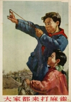 Campaigns are meant to have a long term impact. However, human errors, wrong judgement or a lack of foresight during the introduction of campaigns can sometimes lead to failures or even disasters to the country. In 1958, the new China launched the Four Pests Campaign in a bid to eliminate rats, flies, mosquitoes and sparrows. The sparrows were targeted because they ate the farmers’ grain seeds. In a short time, millions of Chinese were mobilised for the campaign. Sparrows, as well as other birds, were shot, with their nests and eggs destroyed. Soon, the Chinese government realised that, besides eating grains, sparrows were also natural predators to many insects. It was too late then. By 1960, rice farms in China were swarmed by locusts, leading to the Great Chinese Famine in which millions died of starvation.

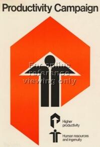
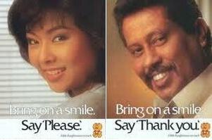 Since its debut, the National Courtesy Campaign has introduced many catchy slogans. The first was “Courtesy is our way of life. Make courtesy our way of life.” in 1979, while other popular ones included “A little thought means so much. Bring on a smile. Say “Please/Thank You” (1985) and “Courtesy begins with me” (1989).
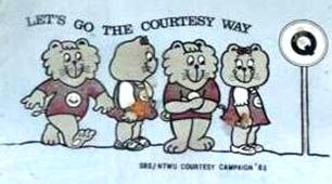 In March 2001, the National Courtesy Campaign was officially replaced by the Singapore Kindness Movement (SKM). Former Prime Minister Goh Chok Tong highlighted in the New Year of 1996 that Singapore aimed to become a gracious society by the 21st century.
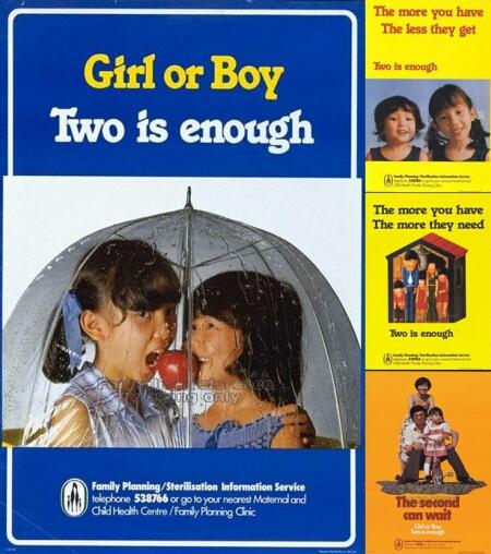 After the Second World War, Singapore experienced a post-war baby boom. Overcrowding became a social issue, leading to various problems in housing, education, medical and sanitation. After Singapore’s independence, former Prime Minister Lee Kuan Yew was concerned that the uncontrolled growing population would put stress on the economy of a developing Singapore. Thus, the National Family Programme was launched with the Family Planning and Population Board (FPPB) established in 1966.
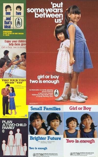 The campaign reached its peak after 1970, when abortion and sterilisation were legalised. Women deemed low-educated with low incomes were urged to go for sterilisation after their second child, and a range of disincentives, such as lesser benefits in maternity leaves, housing allocations, tax deductions and children’s educations, was implemented for those had three or more. The campaign also aimed to discourage families to stop trying for a boy after having two girls.
 The Graduate Mothers’ Scheme was the beginning of the reversal of the population control scheme. In 1986, the Family Planning and Population Board was abolished, and a new campaign “Have Three or More, if you can afford it” was launched. It was predicted that Singapore’s birth rate would recover by 1995. But it never did.
 Some critics note that even without the population control campaigns, Singapore’s birth rate would still decline as the society became more developed. The rising number of higher-educated individuals who were less willing to start a family at an early age would be unavoidable. In any case, it was obvious that the campaign had lasting effects even till today. In recent years, the government relaxed its immigration policy in a bid to battle against an aging population and a shrinking workforce in Singapore, a move that proves to be hugely unpopular among the Singaporeans.


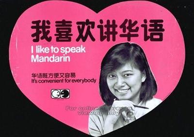 The Speak Mandarin Campaign has been a controversy since its introduction. Some critics view it as a propaganda tool to eliminate the Chinese dialects. It was a dilemma for the Singapore government in the seventies. While it was great foresight to predict the rise of China and the importance of Mandarin as a common language, the danger of Chinese-dominated institutes being used as breeding grounds for communist ideas meant that the authority was always quick to act.


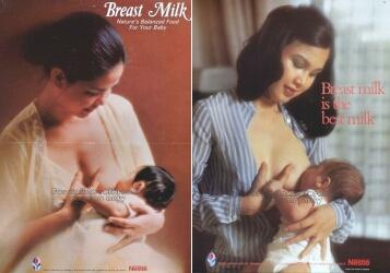 In the seventies, breastfeeding by Singaporean mothers had fallen to an all-time low. Studies show that it was due to many women entering the working sector. In 1971, only 28% of high income mothers, and 51% of low income mothers, initiated breastfeeding to their babies, as compared to 85% and 90% in the fifties.

 Road Safety Campaigns

 Other Campaigns
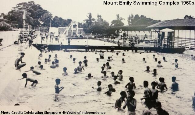
 The
The 


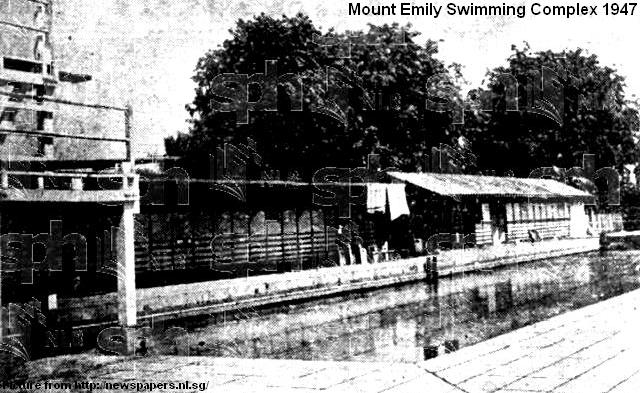
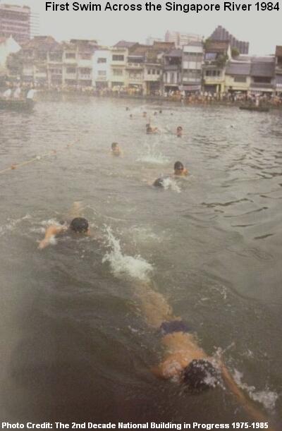
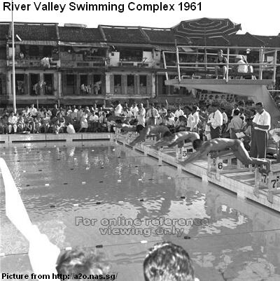 After the independence of Singapore, the National Sports Promotion Board and the Singapore Sports Council took over the swimming complex in 1971 and 1973 respectively. As more swimming facilities were built in the new towns in other parts of Singapore, River Valley Swimming Complex went into a decline. Its non-favourable location among commercial buildings and shopping malls meant that few residents would travel far to visit the pools. It was finally shut down in April 2003.
 The
The 


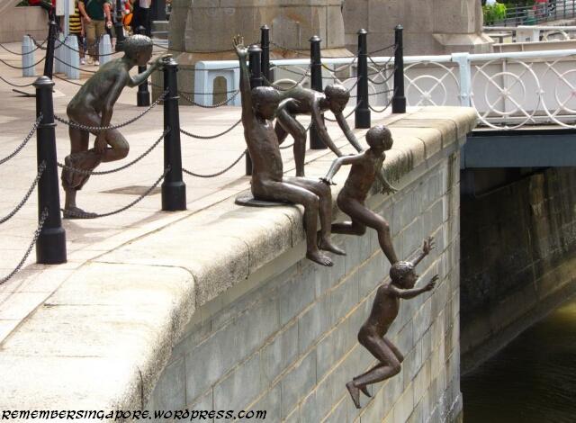
 Pig and poultry farms near the Kallang Basin were phased out, 5,000 street hawkers along the river were resettled at the markets and hawker centres elsewhere, and 800 bumboats were towed to Pasir Panjang.
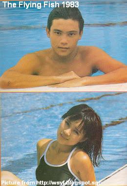 In 1983, the Singapore Broadcasting Corporation (SBC) produced an eight-episode drama named The Flying Fish (小飞鱼). Dubbed as Singapore’s first idol drama, it catapulted actor Wang Yu Qing to national fame and inspired many youngsters to take up swimming.


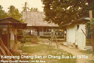 Cheng San, in particular, was named after Kampong Cheng San, also known as Cheng Sua Lai (青山内, “Green Hills Interior” in Hokkien), a dominant village that existed in the area between the fifties and seventies. It was made up of many clusters of Hokkien and Teochew villages, as well as some Malay and Indian families. A long track known as Cheng San Road once cut through the vegetation and farmlands in old Ang Mo Kio to link between Upper Thomson Road and Serangoon Gardens.
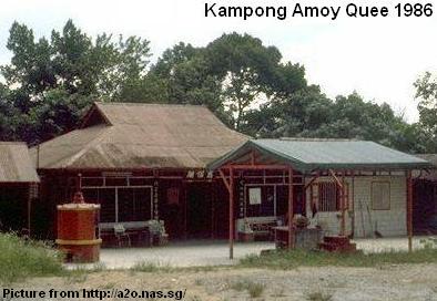 During the pre-independence days, the military personnel living at the Serangoon Gardens would drive through the kampong as a shortcut to the Seletar and Sembawang camps. Their reckless drivings sometimes killed the villagers’ chicken and other livestock. The angry locals thus nicknamed the Caucasians as “ang moh kwee” (“red-haired devils” in Hokkien).


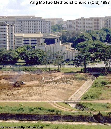 The services of Ang Mo Kio Methodist Church was originally held in 1976 in a rented house at Mayflower housing estate. As the number of its followers grew, it decided to build its own building together with two other Methodist conferences (Paya Lebar Chinese Methodist Church and Emmanuel Tamil Annual Conference). The church was completed at Ang Mo Kio Avenue 1 in 1981, and was upgraded several times over the years.
 Catholic Church of Christ the King, the only Catholic Church in Ang Mo Kio, was opened in September 1982 at a cost of $3 million. In the seventies, the Catholics living in the vicinity of Ang Mo Kio had to travel to Upper Thomson (Church of Holy Spirit) or Serangoon Gardens (Church of St Francis Xiavier) to call their parish.


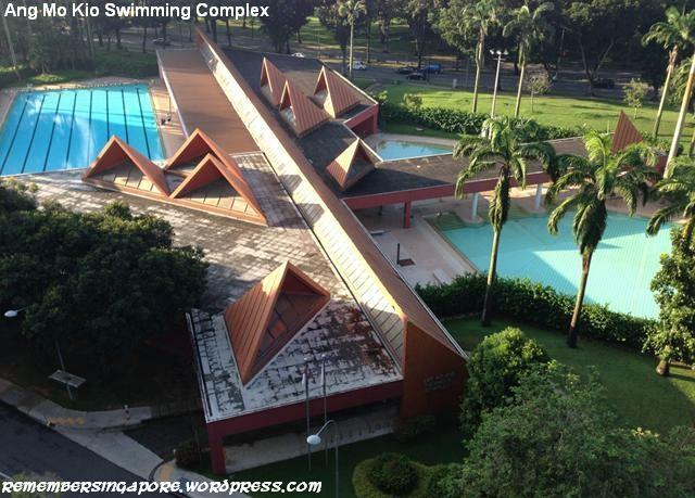
 The construction of Ang Mo Kio Swimming Complex by the HDB in 1982 was welcomed by the residents of Ang Mo Kio, who otherwise had to travel to Toa Payoh if they wanted to enjoy a dip in the water.


")

")

