
The recent news of BlackBerry ending the support for its signature devices brings back memories to many who have previously owned the phones.
One of BlackBerry’s iconic series was BlackBerry Bold, first launched in 2008. Designed with a leather back cover, chrome curves and sleek appearance, BlackBerry Bold was the stylish and premium product that everyone, especially the professional workers, desired, even when the Apple iPhones were beginning to take the world by storm.

The BlackBerry phones came with three distinctive features – BBM, its instant messaging service, a centre trackball for easy device navigation and the small physical qwerty keyboard, an innovative design in an era when most phones were still using 12 basic buttons for keying of numbers and letters.
Technology has since advanced so rapidly that applications and gadgets of the nineties and 2000s seem awfully outdated now. Other than Blackberry Bold, here are 16 more iconic gadgets, software and apps of the nineties and 2000s that we were once familiar with.
The list is not in any order:
1. Motorola Bravo Pager (1986-2012)
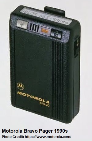
There used to be a local humour phrase of “hello, siang kar pager?” (hello, who paged me?). Pagers were first developed in the fifties but only became widely used in the eighties. Its popularity last for almost two decades until the mobile phones took over as the main telecommunication means.
Motorola had been the leader in the development and manufacturing pagers. Its line of pagers included some iconic models, such as the Dimension IV pager in 1977 and Bravo numeric pager in 1986, which became the world’s best selling pager. By the mid-nineties, the new Motorola Tango alphanumeric pager allowed users to receive text messages and emails, and reply with a standard response.
It was a common sight in Singapore in the nineties to see people with pagers clipped by the side of their pants, and they would make return calls at the coin phones when their little black boxes beeped. Creative teenagers soon began to use pagers to relay their messages using numeric codes and shorthand, such as 07734 (an upside down “Hello”), 1-177155-400 (“I miss you”) and 6000-843 (“Good bye”).

As Short Message Service (SMS) in mobile phones became popular, pagers were gradually deemed redundant. Into the 2000s, pagers were still used by doctors, military personnel and those whose jobs required standby or on-call duties. But by April 2012, pagers finally could no longer work as Sunpage, Singapore’s last paging service provider, decided to end the service.
2. CallZone and Zonephone (1991-1998)
The Singapore Telecom conducted a technical trial for its new CallZone service in 1991, using public base stations to connect to second generation cordless phones (CT2), dubbed as the Zonephones. In January 1992, the CallZone service made its debut and more than 2,500 Zonephones were quickly snapped up at $398 each.
The success prompted Singapore Telecom to install and provide a further 300 CallZone areas for its customers, increasing the total number of CallZone areas to 3,000 by the end of 1992. Zonephones, which could only be used for outgoing calls, provided a convenient way for pager users to return calls without having to reach for any public or coin phones.

But soon, the CallZone service ran into issues. The network would jam if there were too many users using their Zonephones at the same area. New cellular phones introduced in the market were also better as they could take both incoming and outgoing calls.
By 1996, the CallZone subscription rate was declining fast and Singapore Telecom began to lose money maintaining the large number of CallZones. The service as well as Zonephones eventually walked into the history in October 1998, barely seven years after their launch.

3. Nokia 8250 (2001-late 2000s)
There were hundreds of Nokia mobile phone models, and many were iconic designs, including the Nokia 8110, commonly known as the banana phone, in the late nineties.
The Nokia 8250 was another iconic one, and was arguably one of the best selling Nokia phone models in Singapore in the early 2000s. A variant of the Nokia 8210 introduced in 1999, the Nokia 8250, nicknamed the butterfly due to the shape of its centre buttons, sported a sleek and light candy bar design, and came with a cool blue backlight, customisable ringtones and screensavers.

Nokia dominated the mobile phone market for more than a decade between the nineties and 2000s. The rise of smartphones knocked out the majority of its shares in the market and its mobile phone business was eventually acquired by Microsoft in 2014.
4. 3½-Inch Floppy Disk (1982-early 2000s)
Universal Serial Bus (USB) was developed in 1996, and the first USB flash drive was invented in 1999. Singapore’s Trek 2000 International was reportedly the first company to commercialise and sell USB flash drives in the market. With relatively larger and faster storage capability, as well as easier to carry around, USB flash drives grew in popularity around the world, marking the eventual death of floppy disks.

By the early 2000s, the 3½-Inch Floppy Disks were limited as emergency boot media and for small data transfers. Many brands of personal computers began to phase out the floppy drives after 2003. But its legacy somehow lives on with the “save” button, resembling the floppy disk, used in Microsoft Office and other software.
5. Zip Disk (1994-early 2000s)
Introduced in 1994, Zip Disk became popular as a portable storage means due to its relatively higher storage capacity compared to the floppy disks. It had 100MB (later versions were 250MB and 750MB) which were useful as data files were getting larger. A Zip Drive, internal or external, connected to the computers was required to read or write the Zip Disks.

Like the floppy disks, Zip Disks fell out of flavour by the early 2000s as CDs (compact discs), USB flash drives and portable hard disk drives (HDD) with higher and faster storage capabilities started to dominate in the market.
6. Modem and Dial-up Connection (1990s-mid-2000s)
Next we move into the internet. Back in the nineties, to access the internet, one required the dial-up connection using a phone line and an analog modem. It would usually take 30 seconds to connect – with that familiar, sometimes irritating, connecting sound – and it would get disconnected whenever a phone call came in or someone needed to use the phone. Its data transfer rate of up to 56 Kbps is unimaginable in today’s context.
Dial-up connection in Singapore was later replaced by the Asymmetric Digital Subscriber Line (ADSL) with faster data transmission in the 2000s, before the high speed fibre broadband becomes the main mode for internet access today.
7. mIRC/ICQ/MSN Messenger (mid-1990s-2000s)
Instant messaging platforms were a rage back then, with many users in the nineties and early 2000s spending hours on the computers chatting with one another.
mIRC was an IRC (Internet Relay Chat) client developed for Windows in 1995. It became one of the most popular IRC clients with almost 40 million downloads. Users were able to communicate, chat and share files via IRC channels, which enjoyed its golden period from the mid-nineties to the early 2000s. After 2003, IRC, facing competition from other new types of instant messaging, saw steady decline in usage.
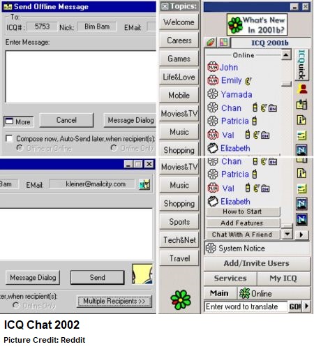
ICQ (name derived from “I seek you”) joined the instant messaging domain in 1996, and reached its peak in 2001 with more than 100 million users worldwide. It was one of the most popular instant messengers but its popularity gradually declined after the early 2000s and did not quite recover after that.
Microsoft’s MSN Messenger entered the scene in 1999. It soon attracted a large following in the 2000s with new features such as games, nudging of friends’ chat windows and large customised or animated emoticons. Later known as Windows Live Messenger, it released a final version in 2012 and quietly departed a year later, with the communication function in Windows replaced by Skype.

Other instant messengers included AIM (AOL Instant Messenger – launched in 1997 and ended in 2017), Yahoo! Messenger (1998-2013) and Google Talk (2005-2013).
Both IRC and ICQ continue to function as software program and app for computers and mobile phones today, but their best days were long over as the instant messaging world is currently dominated by Whatsapp, Telegram, WeChat and Facebook Messenger.
8. Netscape (1994-2008)
Netscape was one of the early widely used internet browsers, with the first Netscape Navigator launched in 1994. Netscape Navigator 3 absolutely dominated the market with 90% share in the mid-nineties, before the rise of Windows 95’s Internet Explorer (IE).
The later versions of Netscape were Netscape Communicator, Netscape 6, Netscape 7 and Netscape Browser, but they would lose out in the so-called Browser War (1995-2001), a period when new internet browsers such as Firefox, Opera, Safari as well as IE fought for market shares. Netscape eventually met its death in March 2008.

By 2017, Google Chrome was the dominant internet browser with 60% market share. IE also faded away, and was replaced by Microsoft Edge in 2020.
9. Hotmail (1996-2011)
One of the first webmail services on the internet, Hotmail was created in 1996 and, just a year later, acquired by Microsoft for $400 million. By 1999, it was the world’s largest email service provider with more than 30 million active users. Hotmail was also favoured as the first email account for many users who had just gotten on board the internet.

After 15 years, Hotmail was phased out in 2011, with Microsoft relaunching its email service as Outlook.com.
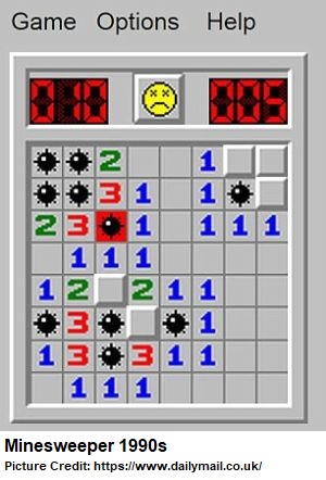
10. Minesweeper (1992-2011) & Solitaire (1990-2011)
 Classic Windows puzzle games Minesweeper and Solitaire were a good means in providing short entertainment breaks from work. The games were fun and simple, yet not so addictive for users to get hooked for hours. Some claimed the games were created to help Windows users to practise how to perform the click, drag and drop functions with the mouse.
Minesweeper was first released in 1990, and became popular after its bundle installation with Windows 3.1 after 1992. It lasted until the early 2010s and no longer came with the new Microsoft operating systems after Windows 7, although it is still available for download in the Microsoft Store.
Solitaire, on the other hand, was developed in 1988 and first released as part of Windows 3.0 in 1990. Like Minesweeper, Solitaire did not come with Windows 8 and subsequent versions of the Windows operating systems, but remains available at Microsoft Store.

New games such as FreeCell and Pinball were later added, but Minesweeper and Solitaire were the iconic games of the early Windows operating systems.
11. Napster (1999-2001)
Pioneering peer-to-peer (P2P) file-sharing software Napster took the storm when it was launched in 1999, allowing users to share songs typically in MP3 format. MP3 was an audio file format that has a reasonably good file size-to-audio quality ratio. It was, back then, a period when MP3 players started to get popular.

Soon, many other P2P file-sharing software also emerged. The copyright issue for songs became a hot topic as the music industry was greatly impacted. In 2001, Napster was forced to shut down after a series of copyright infringement lawsuits and the founding company got eventually bankrupted a year later.
12. Sony Discman (mid-1990s to early 2000s)
The world’s first commercially available CD player was sold by Sony in 1982. Two years later, the Japanese company also produced the first portable CD player. Vinyl discs and cassettes were still dominant in the music industry in the eighties, but CDs had higher audio quality in digital formats.
The early Sony Discman, Sony D-5 (D-50 in foreign markets) did not have any buffering mechanism, which means songs would skip when there were impacts or vibrations to the player. Hence, CD players were not that popular until the anti-skip technology came out in the nineties.

In 1995, the ESP (electronic skip/shock protection) technology was developed. Able to store up to 10 seconds of music in the memory, it allowed smooth, uninterrupted music playback even when the player was bumped. Sony Discman thus became a hit.
In 1997, Sony rebranded their Discman to CD Walkman. By 1998, Sony had sold more than 50 million Discman globally.
13. Creative Zen Micro (mid-2000s)
If the Walkman (cassette player) and Discman (CD player) were the representative portable music players of the eighties and nineties, then the 2000s belonged to the MP3 players.
Apple’s iPod was iconic but Creative Technology’s Zen series of MP3 players were also popular and familiar gadgets to many Singaporeans. The locally bred company developed its first Zen player in 2004, participating in the so-called “MP3 player war” with Apple, Sony, Rio and others in the mid-2000s.

Zen Micro, arguably the most recognisable model in the Zen series, was introduced in November 2014 with a display screen and touch-sensitive vertical strip for easy navigation of the songs stored in the player.
Subsequent models included Zen Neeon, Zen Nano and Zen X-Fi but by 2007, Apple had moved ahead with the launch of their first generation iPhone. MP3 players’ popularity gradually declined by the late 2000s.
14. Friendster (2003-2015)
Before Facebook, there was Friendster, one of the earliest truly popular social networking websites. It was launched in 2003, and rapidly grew in the number of registered users, who could add friends, share photos and videos as well as make comments or chats. By 2008, Friendster had more than 100 million users.

But the rise of Facebook impacted Friendster and its popularity started to fade away. In 2011, Friendster switched from a social networking site to a gaming site. It lasted for four years after which its site and services were completely shut down in 2015.
15. Pioneer LD Player (1980s-late 1990s)
The Video Home System (VHS) tapes and Video Cassette Recorders (VCR) had been the most commonly used media for home videos since their industrial standardization (for the videotapes) and release (VCRs) in 1976. Then came the Digital Video Disc (DVD), with higher quality video formats, in 1995 that spelt the eventual death of VHS tapes in 2016.
Between the VHS tapes and DVDs, there was one more, almost forgotten, video media called the LaserDisc (LD). It was not fully digital and required the use of analog video signals, but nevertheless produced better video qualities than the videotapes.

First released in 1978, LD players, with Pioneer as the prominent brand, gained popularity in Japan, Hong Kong and Singapore in the nineties yet never did capture the US and European markets. The popularity of LD eroded away by the late nineties, replaced by the likes of DVDs and Blu-ray discs (BD).
Home movies and television drama series are now available through digital streaming services such as Netflix and Disney+. Digital streaming services have overtaken the sales of films in DVDs and Blu-rays for the first time since 2017.
16. Teletext (1983-2013)
The Teletext was first developed by the British in the seventies. In 1983, the Singapore Broadcasting Corporation (SBC) launched Teletext, the first such service in Asia, as televisions became a staple home appliance in many households (although one required a Teletext TV set to access Teletext).

Initially called SBCtext with 100 pages each on Channel 5 and Channel 8, it provided news flashes, stock prices, weather forecasts, football matches’ scores, lottery (4D and Toto) results and many other daily and updated text-based information.
However, as internet became popular and widely used by the 2000s, information was easily accessible via the computers and phones. Teletext gradually became underutilised and eventually walked into history on 30 September 2013.

What other old iconic gadgets, software and apps that you have previously used?
Published: 18 January 2022


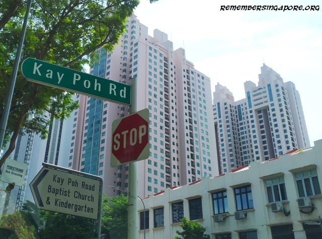

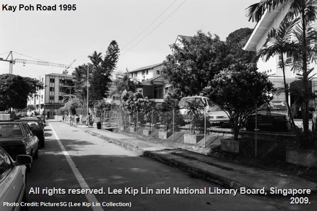
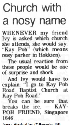 A misnomer of Kay Poh Road is its inaccurate association with kaypoh (“busybody” in Hokkien), a word popular in Singapore and Malaysia in describing those who are nosy, like to gossip about others, or spread malicious rumours, behind one’s back.


")

")

