The Hauntingly Beautiful Terrace Houses of Petain Road

There are more than 230 shophouses at Jalan Besar. The rich history of Jalan Besar’s shophouses spanned almost eight decades, ranging from the oldest shophouses that were built in the 1880s, to the post-war ones developed in the sixties. Their various architectural designs also extended from the early traditional types to the late Art Deco styles.

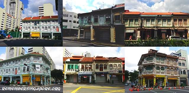
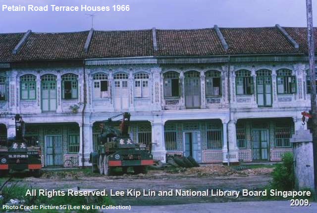
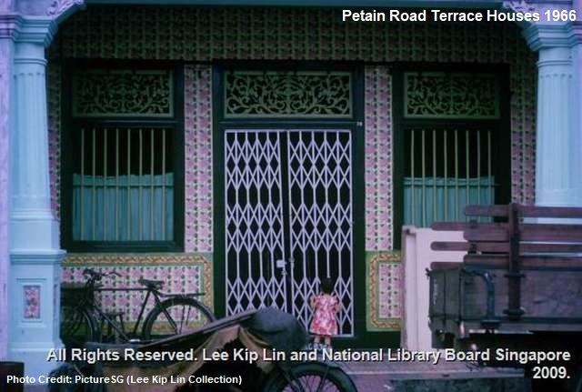
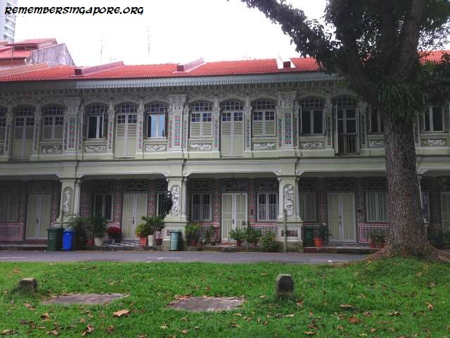
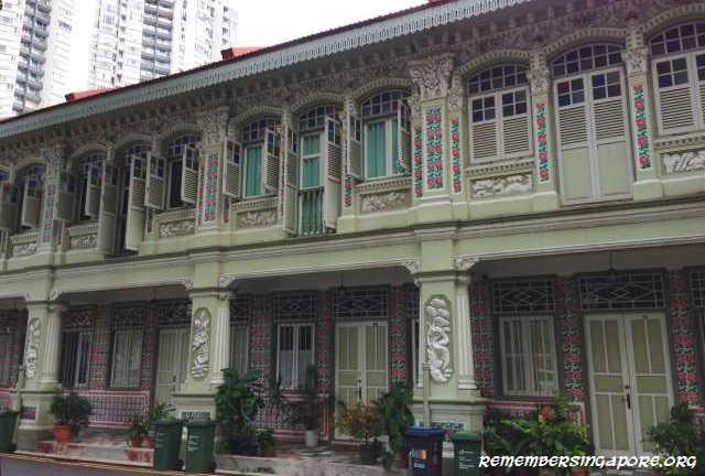
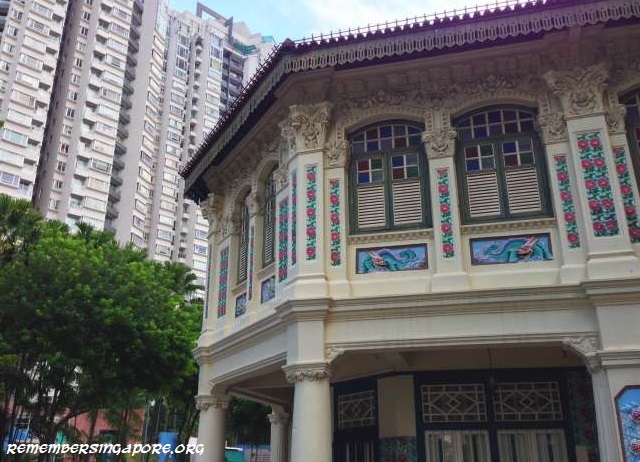
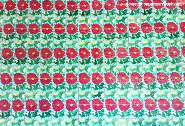
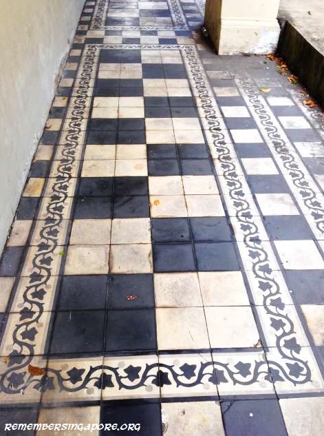
Some of the most beautiful and best preserved ones are situated along Petain Road, consist of 18 double-storey pre-war terrace houses (terrace houses are the residential version of shophouses). Built in the early 1930s, they are the classic examples of Chinese Baroque-style shophouses in Singapore, designed with symmetrical lines, delicate ornaments and ceramic tiles on both the floors and walls.

Petain Road’s terrace houses were initiated by a landlord named Mohamed bin Haji Omar, who first owned a row of shophouses in 1925 at the junction of Jalan Besar and Kitchener Road. Built by J.M. Jackson, a municipal engineer-turned-architect, they were the first three-storey shophouses in the vicinity, and possessed then-contemporary features such as terraces on the top floor and partial flat roofs.

Architect E.V. Miller was engaged to design the Petain Road terrace houses for Mohamed bin Haji Omar. A Modernist, E.V. Miller preferred designs with rounded lines and streamlined functionality. However, insisted by his client, the Petain Road terrace houses eventually turned out to be of Chinese Baroque style with neo-classical features complimented with Peranakan flavours.

This interesting mix of European and Peranakan styles was demonstrated by the pale green and pink birds and flowers’ plaster ornaments on the facades, floral ceramic floor tiles along the five foot way and elaborated Chinese motifs on the Greco-Roman columns. Originated from Malacca, this design was found nowhere else in the world but Malaysia and Singapore.

Petain Road has had several controversies in the past. Henri Philippe Benoni Omer Joseph Pétain (1856-1951) was the Marshal of France who commanded and led the French army to victory at the Battle of Verdun during the First World War. In 1928, the colonial government’s Municipal Committee decided to name it after the great French hero, as part of the naming exercise of the eleven roads at Jalan Besar after First World War’s famous commanders and battles. The other ten were Kitchener Road, Verdun Road, Sturdee Road, Somme Road, Beatty Road, Mons Road (defunct), Marne Road, Flanders Square, Jutland Road (defunct) and Falkland Road (defunct; there is another Falkland Road at the Sembawang area).

It was a twist of fate by the Second World War, when Philippe Pétain became the Prime Minister of France. No match against a strong and aggressive Nazi Germany, he decided to collaborate with the Axis, allowing France to humiliatingly relegate into a puppet state. After the war, Philippe Pétain was convicted of treason and life imprisonment. Due to this tainted legacy, there have been appeals to rename Petain Road.

Other than the name, Petain Road also had an unsavory reputation of being a red light district in the past. During the early 20th century, this vicinity was commonly known as “kim jio kar” (foot of the banana tree in Hokkien), where vegetable farms were abundant. The farms were later cleared and replaced by the shophouses. The neigbourhood became rowdy and complicated by the 1930s, during the peak popularity of the nearby New World Amusement Park. Rivalling secret Societies, smuggling and extortion became rampant around Petain Road. Some of the shophouses were turned into brothels.

Petain Road continued to be a hotbed of gangsterism and vice that by the early sixties, it was reported in the news that many residents were frustrated by the rising criminal offences and wanted the police to step up their actions.

In 1976, the Preservation of Monuments Board (PMB) collaborated with the Urban Redevelopment Authority (URA) and Singapore Tourist Promotion Board (STPB) to study the residential districts at Petain Road, Blair Road and Emerald Hill Road with a view to recommend preservation.

The Housing and Development Board (HDB), in the seventies and eighties, developed public housing at several sites in the downtown area, including Petain Road, French Road and Towner Road. At Petain Road, a rental block was built in addition to the cluster of Singapore Improvement Trust (SIT) flats situated beside the shophouses, which were fortunately spared from the bulldozers during the construction. The Petain Road SIT and HDB flats had been demolished since, and today, private condominiums Kerrisdale and Sturdee Residences stand at the site.

But in 1979, the Petain Road shophouses again faced the threat of demolition. Kin Ann Pte Ltd, a private developer which bought and owned the land deed in 1977, was planning to replace the shophouses with a six-storey apartment block. In the early eighties, they dismantled the front facades of the three Petain Road shophouses without permit, causing an uproar from the public, architects and heritage enthusiasts. The works were halted by the authority in time to prevent further damages.

In 1981, the Petain Road shophouses were earmarked for preservation. They officially came under the general coverage of the Jalan Besar Conservation Area, designated by the URA, in October 1991. As some of the floor and wall tiles were damaged or lost over time, they had to be replaced by similar pieces made in Vietnam during the restoration projects.

Published: 29 December 2019

Updated: 29 December 2025

Posted in General, Historic | Tagged , , , , , , , , , , , , , , , , , , , , , , , | 11 Comments

The Fate of Old New Town Secondary School

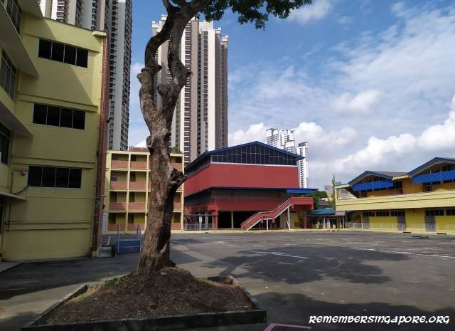
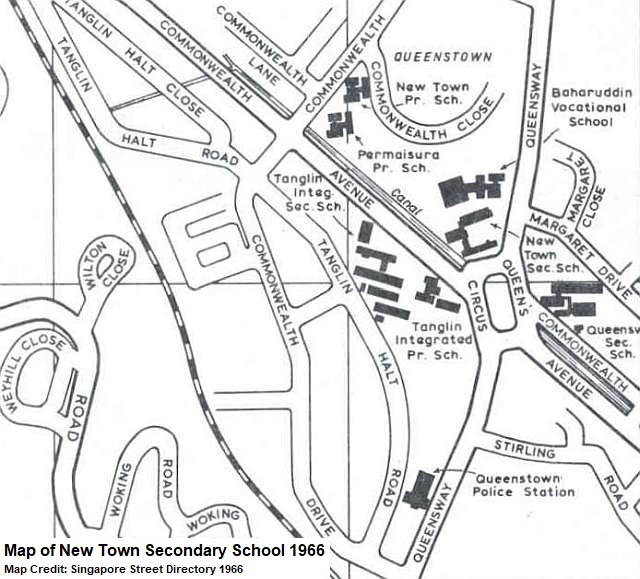
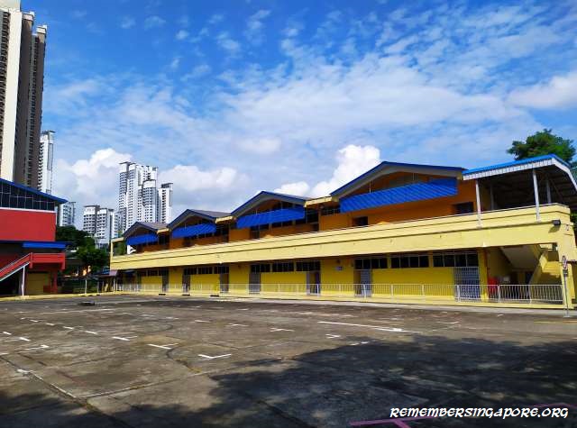
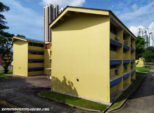
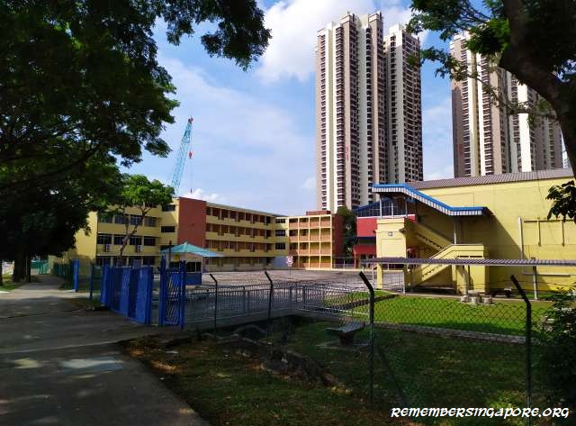
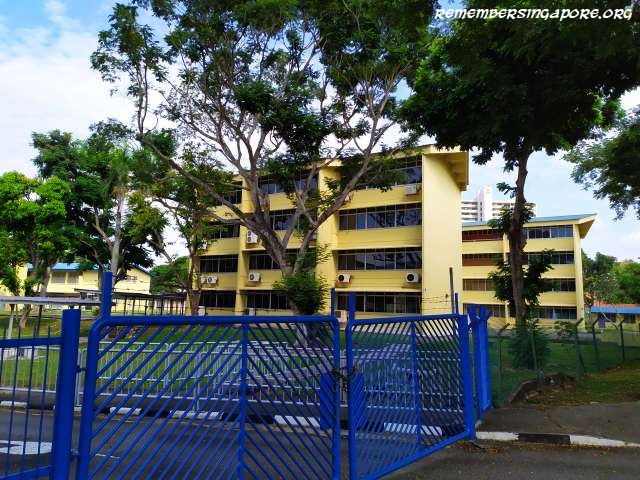
Opposite of Margaret Drive, at the junction of Queensway and Commonwealth Avenue (previously was a roundabout called Queen’s Circus), lies the former campus of New Town Secondary School.

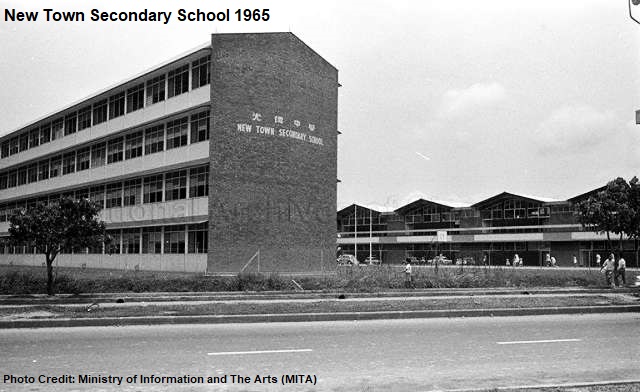
Established in 1965, the same year as Singapore’s independence, the school was initially made up of only a multi-purpose hall building, a four-storey block of classrooms and open-air basketball courts. At the start, it was known as Queensway’s Third Secondary School (the other two being Queensway and Queenstown Secondary Schools), aimed in providing english-medium education to the children of the Queenstown’s residents.

The school was officially named New Town Secondary School in mid-1965, referencing to the relatively new satellite housing estate of Queenstown. The school’s motto was “to forge a better life”, reflecting the goals and objectives of a new state emerged during late fifties and early sixties, hoping that the school and education could forge a better future for its students and, in turn, they could contribute to the nation’s progress and development.

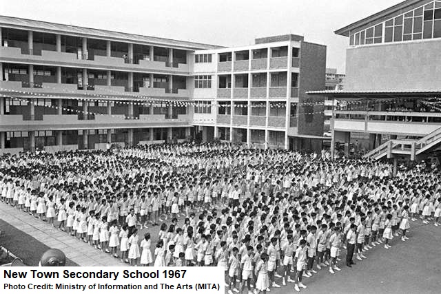
The first year of New Town Secondary School had 45 classes, made up of 73 teachers and 1,819 students. It was one of the first schools in Singapore to provide bilingual education to the students. Many of its upper secondary classes had students from Hua Yi Secondary School, Queensway Secondary School and Tanglin Integrated Secondary School (renamed Tanglin Technical Secondary School in 1969 and Tanglin Secondary School in 1993).

After well-established for almost 20 months, New Town Secondary School was officially opened on 17 September 1966 by Jek Yeun Thong, Minister for Labour and Member of Parliament (MP) for Queenstown.

The importance of Singapore’s secondary education after independence was demonstrated by the school’s distinguished guests of honour. Former Prime Minister of Singapore Lee Kuan Yew and former Singapore President Benjamin Sheares had visited the school in 1967 and 1971 respectively.

In 1969, New Town Secondary School merged with the neigbouring Baharuddin Vocational School, doubling the size of its school compound and increasing its students intake to more than 3,000. By the mid-seventies, New Town Secondary School was the largest secondary school in Singapore.

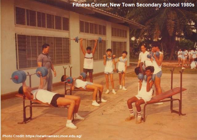
To accommodate the increased number of students, many of the school amenities were upgraded or expanded. In the seventies and eighties, a running track, grandstand, fitness corner and tennis courts were constructed. Also, long benches and tables were added around the school compound for the students to study and rest. An overhead projector was installed in each classroom. In 1988, New Town Secondary School set up its first computer laboratory.

New Town Secondary School in the seventies was a keen participant in many national campaigns such as “Better Food for Better Health” and “Use Your Hands”, where many of its students competed in inter-school cookery contests, while the rest were involved in the spring cleaning and repair works of their classrooms.

New Town Secondary School achieved a major milestone in the nineties, when it decided to be relocated to a newer and larger premises at Dover Road. The construction of the new campus kicked off in 1996. Two years later, in November 1998, the staff and students of New Town Secondary School gathered one last time at the old campus to bid farewell to their beloved and familiar school. A tree was removed and shifted to the new Dover Road campus as part of the symbolic move.

Since then, for more than two decades, the old premises of New Town Secondary School had been left vacant or leased as temporary campuses to other educational institutes, such as Clementi Town Secondary School, Convent of the Holy Infant Jesus (CHIJ) Saint Theresa’s Convent School and Assumption English School.

There are no concrete plans for its redevelopment yet, but the piece of land that the old premises of New Town Secondary School is sitting on will likely not be left vacant for too long.

Published: 23 December 2019

Posted in General | Tagged , , , , , , , , , , , , , , , , , , , , | 3 Comments

Walking Down the Memory Lane of Margaret Drive

Margaret Drive was named after Princess Margaret (Margaret Rose, 1930-2002), the younger sister of Queen Elizabeth II. Constructed in the mid-fifties, Margaret Drive was simply known by the locals as the new road, as it was the main road to serve the newly developed Queenstown housing estate. It ran through Queenstown’s first two neighbourhoods, namely Princess Margaret Estate (later shortened to Princess Estate) and Duchess Estate.
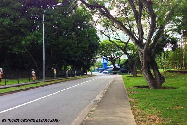
The early Margaret Drive was extended from Alexandra Road to connect with Tanglin Road. It was linked with Queensway at its other end by the early sixties, making the road a total of about 2 km long.

Margaret Drive’s route remained the same for 50 years until 2016, when part of the road was altered due to the Housing and Development Board’s (HDB) residential projects in the vicinity. The modified Margaret Drive is now linked to Kay Siang Road and Dawson Road before continuing its way towards Tanglin Road.
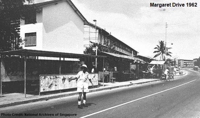
Located along Margaret Drive, the Princess Estate’s early terrace houses were built by the Singapore Improvement Trust (SIT) in the early and mid-fifties, selling for $7,000 to $7,700 each. Other similar houses, designed with two bedrooms and modern sanitation, were located at Duchess Estate’s Dawson Road.

At the same period, the SIT also built blocks of SIT flats of one-, two- and three-bedroom units at Margaret Drive. The relatively low construction cost of the flats also meant that the quality could be compromised, and various defects such as wall cracks started to show up by the early seventies.
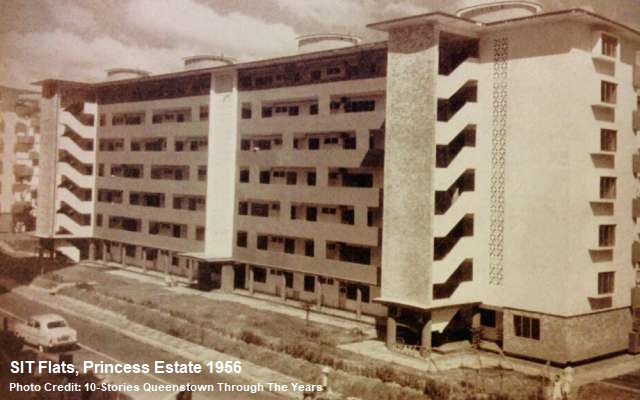
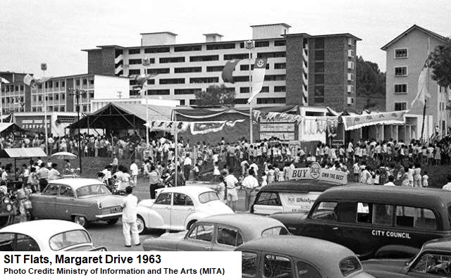
In 1973, the HDB, who took over the role from SIT in 1960, proceeded to redevelop some of the aging residences at Margaret Drive. Several terrace houses (Block 35, 36, 38) and low-rise flats (Block 34, 37, 93, 95, 99) were identified, with their residents served moving out notices. Many of the residents had rented the units for monthly fees of $35 to $40.

The demolition of the SIT flats and houses freed up the space for new redevelopment projects. In the following years, amenities such as supermarket, cinemas, community centre, multi-storey carparks as well as new HDB flats were built to serve the needs of the increasing Queenstown population. The eighties saw another batch of SIT flats torn down, whereas the remaining survived until the late nineties.

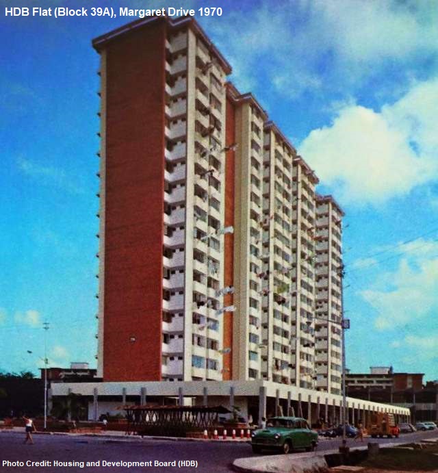
While the SIT flats phased out in the vicinity, the taller HDB flats faced their own fate of demolition too, as the likes of Block 39, 39A and 40, built in the mid-sixties, were torn down in the early 2010s to make way for a newer batch of public housing.
Margaret Drive had new pipping and extension to its water networks installed in the late fifties. The street lighting, however, did not arrive until the sixties.

In the early sixties, both sides of Margaret Drive would be busily dotted with street hawkers, providing a convenient source of food for the residents. However, at the same time, they were congesting the pedestrian walkways in a disorderly manner. The poor hygienic conditions of the street hawkers also posed an issue.

The Margaret Drive street hawkers were later disallowed to ply their trades, and their makeshift stores and tents demolished by the authority. Many later found home at the new markets and hawker centres at Margaret Drive and Tanglin Halt established in the late sixties.

Queenstown’s increasing number of residents and motorists often led to heavy traffic conditions and jams during the peak hours in the sixties, especially at the junction of Margaret Drive and Tanglin Road. It was not until the seventies when the installation of traffic lights at the junctions that the situation started to improve.
Schools

More than a dozen schools once co-existed along Margaret Drive in the sixties and seventies. Many of the schools had closed, or merged. Only a handful of them – Queensway Secondary School, Queenstown Primary and Secondary Schools, Rainbow Centre – Margaret Drive School and Lee Kong Chian Gardens School – still stand at Margaret Drive.

1. Queensway Secondary School (1961-Present)

2. Margaret Drive School (1958-1986) – Not to be confused with Rainbow Centre – Margaret Drive School (RCMDS) which caters for students with special needs. It was established at Margaret Drive School’s former premises in 1987.

3. Birkhall Road School (1956-1984) – Merged with Queenstown School in 1984.
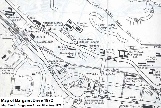
4. Queenstown School (1956-Present) – Merged with Birkhall Road School in 1984. Merged again with Mei Chin Primary School and Tanglin Primary School in 2002 to form the new Queenstown Primary School.

5. Strathmore School (early 1960s-1980) – Established next to Birkhall and Queenstown Schools. Shifted further down Margaret Drive and near Kay Siang Road in 1969. Merged with Keng Seng School in 1980.

6. Hua Yi Primary School (1963-1991) – Established as Hua Yi Integrated School. Closed in 1991 due to low student enrolment.
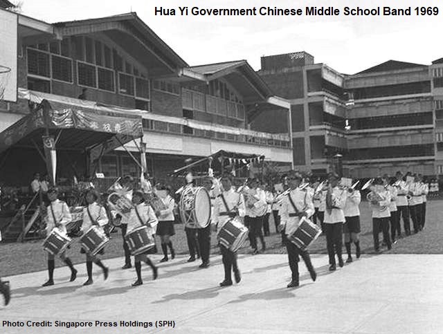
7. Hua Yi Government Chinese Middle School (1956-Present) – Established at Fowlie Road in 1956 as Singapore’s first government Chinese secondary school. Relocated to Margaret Drive in 1958. Renamed Hua Yi Secondary School and moved to Depot Road in 1985. Shifted to Jurong West in 1999.

8. Tanglin Boys’ School (1958-sixties)

9. Tanglin Girls’ School (1957-late eighties) – Merged with the nearby Belvedere Primary School and Xianglin Primary School in the late eighties.

10. Kay Siang Primary School (1969-1983) – Took over Tanglin Boys’ School’s premises in the late sixties. Lasted 15 years until its closure in 1983.
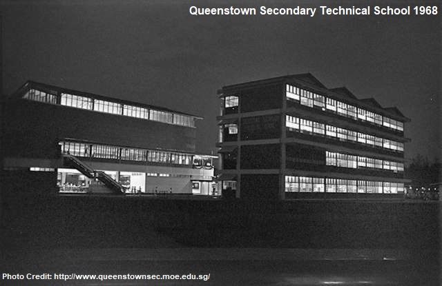
11. Queenstown Secondary School (1956-Present) – Established in 1956 at Jalan Eunos School and moved to Strathmore Avenue as Queenstown Secondary Technical School a year later. Renamed Queenstown Secondary School in 1993 and shifted to a temporary site while its old school buildings were demolished. Moved back to its new school campus in 1997.

12. Townsville Institute (1988-1995) – Established at the former premises of Hua Yi Government Chinese Middle School as a centralised institute for three-year pre-university students studying commerce. Closed in 1995, along with Seletar Institute, as a result of declining student enrolment.
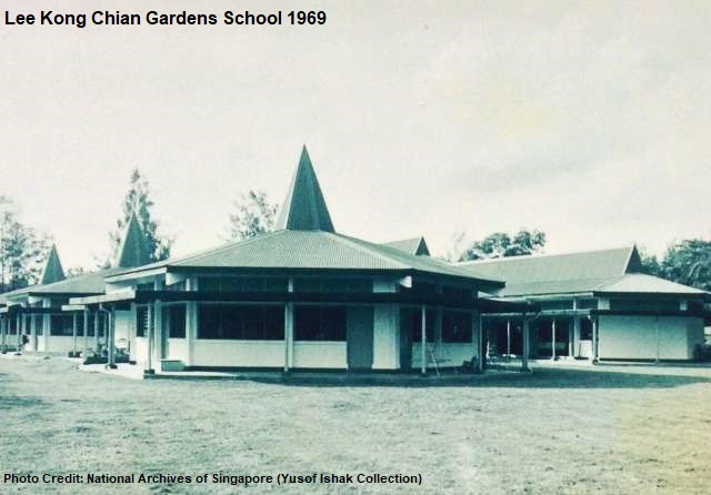
13. Lee Kong Chian Gardens School (1961-Present) – Singapore’s first permanent school for children with intellectual disabilities. Moved to Margaret Drive in 1970 after temporarily housed at Ah Hood Road and Outram. Its old iconic octagonal blocks were demolished in 2000, and replaced by new buildings.

Library

Besides the flats and schools, Margaret Drive had numerous prominent landmarks, one of which is the Queenstown Public Library, Singapore’s first full-time branch library. Initially called Queenstown Branch Library, it was officially opened by former Prime Minister Lee Kuan Yew on 30 April 1970.
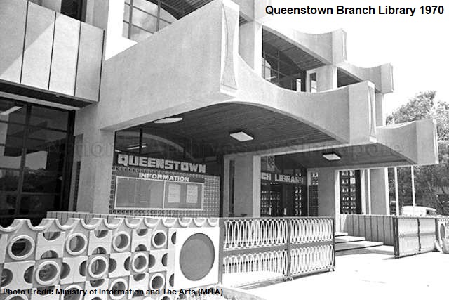
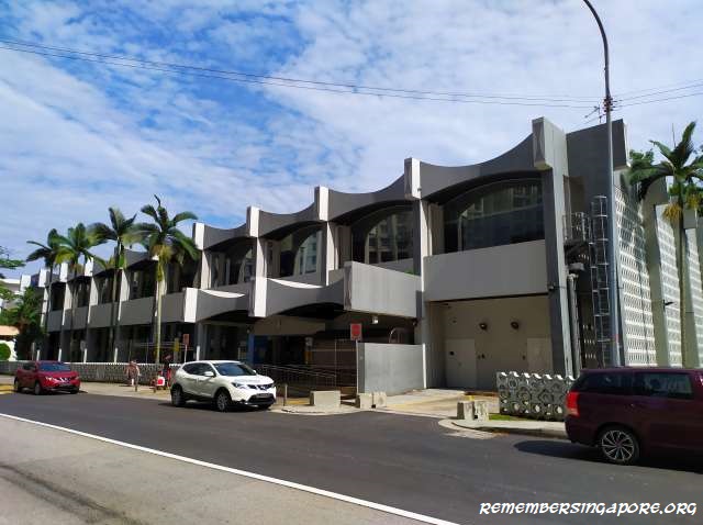
Costing more than $1 million in construction, the double-storey library was designed in Modern style, with unique features such as a “bow-tie” motif along its parapets, sun-shading block and large glass windows that allowed the reading rooms to be naturally lit.

At the start, the library offered as many as 50,000 books – 25,000 of them were children books – allowing the population living in the vicinity who could not afford to buy books to have free access to reading. The library also supplemented the mobile library services that used to ply along Margaret Drive. By the early seventies, Queenstown Branch Library had almost 13,000 members. Between 1,500 and 2,000 books were loaned out on a daily basis, a testimonial of its high popularity.
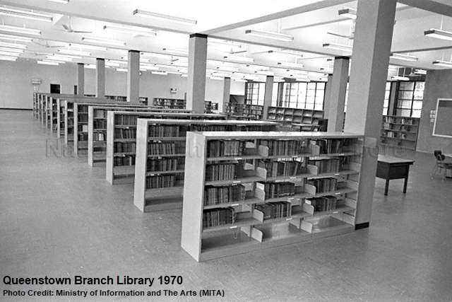
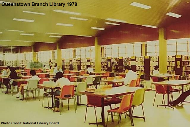
Equipped with information counter, large reference area, reading room and discussion corners, Queenstown Branch Library was the main venue for many activities in the seventies, including various crime prevention talks, photo competition exhibitions, career fairs, guitar lessons and films on awareness of drug abuse. In 1973, the library’s operating hours were extended to 10pm for four days a week, due to popular demands.

By 1978, Queenstown Branch Library had 48,000 members. Its success was replicated at other new towns and housing estates, such as Toa Payoh, Jurong, Kampong Chai Chee, Joo Chiat and Kaki Bukit. Overall, the National Library, its various branches and mobile library services achieved almost 350,000 memberships by the end of the seventies.
For the many schools along Margaret Drive in the seventies and eighties, the library provided a convenient venue for their students to revise homework or do researches on different topics after classes.

In 1978, Queenstown Branch Library was upgraded with air-conditioning, giving additional comfort to the many library-goers. The library was further refurbished in 2003, with installation of elevator, new lighting and cafeteria. The library was renamed Queenstown Public Library in the nineties.
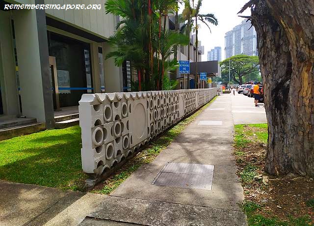
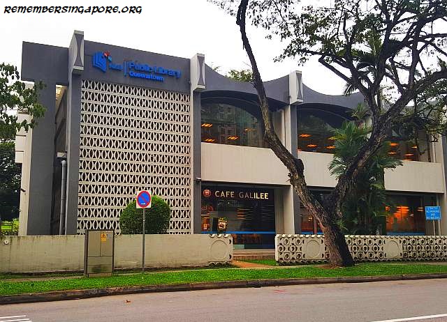
Along with 74 other buildings in Singapore, the 43-year-old Queenstown Public Library was included in the conservation list of Urban Redevelopment Authority’s (URA) Master Plan 2014.

Polyclinic

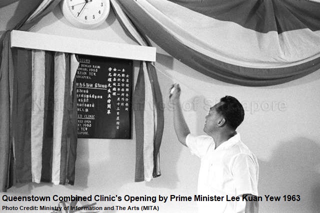
The former Queenstown Polyclinic (known as Queenstown Combined Clinic at the beginning) at Margaret Drive was officially opened on 13 January 1963 by former Prime Minister Lee Kuan Yew. It was Singapore’s first polyclinic, and was established to provide subsidised affordable healthcare and medical services to the residents of Queenstown.
Queenstown Polyclinic comprised an outpatient clinic, psychiatric clinic, maternity centre and a healthcare services outlet for children. A private dental clinic was also added in 1984. In 1986, the polyclinic was upgraded for more consultation rooms and to improve on its registration processes.
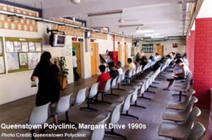
Queenstown Polyclinic was involved in many government’s medical programs in the seventies, such as the free vaccine for children’s immunity against smallpox, measles and diphtheria. By the late seventies and early eighties, polyclinics became essential amenities in the newly developed housing estates, including Clementi and Ang Mo Kio. There were as many as 12 polyclinics in Singapore in 1980, but Queenstown Polyclinic remained the only one to be opened during Sundays and public holidays.

In 1985, Queenstown Polyclinic underwent another round of renovations. After completion, it became the main medical centre servicing both the Queenstown residents and those living in the Holland Road area, taking over the functions of Chip Bee Outpatient Dispensary and Holland Road Maternity and Child Health Centre.
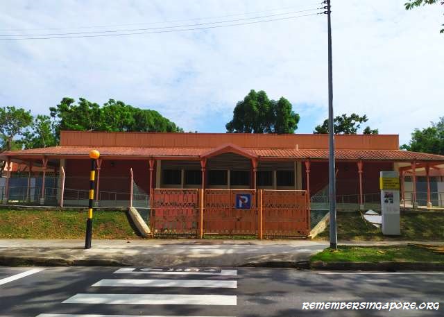
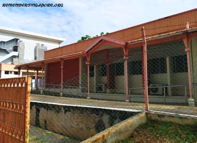
Medical services remained affordable at polyclinics in the late eighties – it cost $2.50 for consultation and 50c for every items of medicine prescribed. However, the waiting time could be exasperatedly long even after the enhancements to the registration processes.

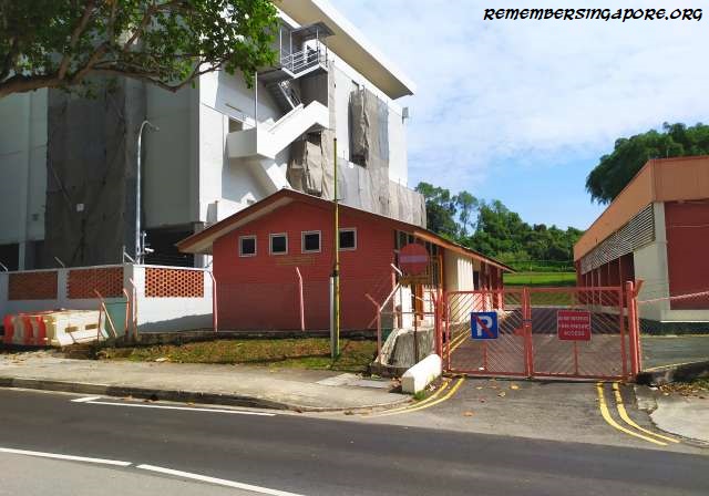
Queenstown Polyclinic was relocated to Stirling Road in 2007, and its old Margaret Drive premises was temporarily leased out as foreign work dormitories for several years. Currently vacated, there are no news of any conservation or redevelopment plans of the former Queenstown Polyclinic yet.
Hawker Centre

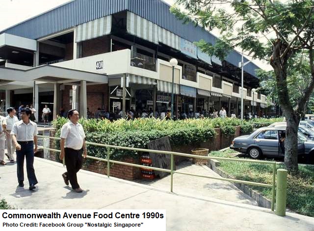
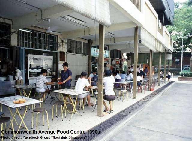
The Commonwealth Avenue Food Centre, or sometimes fondly known as Margaret Drive Hawker Centre, was built in 1969 to accommodate the street hawkers. The makan place was a popular venue for the Margaret Drive residents, who patronised it for their morning doses of kopi and savoured their favourite fish ball noodles and chicken rice during lunches and dinners.
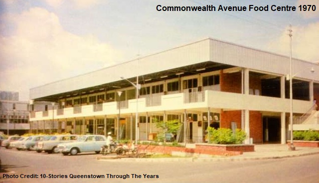
By the late 2000s, as more Margaret Drive residents moved out and old flats vacated, it was clear that the double-storey hawker centre, housed in block 40A, would not last for long. Even then, it remained popular among diners from the nearby factories and offices. In 2011, the 42-year-old hawker centre was eventually closed for good, and was subsequently demolished.

Its site was left vacant for several years before a new residential project – SkyResidence @Dawson – kicked off recently. Its completion will be accompanied by a new hawker centre called Dawson Hawker Centre.
Market

Other than Commonwealth Avenue Food Centre, the Block 38 Commonwealth Avenue Wet Market, a stone’s away from the hawker centre, provided another alternative for food. It was also the main market for the residents to buy fresh produce, vegetables, eggs and other necessities.

Known as the “coffin market” by the residents due to the distinguished parabolic shape of its roof, the market, built by SIT in 1960, was the first wet market to be conserved by URA. It is also one of the two conserved Margaret Drive landmarks, along with the Queenstown Public Library.
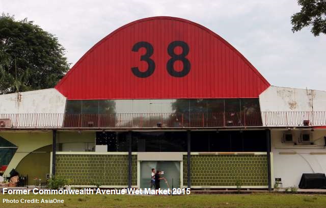
Today, the wet market no longer functions, having closed back in 2005. There will be redevelopment plans to the building, one of which is restoration to a wet market place.

Cinemas

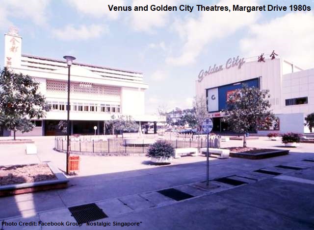
Queenstown welcomed its first cinemas when the Venus Theatre and Golden City Theatre opened at Margaret Drive in late 1965. Screening popular Hokkien, Cantonese and Teochew movies, the cinemas were a hit among the residents of Queenstown. Both Venus Theatre and Golden City Theatre arguably enjoyed their golden periods in the seventies, but would suffer their declines a decade later.

Facing stiff competition from newer neighbourhood cinemas and the rise of colour television programs, the cinemas’ revenues dropped and had to end their businesses by the mid-eighties. Their buildings have been occupied by the Church of Our Saviour and The Fisherman of Christ Fellowship since then.
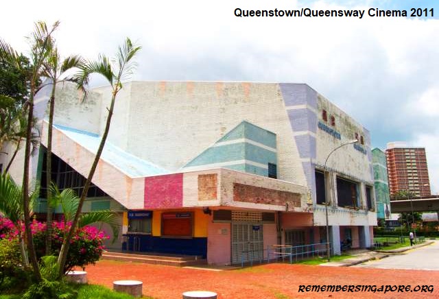
A third cinema in the vicinity fared better. The twin-screen Queenstown/Queensway Cinema was opened in 1977 and lasted more than two decades until 1999. It was the go-to place for many Margaret Drive and Queenstown youngsters and dating couples, especially in the eighties, when Hong Kong kungfu flicks and Taiwanese romance films were permanent fixtures on the screens.

The cinema also had a neighbouring bowling alley, known as Queenstown Bowl. In the later years, a karaoke lounge was also added. Both of those amenities provided additional entertainment options for those who had finished the late night movies.
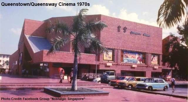
But the late nineties saw the popularity of the cinema and bowling alley declined along with the population of the Margaret Drive estate. They were subsequently shut down, and were left vacated for years. In 2013, the former buildings of the old school cinema and bowling alley were finally demolished. A new Queenstown Mall will be constructed at their former sites in early 2021.
Emporium

Opened on 9 September 1967, Tah Chung Emporium was the undisputed number one shopping venue for the residents of Queenstown. It was housed in a three-storey building, numbered 40B, located between Commonwealth Avenue and Margaret Drive.

While the emporium occupied the building’s second floor, the ground floor was reserved for the numerous street hawkers formerly from Margaret Drive and Commonweath Avenue. On the third floor was Golden Crown, a popular dim sum and Chinese cuisine restaurant.
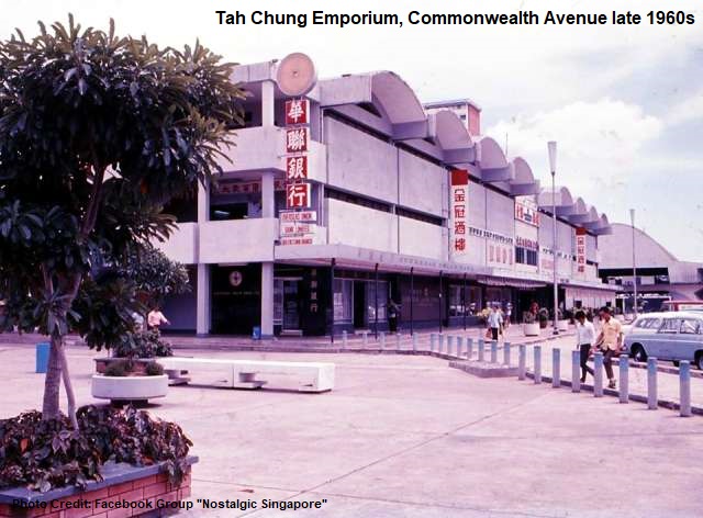
The emporium, together with the neighouring market, hawker centres, cinemas, post office, library and polyclinic, served as the unofficial self-sufficient town centre for Queenstown from the seventies to the nineties. An aging neighbourhood and declining resident population, however, brought an closure to Tah Chung Emporium in the nineties, and its three-storey building was subsequently demolished in 1999.

Mosque

Located at the junction of Margaret Drive and Tanglin Road, Masjid Jamek was constructed in the early sixties to cater for the religious needs of the Muslim residents and workers at Queenstown. Upon its completion, it was officially opened on 25 December 1964 by Mohamed Khir Johari, the former Malayan Minister for Agriculture and Co-operatives.
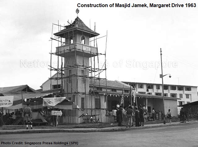
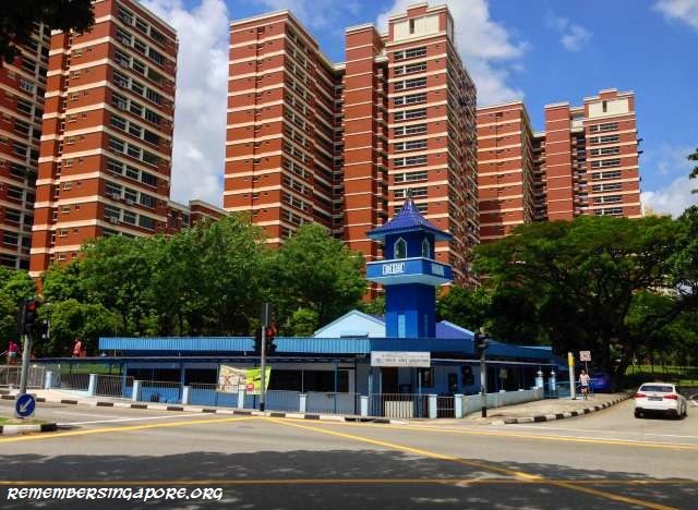
The single-storey mosque was designed in traditional Javanese style and could accommodate as many as 400 worshippers. Masjid Jamek’s most distinguished feature is its tall minaret with a pitched roof, situated above the prayer room.

The mosque also used to have a miniature garden filled with tropical decorative plants and wooden fences, but it had to make way for a drainage when the road next to the mosque was raised. This was due to the frequent flooding in the area during the seventies and eighties.
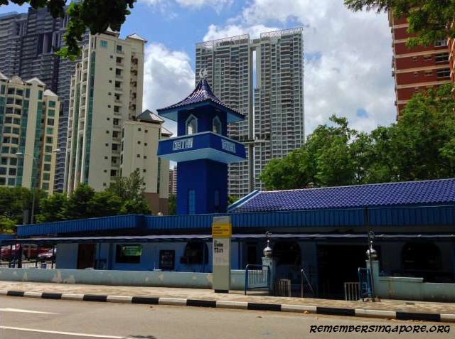
In some cases, Masjid Jamek was affected so badly that its compound would be filled with water at knee-deep levels. The mosque personnel had to clear the flooded premises by painstaking scooping the water out. The situation only improved after the upgrading of the Alexandra Canal.

Previously painted in bright blue colour, Masjid Jamsek formed a striking contrast with the tall reddish HDB flats in its background. The mosque has been changed to a beige and brown tones recently. Today, it conducts religious lectures on Thursdays, Fridays and Saturdays as well as madrasah classes during the weekends.
Prison

With imposing watch towers and tall walls, the Queenstown Remand Prison was perhaps the only unapproachable landmark along Margaret Drive. It was built in the mid-sixties as the replacement for the old Outram Prison, which was demolished and redeveloped into Outram Park housing estate.

Queenstown Remand Prison was opened in 1966 by then Minister for Culture and Social Affairs Othman Wok. It was situated at the end of a short minor road called Jalan Penjara, off Margaret Drive.
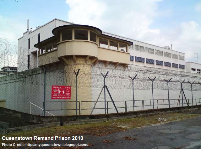
The 388-cell prison was used for holding inmates on short sentences or those waiting to be transferred to Changi Prison. Typically, three to four inmates were locked in one cell, equipped with squatting toilet with a flush system. The prison also had blocks of quarters as accommodation for the prison wardens.

Queenstown Remand Prison was closed in August 2009, after almost 43 years of operation. There were suggestions to convert it into a hostel, studio, artists’ gallery or even a youth campsite. But the premises were eventually demolished a year later. Its site is currently an empty piece of land waiting to be redeveloped.

Rain Trees

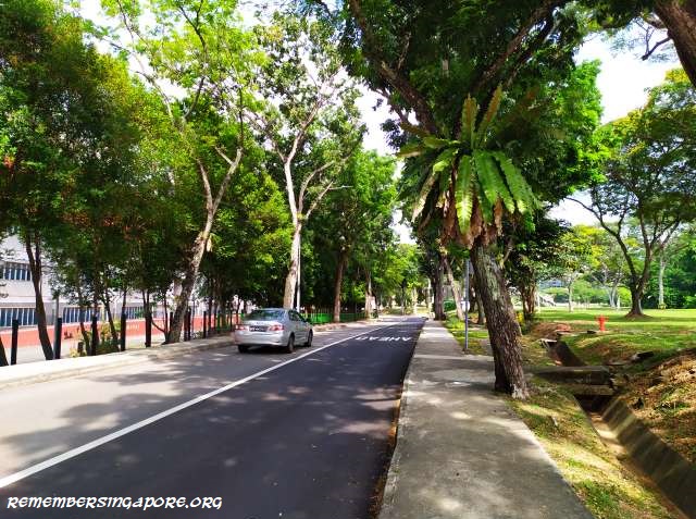
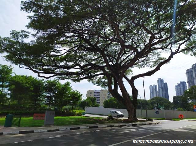
Last but not least, there are numerous majestic rain trees along Margaret Drive that have grown, flourished and witnessed the past peacefulness and recent changes at Margaret Drive. It is a pity that a number of the decade-old rain trees, many of them more than 50 years old, have to be cut and removed due to the widening of the road and residential development of the vicinity.
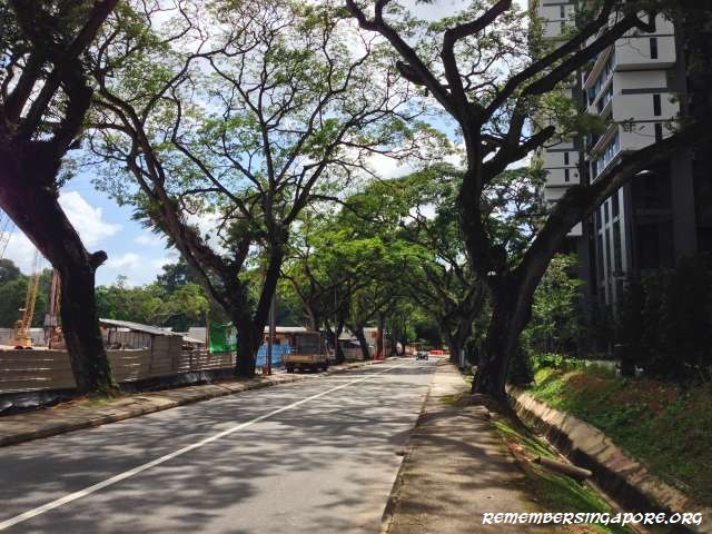
Margaret Drive is currently undergoing rejuvenation. Other than SkyResidence @Dawson, several HDB residential projects are expected to be completed by the end of 2020. These include SkyOasis, SkyParc and Dawson Vista, which will add more public housing units to the already completed SkyTerrace and SkyVille HDB flats in the vicinity.

Published: 15 December 2019

Updated: 18 December 2019

Posted in General, Nostalgic | Tagged , , , , , , , , , , , , , , , , , , , , , , , , , , , , , , , , , , , , , , , , , , , , , , , , , , , , , , | 30 Comments

The Remaking of Jalan Kayu’s Church of The Epiphany

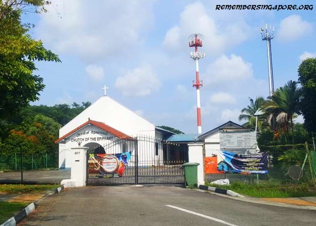
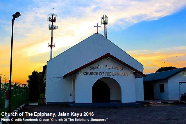
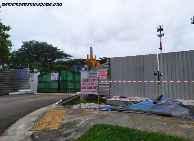
The familiar old white building of the Church of The Epiphany, located off the roundabout outside the former Royal Air Force (RAF) Seletar (later Seletar Camp) main gates, had been demolished.

An Anglican church at Jalan Kayu, the Church of The Epiphany was dedicated on 01 May 1967. Its historical links went back further to the early 20th century, during the construction of the Seletar Airbase. Back then, the airbase’s Indian labourers had their worshipping and religious rituals carried out in a small attap shed.

During the Second World War, the prayers were moved to a shed with a metal roof along Lorong Thanggam. In 1965, with the assistance from Christ Church, a new chapel was built at its present site of 407 Jalan Kayu. Blessed by Reverend C.K. Sansbury, the Bishop of Singapore and Malaya, the foundation stone was laid, on 01 January 1966, by Group Captain R.W.G. Freer of the RAF.

For 52 years, the old Church of The Epiphany had witnessed the changes of its surroundings. Its former neighbours – the likes of Jalan Kayu Village, Jalan Kayu Bus Terminal and Jalan Kayu Primary School – had long vanished into history. Its relatively undisturbed environment came to an end in the nineties when the Tampines Expressway (TPE) and Sengkang New Town were constructed.

As for the Church of The Epiphany, it will be undergoing massive changes too. The demolition of its iconic white single-storey building will pave the way for the development of a new five-storey church building, expected to be completed by late 2020. Meanwhile, its church members will continue to hold their prayer sessions at the nearby Abundant Grace Presbyterian Church along Jalan Kayu.

Published: 08 December 2019

Posted in Religious | Tagged , , , , , , , , , , , , , , , | 1 Comment

Singapore Trivia – The Red Junglefowl of Singapore

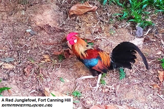
The red junglefowls (gallus gallus) are frequently mistaken as domestic chicken, although they are truly the chicken’s wild ancestors. They belong to the pheasant family, which includes pheasant, peacock, quail and partridge. Native to most of Southeast Asia and East Asia, the red junglefowl, however, is listed as an endangered animal in Singapore.

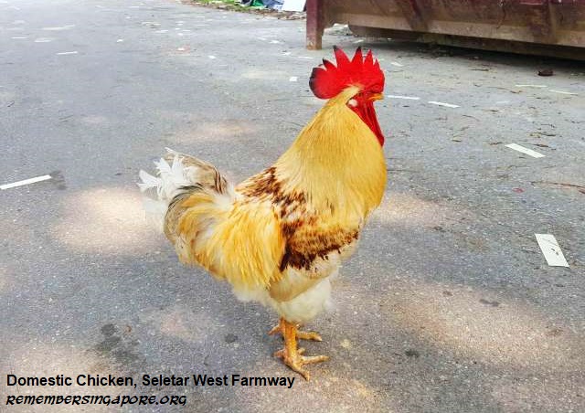
There have not been many records of the red junglefowls until the eighties, when they were first observed at Pulau Ubin by some bird-watchers. Nowadays, the red junglefowls have found home at mainland Singapore, where they can sometimes be spotted wandering out of the dense vegetation at the Western Water Catchment area, Fort Canning Hill and Seletar West Farmway.

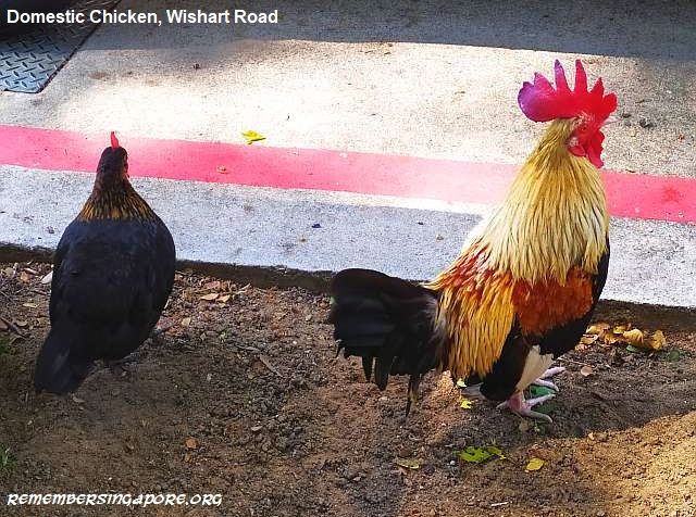
While they may look very alike, there are several noticeable differences between a red junglefowl and domestic chicken. A male red junglefowl has two obvious white patches on its body – below its eyes and at its rump, near its tail. It also has grey legs, while a domestic rooster has yellow or pink ones. A rooster also has a long crowing, whereas the male red junglefowl’s call is strangled at the end. The most glaring difference is perhaps the flying ability of a male red junglefowl.

An adult male red junglefowl can grow up to 75cm long. Polygynous by nature, a red junglefowl family typically consists of a rooster, several hens and many chicks, roaming around and pecking insects and seeds for food. Due to their occasional contacts with domestic chicken, it is not unusual to find hybrid descendants of red junglefowls and their domestic relatives.

In 2017, the Agri-Food and Veterinary Authority (AVA) and National Parks Board carried out culling of the free roaming chicken found around Sin Ming and Thomson View for several reasons, including noise pollution, bird flu risk and to reduce the possible dilution of the genetic stock of purebred red junglefowls.

Published: 24 November 2019

Posted in General | Tagged , , , , , , , | 1 Comment

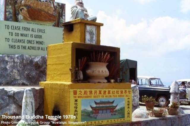
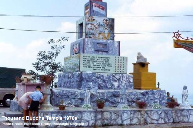
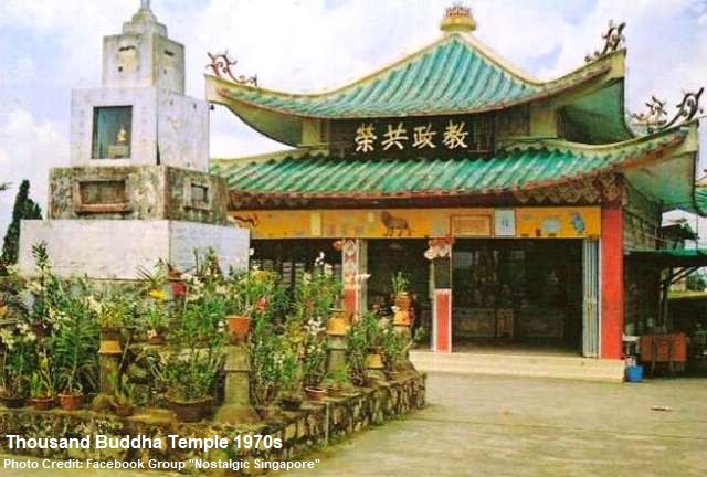
A Thousand Buddhas at Telok Blangah Hill

The Telok Blangah ridge area was made up of at least seven small hills. In 1845, Singapore’s superintending engineer Captain Charles Edward Faber (1807-1868) was tasked to clear the thick vegetation and construct a road and signal station on top of Telok Blangah Hill. For his achievements, Telok Blangah Hill was renamed Mount Faber after him.

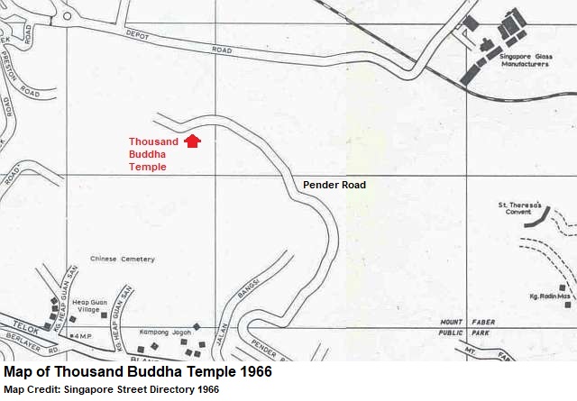
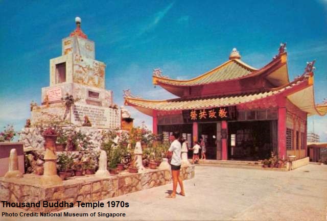
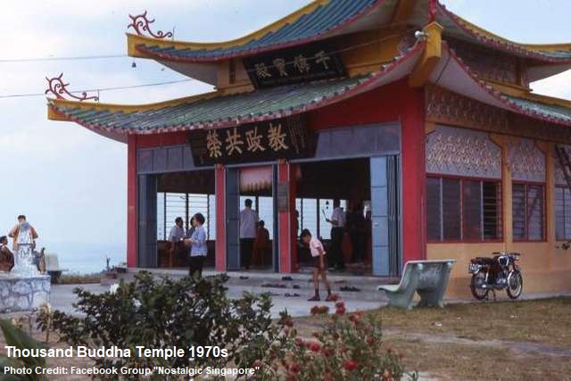
Telok Blangah Hill was also known as Washington Hill and Thousand Buddha Hill. The latter name was derived from the three Buddhist landmarks on the hill between the late fifties and eighties. The landmarks were the Thousand Buddha Temple, its hall and the World Buddhist Society headquarters housed at the former Alkaff Mansion.

Dedicated to pure Buddhism, the Thousand Buddha Temple and its hall were built in late fifties and mid-sixties respectively. The temple had a large following of devotees, who contributed to the building of the hall with tiles specially made by the four monks residing in the temple. The hall was mainly used for prayers and medical consultations. Both the Thousand Buddha Temple and hall lasted more than two decades until their demolition in the mid-eighties.

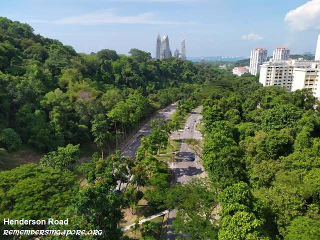
In the early seventies, several roads were constructed by the Public Work Department due to the development of a new Telok Blanglah housing estate. Telok Blangah Heights and Telok Blangah Drive were built, while Henderson Road was extended between Depot Road and Telok Blangah Road, cutting through the Mount Faber ridge. The road extension disrupted Pender Road, which was originally the road leading to the Thousand Buddha Temple.

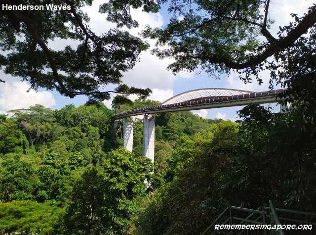
With Henderson road dividing the vicinity into two sides, one side of the ridge retained its name as Mount Faber, while the other side was called Telok Blangah Hill again. Today, the two hills are connected by the spectacular 36m-tall Henderson Waves bridge, built in 2008.

Containing hundreds of Buddha statues, murals and images, the Thousand Buddha Temple was popular among the locals, and was promoted as a tourist attraction by the Singapore Tourist Promotion Board (STPB). Crowds of devotees would make their way to the temple during the first and fifteen day of the lunar month, as well as important Buddhist dates such as Vesak Day. The World Buddhist Society, in the early seventies, proposed the idea of building Singapore’s first Buddhist hill resort at Telok Blangah, but the plan did not materialise.

One of the unique features of the temple was the Rishi Wheel of Fortune, an automated divination machine that, with a coin inserted, spun and gave an number. The devotees could then match the numbers to their respective divination papers. Another was the statue of a seven-headed Makara (Dragon) that coiled around a seated Buddha. The relic was gifted by Thailand’s Wat Suthat Temple. There was also an old sacred Bodhi tree at the hall’s grounds, said to be imported from India.

In the early eighties, the Ministry of National Development decided to redevelop Telok Blangah Hill into a recreational and leisure destination. The plan included the creation of a new park and the refurbishment of the Alkaff Mansion. Being religious entities, the Thousand Buddha Temple and World Buddhist Society had to be demolished or relocated, much to the dismay of their devotees and the general public, who appealed to the authority without success.

Today, the terrace garden of the Telok Blangah Hill Park occupies the former site of the Thousand Buddha Temple. The unobstructed panoramic views of the Telok Blangah and Keppel Harbour areas remain as enchanting as before, but few can remember the existence of this glorious temple on a hilltop.

Published: 10 November 2019

Posted in Cultural, Historic | Tagged , , , , , , , , , , , , , , , , , , , | 5 Comments

Goodbye Sentosa Merlion

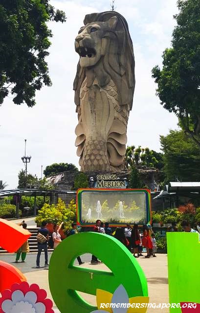
The only constant is change, and Sentosa is the perfect example. Its latest change is the closure of the Sentosa Merlion, which has officially walked into history on 20 October 2019. Come end of the year, the gigantic landmark will be demolished to make way for Sentosa’s newer developments.
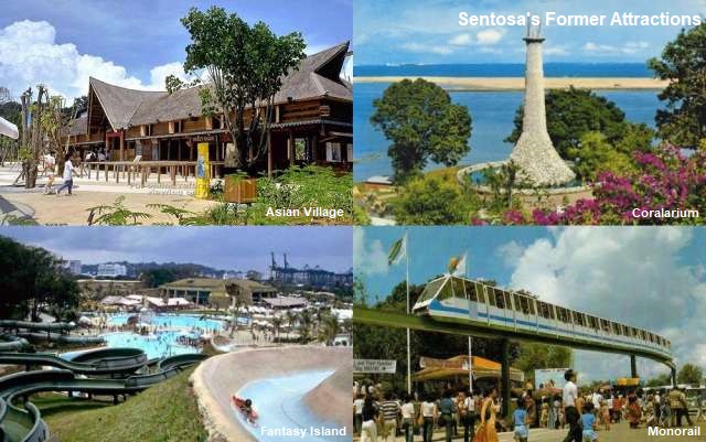
Since its transformation from a sleepy fishing village and military barracks in the seventies to become one of Singapore’s top tourist destinations, Sentosa is destined to keep evolving.

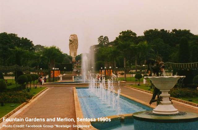
Over the years, its iconic landmarks came and disappeared. Various generations of Singaporeans would have their different memories of the leisure island. The Coralarium (1974-1983), Monorail (1982-2005), Musical Fountain (1982-2007), Fountain Gardens (1989-2007), Underwater World (1991-2016), Asian Village (1992-2001), Fantasy Island (1994-2001), Volcanoland (1995-2002) and Tiger Sky Tower (2004-2018) formed part of those memories.

Sentosa’s various attractions – many of them were successful, others not quite – had boosted the visitorship to the leisure island. In over two decades, the number of visitors to Sentosa grew from about 5 million (in the mid-nineties) to 19 million (2018). The idea of another attraction in the form of a gigantic Merlion was mooted in the early nineties. When the proposal was finalised, tender was called, with seven bids received in 1991. Two years later, the groundbreaking ceremony was officiated by Senior Minister Lee Kuan Yew.

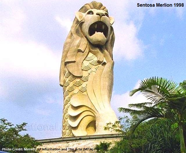
Finally completed in 1995 at a cost of $8 million, the Sentosa Merlion stood 37m tall, making it the tallest Merlion in Singapore and many times taller than the original 8m-tall Merlion at the Singapore River and the two 3m-tall Merlions at Mount Faber and Singapore Tourism Board (STB) office along Grange Road.

The Sentosa Merlion received its fair shares of distinguished guests after its opening. The Crown Prince Albert of Monaco, Estonia Prime Minister Tiit Vahi and Vietnam’s Minister for Culture and Information Nguyen Khoa Diem visited it between 1996 and 1998.

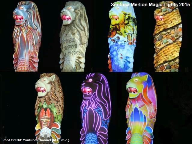
Some of the memorable displays at Sentosa Merlion included the green laser beams’ shooting from its eyes, forming the grand finale of Musical Fountain shows. Another would be the Magic Lights show in which the Merlion transformed into a captivating colour-changing spectacle of lights and sounds.

The expected demolition of Sentosa Merlion by the end of 2019 will make way for a new $90-million multi-sensory walkway. The walkway, expected to be completed in 2022, will be a part of the Sentosa and Pulau Brani’s redevelopment plan, which, in turn, is under a much larger-scale Greater Southern Waterfront (GSW) project.

Published: 26 October 2019

Posted in General | Tagged , , , , , , , , , , , , , , , , | 3 Comments

Seah Im Road and the Mysterious Bunker

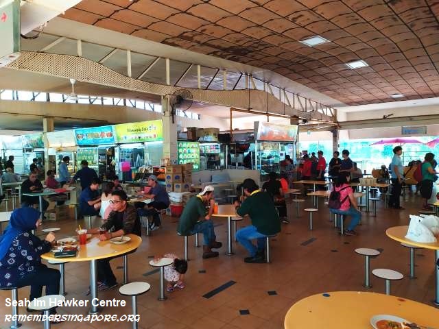
The name Seah Im, to many Singaporeans, may ring a bell when they think of that popular hawker centre opposite of Harbourfront that serves delicious duck porridge, nasi goreng ayam and curry rice. It is Seah Im Road, however, a short road located off Telok Blangah Road, that gives the hawker centre its name.

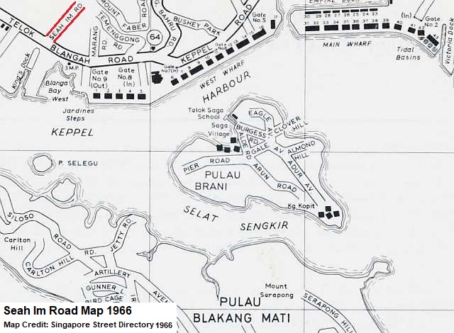
Seah Im Road began as a private road in the early 20th century. It was built at the request of Ang Seah Im (undetermined-1927), a wealthy Hokkien tin mining businessman who had many properties at Telok Blangah. In 1907, the Municipal Commission agreed to name it Seah Im Road, after Ang Seah Im met the requirements of installing lighting, fences and embankments on his new private road.

One of the early notable landmarks at Seah Im Road was the Keppel Harbour Community Centre, built by the Social Affairs Ministry in 1957 at a cost of $40,000. The People’s Association took over and manage it in 1960. The community centre served the Telok Blangah residents well for more than two decades until the early eighties.

Low-rise blocks of staff quarters and a pre-war colonial bungalow also once stood at Seah Im Road, managed by the Port of Singapore Authority (PSA) in the seventies.

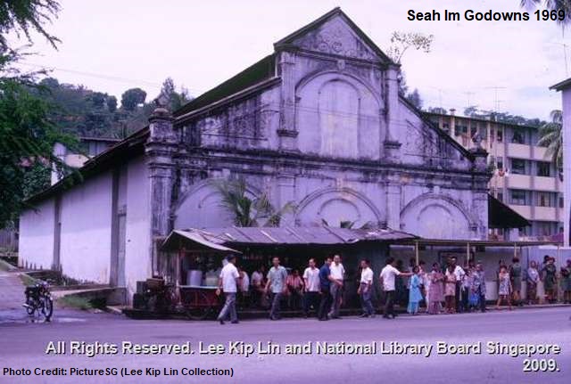
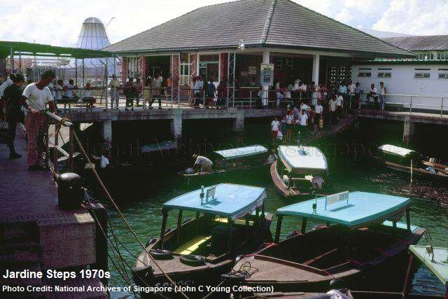
On the opposite side of Telok Blangah Road were known as Seah Im, made up of rows of godowns and warehouses, and Jardine Steps, a docking place for boats plying between the mainland and Pulau Belakang Mati (present-day Sentosa). The facilities and dock later made way for the development of World Trade Centre, Maritime Square and Harbourfront Centre.

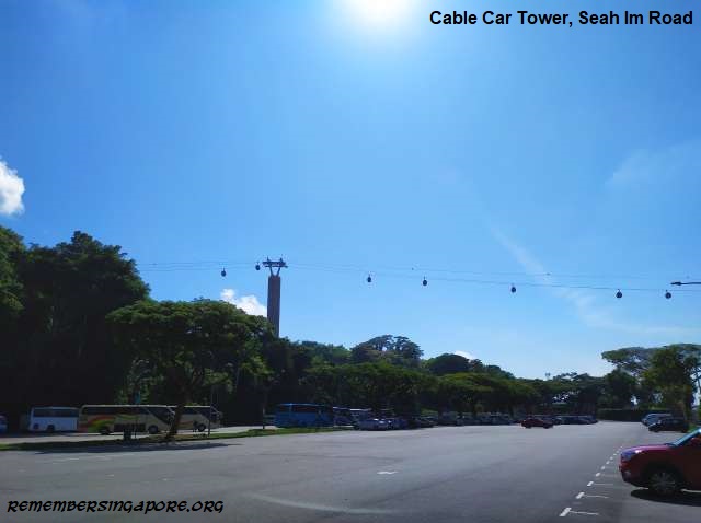
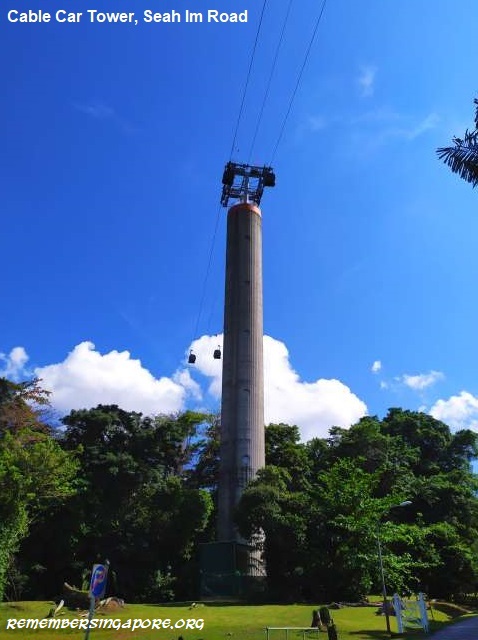
In 1974, a tower was built at Seah Im Road as part of the $5.8-million cable car system between Sentosa and Mount Faber. The 64m-tall Seah Im Road tower is one of the two towers – the other was at Pulau Selegu (the little island had since been absorbed into the larger Sentosa) – supporting the cable car system. The pair of towers cost $1.1 million in construction in the early seventies.

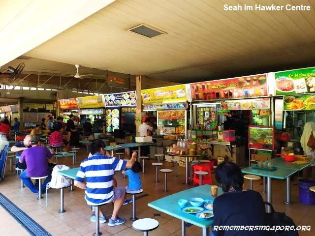
The mid-eighties saw two landmarks appeared beside Seah Im Road – the popular Seah Im Hawker Centre in 1984, and the World Trade Centre bus terminus in 1985 (present-day Harbourfront Bus Interchange), built at the site of a former Malay kampong.

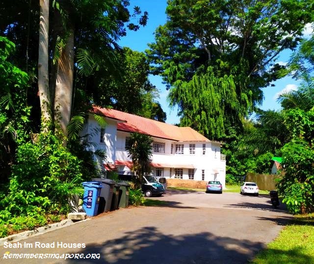
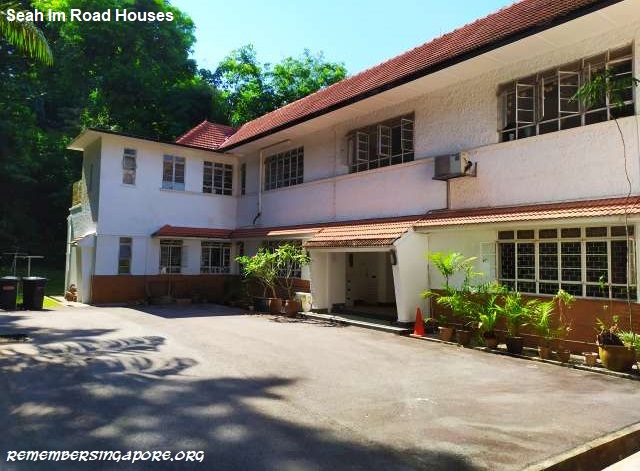
Today, there are several double-storey private residential houses still existing at the end of Seah Im Road.

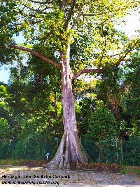
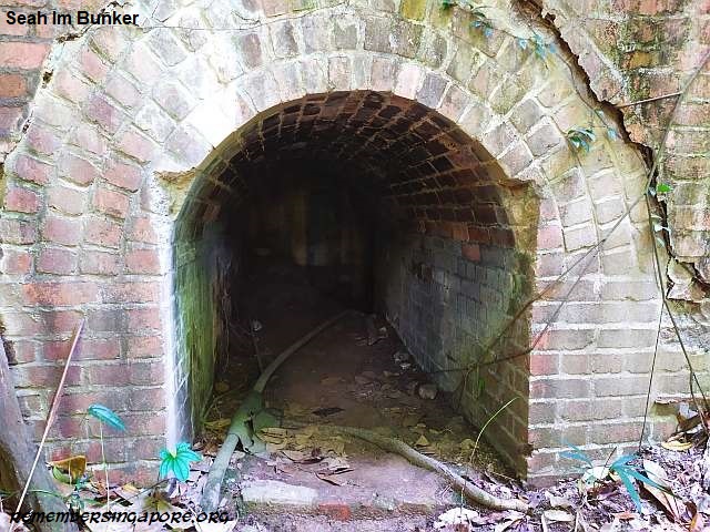
The mysterious Seah Im bunker entrance is hidden in thick vegetation about 20m just behind a heritage tree called Kapok Tree, standing on the fringe of Seah Im Carpark.

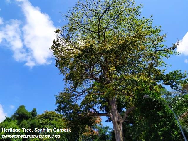
The tall sturdy tree – Kapok Trees are able to grow up to 40m tall – originates from tropical America and is, in fact, the national tree of Puerto Rico. From far, it is easily recognisable by its cream-coloured flowers during the flowering and fruiting stage. This particular Kapok Tree at Seah Im Carpark has been endorsed as one of Singapore’s heritage trees since 2005.

The name of Kapok Tree is derived from kapok which, in Malay, refers to the white fibre that surrounds the seeds inside its large hanging fruits. The fruits, or seedpods, split open when ripe, releasing tiny black seeds with kapok that are scattered and carried away by the winds.

Kapok is useful for its softness, good water-resistance and buoyancy. It is often used for a stuffing material for life jackets, pillows and mattresses.

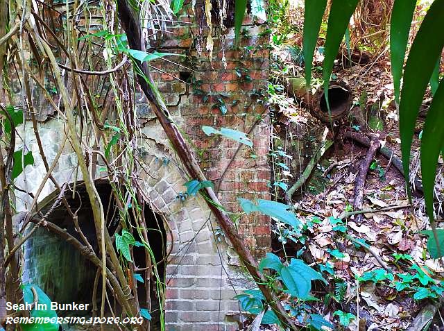
The 1m-tall Seah Im bunker lies on the forested slope of Mount Faber. Its brick entrance leads to an elongated tunnel, about 2.5m tall on the inside and was designed with small ventilation holes along its walls.

Little information is known of the bunker. It was likely to be built just before the Second World War, and might be used for imprisonment of the prisoners-of-war (POWs), or as a storage place for wartime equipment and ammunition. Over the decades, it became covered by thick vegetation and its existence gradually forgotten.

There are several surviving WWII tunnels and bunkers in Singapore. Labrador Park, Fort Canning, Alexandra Hospital, Sentosa’s Fort Serapong and the Marsiling Tunnels are some of the examples.

As for the Telok Blangah vicinity, it has a number of lesser-known heritage sites that have caught the attention of heritage enthusiasts and media in recent years. Other than Seah Im bunker, the sites are the abandoned Keppel Hill Reservoir, a mysterious Japanese tomb and the old Marang Road graves.

Published: 13 October 2019

Posted in Exotic, Historic | Tagged , , , , , , , , , , , , , , , , , , , , , , | 2 Comments

Reminiscences of the Old Beauty World

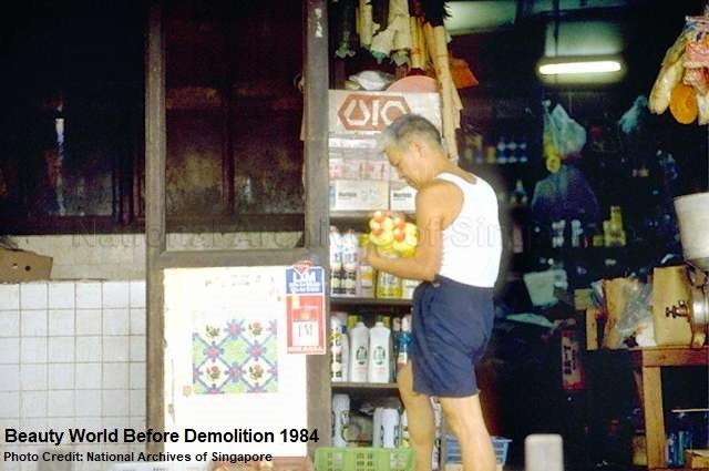
Located at the junction between Upper Bukit Timah Road and Jalan Jurong Kechil, used to be known as the Bukit Timah Road 7.5 milestone, was once a popular market and shopping destination for locals during weeknights and weekends.

Before the Second World War, the Bukit Timah vicinity was mostly made up of kampongs and rubber and pineapple plantations. Beauty Timah Village was the dominant kampong; its surrounding area was then known as “Chin Huat”, derived from the name of a grand mansion – the only brick house in the vicinity – owned by a Chinese mandarin who had settled in Singapore in the early 20th century. The house was destroyed by the bombings during the Japanese invasion, and its site later replaced by Halfway House nightclub and restaurant.

Tai Tong Ah

During the Japanese Occupation, some local businessmen collaborated with the Japanese to open an amusement park at Bukit Timah Road 7.5 milestone. It was named Tai Tong Ah Sai Kai (大东亚世界 in Cantonese), after the Japanese’s Greater East Asia Co-Prosperity Sphere propaganda during the Second World War. The new amusement park cost almost $1 million to build, with funds likely raised by the Overseas-Chinese Association.

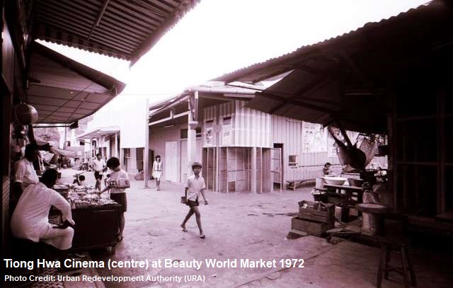
A grand opening of the amusement park was held in September 1944, opened by Japanese officers and several invited Overseas-Chinese Association members. The new recreational place was made up of getai (singing stages), food and drink stalls, photo studios, medicine shops, a Japanese films-screening theatre called Tiong Hwa Cinema and all types of gambling booths such as lottery, tikam-tikam, pai-kow and fan-tan.

It was said that the Japanese wanted gambling to divert the people’s attention from their oppressive rule, and, at the same time, soak up their wealth and recoup the banana notes which were not printed fast enough to deal with the runaway inflation during the Japanese Occupation. It was not uncommon to see lucky gamblers went home at night carrying sacks of banana notes, without any fears. Robberies were rare then – thieves and robbers would have their heads chopped off during the Japanese Occupation.

Powered by generators, the amusement park’s stalls were brightly lit at night and packed with people, making it stood out in a vicinity of ruralness and darkness, and was dubbed as the most “beautiful” place at Bukit Timah. Hence, Tai Tong Ah was also known as Beauty World.

After the end of war in 1945, Tai Tong Ah was allowed to operate for another year with a temporary license granted by the returning British. The gambling booths, however, were banned, greatly affecting the park’s business. With the crowds not returning, a businessman and hotel owner Giam Kok Eng sought approval from the British authority to dismantle the park and convert the site into a market place.

Old Beauty World

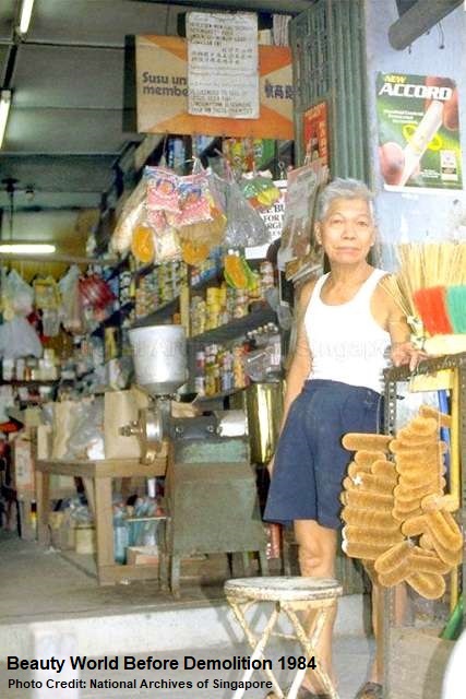
In 1947, the Beauty World (美世界) Market was opened, retaining its former popular name. The name was also catchy and easy to remember among the locals, as it resembled the three well-known leisure places in Singapore then – Great World (大世界, located at Kim Seng Road), Gay World (繁华世界, Geylang Road) and New World (新世界, Jalan Besar). The new market-shopping venue was filled with stalls selling a wide range of products from food, beverages, textiles and shoes to books, hardware and utensils.

But Beauty World during the fifties was plagued by extortion, violence and territorial fights by the secret society members. The stallholders and hawkers at the market had to pay protection fees to the gangsters. Otherwise, they would be beaten up and their stalls wrecked. It would be the sixties before the anti-gang laws came into effect to reduce and suppress the illegal activities of the secret societies.

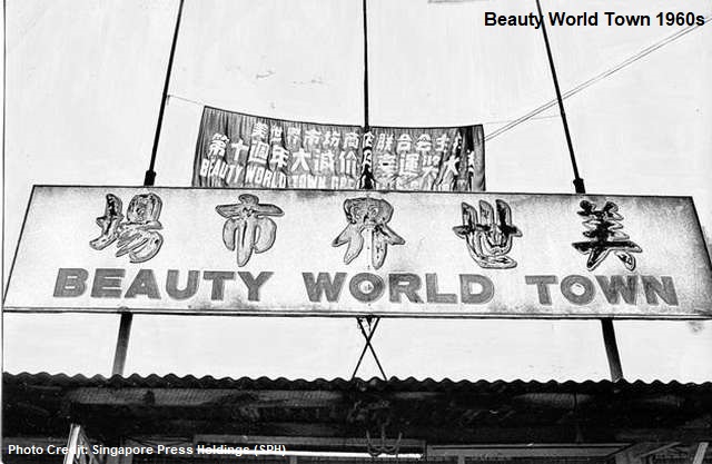
In 1962, the market saw expansion with the establishment of Beauty World Town, adding vitality to the busy stretch from Bukit Timah Road 7 milestone to 8 milestone that was already buzzing with business and industrial activities.

In fact, the Bukit Timah area was one of Singapore’s first industrial areas established after the war, with numerous rubber, canned food, beverage and sauce production plants operating in the vicinity, such as Bin Seng Rubber, Lam Choon Rubber, Amoy Canning, Lam Soon Cannery and Yeo Hiap Seng. There were also the famous Singapore Cold Storage and Ford Motor Company.

The withdrawal of the British military in the early seventies dealt a blow to the businesses at Beauty World. Like many other markets and clusters of shops elsewhere in Singapore, including Jalan Kayu, Changi and Nee Soon Village, Beauty World also relied on the spending powers of the British troops stationed in Singapore.

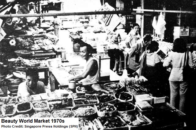
But with the opening of more factories and industries in the vicinity, Beauty World managed to survive and flourish. By the mid-seventies, the Beauty World Market had grown to include more than 150 stalls, selling all types of food, necessities and appliances popular with the locals, tourists and expatriates.

But its popularity came with a price. Jalan Jurong Kechil was constantly jammed with many illegally parked cars, and the crammed market was often complained by the public for its dirtiness and poor hygienic conditions.

The congested stalls covered with corrugated zinc and canvas tops, messy huts and makeshift structures at Beauty World Market and Beauty World Town were also a potential hazard for fire-related incidents. At least five major fires broke out at Beauty World Market and Town between the seventies and eighties.

In 1975, a fire roared through two coffeeshops and seven stalls that sold food, poultry, textile and radios, destroying $200,000 worth of properties. The last fire incident, occurred in 1984, razed the 40-year-old Tiong Hwa Cinema to the ground.

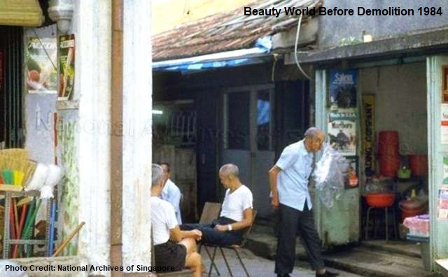
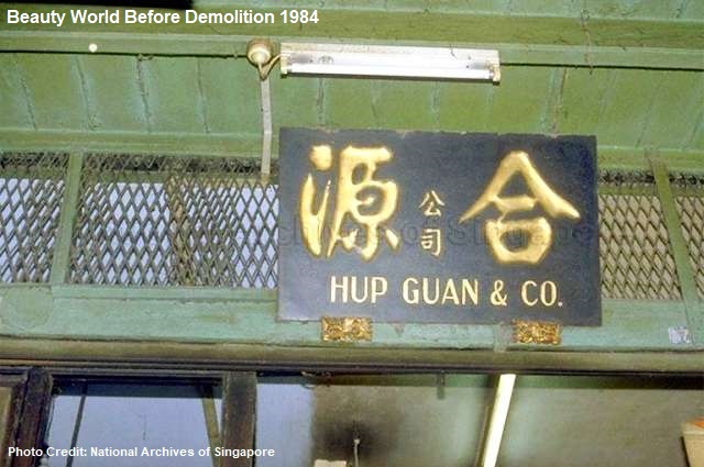
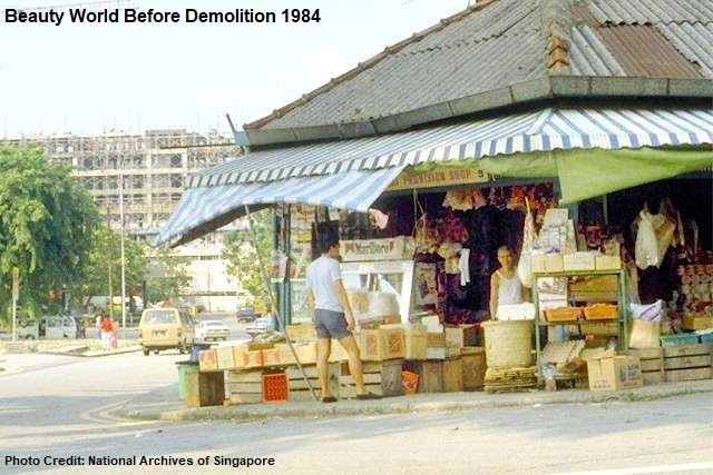
The Beauty World site was acquired by the Singapore government in 1975, and by late 1983, it was decided to close and demolish the old and dilapidated Beauty World. The former market saw its last batch of stallholders and hawkers moved out by 1984.

The old shophouses at the nearby Chun Tin Road and Cheong Chin Nam Road are perhaps the only survivors in the vicinity that have witnessed the rise and fall of the old Beauty World. The shophouses have since been refurbished and converted into popular restaurants, cafes and pubs.

New Beauty World

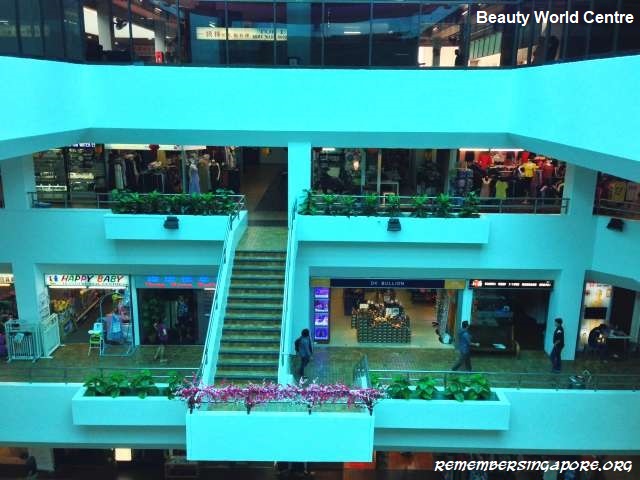
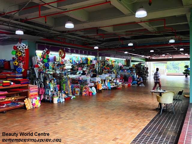
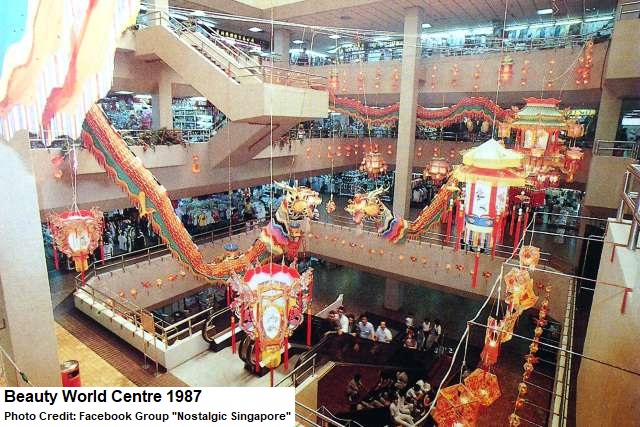
As the old Beauty World walked into history, a new Beauty World – the government-built Beauty World Centre and the privately-developed Beauty World Plaza – emerged on the opposite side of Upper Bukit Timah Road.

Opened in 1984, Beauty World Centre was designed and built by the Urban Redevelopment Authority (URA) at a cost of $45 million. The new mall’s shops on its first three storeys were mostly reserved for the former stallkeepers at the old Beauty World. On its fourth level was a 41-stall food centre, where the previous hawkers shifted and continued their trades.

The remaining old Beauty World tenants, who did not want to shift to the new place or not agreeable to the rents, had mostly relocated to the new town of Clementi.

Beauty World Centre was bought over by Pidemco Land in 1989. Nine years later, the ownership of the mall was sold to its 194 individual shopowners in a strata-titled deal that amounted $80 million in total.

As for the former sites of Beauty World Market and Beauty World Town, there had been proposals since the mid-eighties to redevelop the land for new high rise buildings or malls, but the plans never did materialise. In the 2010s, the Downtown Line cut through the vicinity, with a Mass Rapid Transit (MRT) station opened in December 2015. The MRT station was fittingly named after Beauty World.

After more than three decades, the new Beauty Worlds are showing signs of aging too. Both Beauty World Centre, including its hawker centre, and Beauty World Plaza have been the subjects of purchases for redevelopment in recent years, albeit unsuccessful deals due to their valuations. However, with Singapore constantly and rapidly evolving, it is not surprising to see a new generation of Beauty Worlds in the near future.

A trip down the memory lane of the old Beauty World (before its resettlement and demolition in the mid-eighties):

Published: 22 September 2019

Posted in Nostalgic | Tagged , , , , , , , , , , , , , , , , , , , , , , , , , , , , , , , , , | 13 Comments

Past and Present Cemeteries of Singapore (Part 2) – Malay/Muslim Burial Grounds

One of the early records of Muslim cemeteries was carried by the Municipal Engineer in 1875, when he was tasked to conduct site surveys on those burial grounds situated within and on the outskirts of the Singapore’s city area.

As many as 20 cemeteries were recorded; among those were six Malay burial grounds, located at Victoria Street, Tanjong Pagar, Orchard Road and River Valley. The others were Chinese, Bugis, Parsi, Hindu, Roman Catholic and Portuguese cemeteries.

Cemeteries

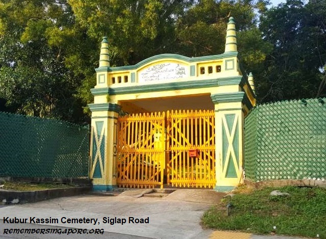
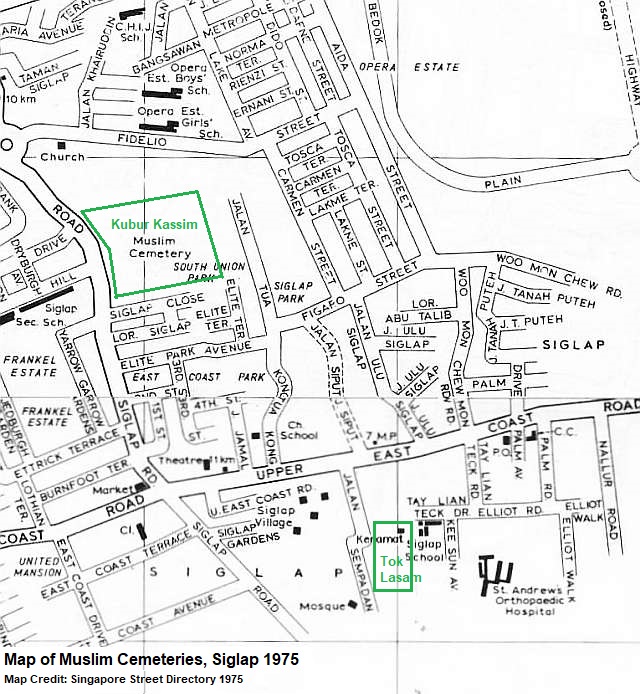
The Siglap and Bedok areas have a number of old and former Muslim graveyards. The maps of the fifties show that there were plots of Muslim cemeteries, often named as Mohammedan cemeteries, in the vicinity. One of them is the Kubur Kassim Cemetery, established in the 1920s on a piece of land along Siglap Road endowed by Ahna Mohamed Kassim bin Ally Mohamed, a cargo boat and steam launch owner.

Kubur Kassim Cemetery’s striking yellow and green gates possess the Indo-Saracenic style of a mixture of Mughal and classical European features, a popular architectural design in Malaya in the early 20th century. The cemetery, which also houses a surau (prayer house in Malay), used to serve as the final resting place for the Muslims living in Siglap.

Buried at Kubur Kassim Cemetery were some of the well-known community leaders, including former Singapore Municipal Commissioner Dr Hafeezudin Sirajuddin Moonshi, who became the first in Singapore to open a Muslim clinic in 1916. Another was Che Lembek binte Abdin, the former headmistress of Kampong Glam Girls’ School during the Second World War.

For years, Kubur Kassim Cemetery has been a source of haunted tales. This may be due to the fact that some of its tombs are dedicated to Orang Bunian, a kind of supernatural human-like beings often portrayed in Malay folklore. However, the 90-year-old cemetery may be facing the likelihood of exhumation. In the Urban Redevelopment Authority’s (URA) 2014 master plan, the site where the cemetery resides has been earmarked for future residential development.

About 200m away from Siglap Road, at Jalan Sempadan, was the grave of a Sumatran prince called Tok Lasam (or Lassam), believed to be the founder and penghulu (chieftain in Malay) of Siglap. Marked by yellow tombs, signifying royalty, the grave also included Tok Lassam’s wife and his panglima (commander-in-chief).

It was said that Tok Lasam came to Singapore and established a fishing village by the sea in the early 19th century. In 1821, a solar eclipse occurred, frightening many of the village’s residents who thought their village had fell into the darkness. This led to the naming of the village as si-gelap, meaning “dark one” in Malay.

Tok Lasam’s grave used to be part of a larger Muslim cemetery. In the nineties, the redevelopment of the vicinity saw most of the cemetery’s graves exhumed and reinterred at Choa Chu Kang Muslim cemetery. It was only after the petitioning from the community leaders and public that the tomb of the legendary prince was retained at its original site.

A Muslim cemetery in the vicinity that did not make it to this day was the one located at the junction of Upper East Coast Road and Hwa San Road (defunct). A neighbour of the Chinese cemetery Hwa San Teng (or Wah Suah Teng), the cemetery had about 4,000 graves, serving as the burial ground for the Malay residents living at the kampongs around Jalan Bilal, Jalan Haji Salam, Jalan Greja and Jalan Langgar Bedok.

The Muslim cemetery’s last burial was done in the mid-seventies. Together with the Chinese cemetery, exhumations were carried out in the mid-nineties, after which the site was used to build a private condominium called Kew Green.

The cemetery at Lucky Gardens was a Boyanese burial ground. Boyanese, or Baweanese, were originally from Indonesia’s Bawean Island, arriving at Singapore in the early 19th century and working for the British as labourers, horse trainers and drivers. The unique cultural identity of Boyanese was their communal lodging house, known as pondoks, a type of social institution for Boyanese to interact, find jobs or settle newly arrivals.

Kampong Boyan and Kampong Kapor, along the Rochor river, used to have many of these pondoks, where the early Boyanese came and worked at the construction site of the racecourse at Farrer Park. The last pondok in Singapore, cleared in 2000, was previously housed at a Club Street shophouse. Most Boyanese, after generations of assimilation and integration, had become part of the local Malay population.

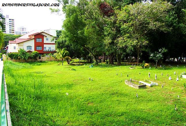
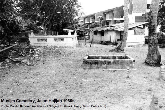
A short distance away from Lucky Gardens’ Boyanese cemetery, near Lucky Heights and Sennett Road, used to exist the grave of Madam Hajijah, a wealthy landowner in the early 20th century who was well-remembered for her contributions to the construction of the Kampong Siglap mosque and welfare of the residents living in the vicinity. The road Jalan Hajijah and the former village Kampong Hajijah were named after her.

Madam Hajijah’s grave stood at Batu Lapan (8 milestone in Malay) until the eighties when her remains were exhumed and shifted to the Pusara Aman Muslim Cemetery at Choa Chu Kang.

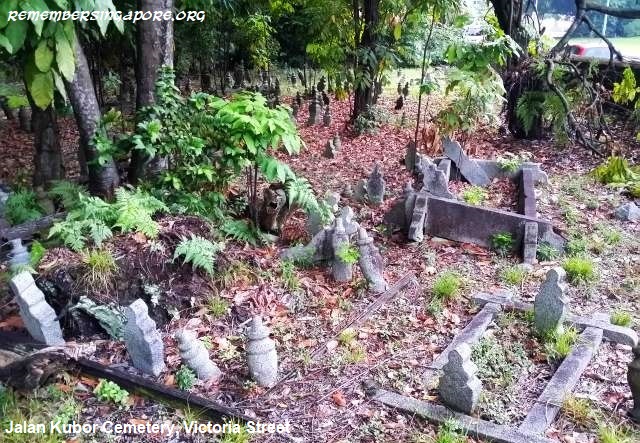
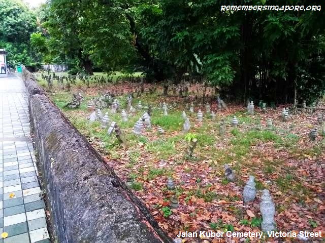
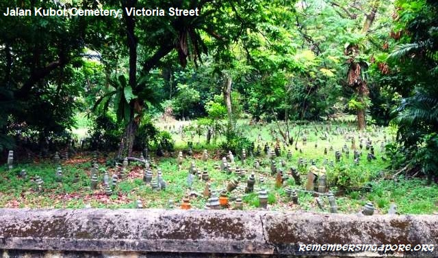
Located at Victoria Street is Jalan Kubor Cemetery. Originated in the 19th century, it is one of the oldest surviving Muslim cemeteries in Singapore. The cemetery was initially separated into three different burial grounds located close to one another, one of which was the reserved royal burial ground for Johor Sultan Hussein Shah’s (1776-1835) family and household. Hence, it was also known as the Tombs of the Malayan Princes, although Sultan Hussein himself was not buried in it.

The graveyard was in an abandoned state by the late 19th century, although it did receive one of its last burials in Tengku Hussain bin Tengku Haji Ali, a royal descendant of Sultan Hussein, in 1954.

The second burial ground was called Malay Burial Ground, meant to be a final resting place for the Muslim commoners. However, it later became better known as Aljunied Burial Ground after prominent businessman and philanthropist Syed Omar bin Ali Aljunied (1792-1852) and his family members were buried there.

The third was the Kling Burial Ground, mentioned in the municipal engineer’s report in 1875. Mainly used as a cemetery for the Indian Muslims residing at Kampong Glam, it later became known as the Tittacheri Muslim Cemetery, and was managed by the appointed trustees of the Indian Muslim community in the early 20th century.

By 1860, the burial grounds, collectively known as Jalan Kubor Cemetery, was deemed full by the municipal government. The Sultan’s Burial Ground and Malay Burial Ground were closed in 1875 and 1901 respectively, although fresh burials were still carried out occasionally. The Tittacheri Muslim Cemetery remained opened until the Second World War, while its accompanying mosque, Malabar Muslim Jama-ath Mosque, exists until today.

Rich in history, with many old tombstones found with inscriptions in Malay, Arabic, Gujarati, Bugis Aksara, Javanese Aksara, English and Chinese, Jalan Kubor Cemetery was also the burial place of many prominent figures. They included Syed Omar bin Ali Aljunied, Perak warrior and chief Ngah Ibrahim (1830s-1895) and Haji Ambo Sooloh (1891-1963), a wealthy Malay businessman and philanthropist of Bugis descent, and possibly the last person to be buried at cemetery.

Like the Kubur Kassim Cemetery, the site of Jalan Kubor Cemetery is also earmarked as a future residential development in URA’s 1998 master plan. There have been suggestions from heritage enthusiasts and groups calling for the preservation of the old cemetery.

Another old plot of Muslim graves is the one located at Marang Road, at the foot of the southern side of Telok Blangah Hill. It is said that the graveyard, containing some 200 tombstones, originated from an old Malay village called Kampong Marang. Kampong Marang had existed in the vicinity for almost 200 years until it was destroyed by a big fire in the eighties.

Overran by thick vegetation today, the forgotten cemetery was apparently also the burial place for Ahmad Marang Omar, the founder of Kampong Marang.

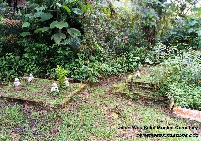
The Jalan Wak Selat Muslim Cemetery was the former burial ground for Kampong Wak Selat. Located beside Kranji Loop today, the cemetery has been forgotten and abandoned for decades. The former kampong was demolished in 1993, and its site was subsequently redeveloped into a small Kranji Industrial Estate made up of three blocks of offices, warehouses and factories. Some of the tombs at Jalan Wak Set Muslim Cemetery dated back to the 1940s.

Keramats

Beside typical cemeteries, there are also a number of keramats (sacred graves or shrines) for Muslim saints or holy men located in various parts of Singapore. Sometimes the keramats contain the makam (tomb) of the holy men, and are regularly visited by pilgrims from other countries. Keramats, other than housing the tombs, also serve as a refuge to the poor and needy, as well as a place of solace for those in distress and agony.

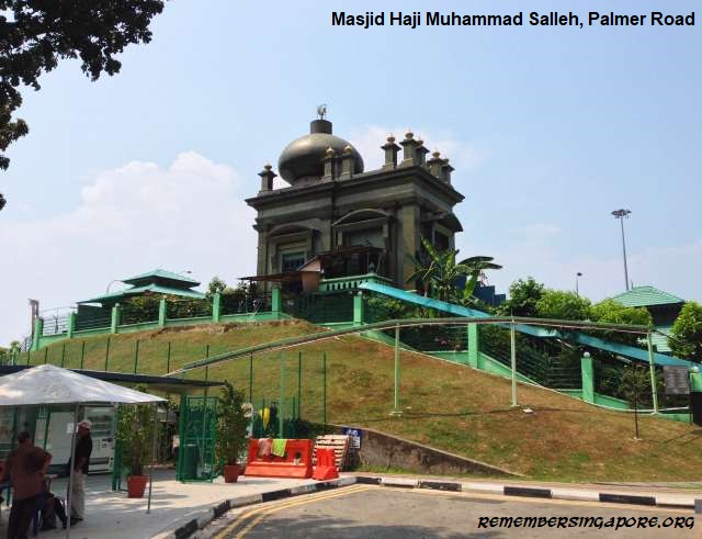
One of the most notable keramats in Singapore is Keramat Habib Noh, dedicated to Muslim saint Sayyid Noh bin Sayyid Mohamad bin Sayyid Ahmad Al-Habshi (1789-1866), also known as Habib Noh. It is situated on the Parsi Hill (previously known as Mount Palmer), where a grand mosque Masjid Haji Muhammad Salleh was built beside it in 1903.

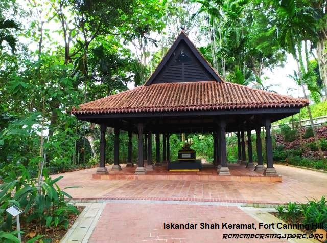
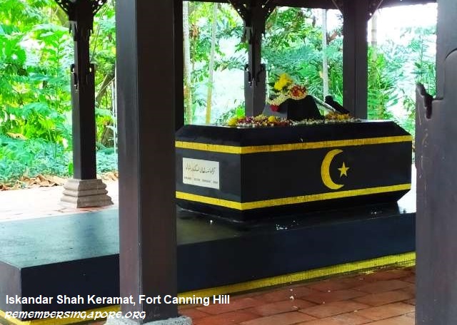
Another famous keramat is located on Fort Canning Hill, belonging to Sri Sultan Iskandar Shah, a historical figure with different accounts regarding his legacy. One such account described him as the last of the five kings of Singapura in the 14th century. He fled during a Javanese attack, and settled and established a new kingdom at Melaka (or Malacca). Another suggested he was the successor of Parameswara, the actual founder of Melaka.

When the British arrived at Singapore in 1819, they observed that the local Malay residents refused to ascend Fort Canning Hill, due to the belief that it was once the palace and the final resting place of the ancient kings. Hence, the hill was formerly known as Bukit Larangan, or Forbidden Hill. The British cleared the forest on the hill and discovered many ancient structures and ruins. By 1822, the burial place of Iskandar Shah was regarded as a keramat and revered by the locals.

Some of the other well-known keramats in Singapore include Keramat Bukit Kasita (at Kampong Bahru Road), Keramat Sheikh Ali (at Kubur Kassim cemetery, Siglap Road), Keramat Radin Mas (Mount Faber Road) and Keramat Kusu (Kusu Island).

Many of the keramats had significant long histories, as reported in the Straits Times in the 1930s and 1950s. However, over the decades, numerous keramats had made way for redevelopment, with their graves exhumed and reinterred at the Muslim cemetery at Choa Chu Kang. Some of the affected ones were, for example, Keramat Maliki, previously located at Sennett Road and Keramat Syed Mustapha at Changi Road 6½ milestone.

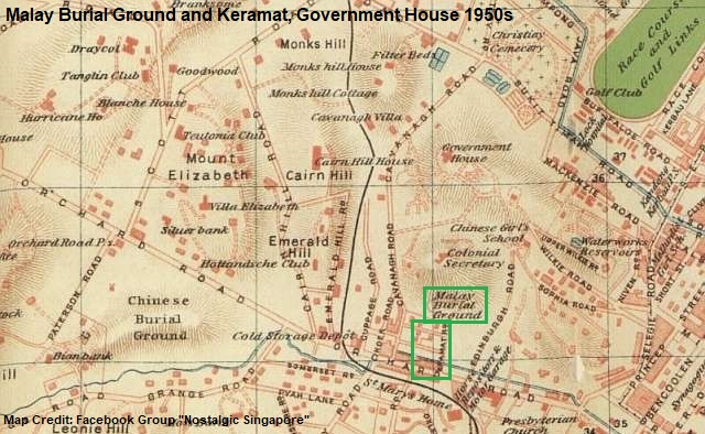
In the fifties, there was even a keramat and burial ground within the Singapore Government House (present-day Istana) premises. Located at a short distance between the Chief Secretary’s bungalow and the Government House’s main gates, it was set up by the Malay staff to commemorate an old Muslim saint, with permission given by then-governor Sir Robert Black.

Closure

Throughout the 20th century, many older Muslim cemeteries had became defunct and closed. Old Malay graveyards – such as those located at Sembawang Road, Upper Serangoon Road, Geylang Road, River Valley Road and near Pagoda Street – had vanished into history.

The early seventies saw another wave of cemeteries’ closure to make way for new developments. In April 1973, the Ministry of Environment announced the shutting down of 34 cemeteries in Singapore. It included 30 Muslim, three Chinese and one Hindu cemeteries.
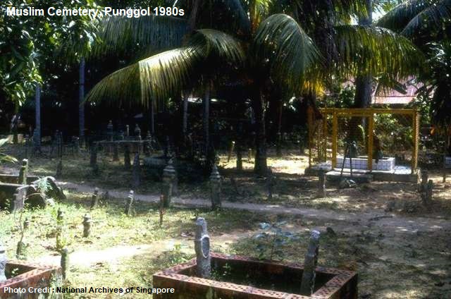
Some of the Muslim cemeteries affected were Kubor Wakaff Nyali (at Parbury Avenue, off East Coast Road), Kubor Wakaff Tanah Merah Kechil (Upper East Coast Road), Kubor Wakaff Serangoon Kechil (Punggol Road), Tanah Perkuboran Islam (Plywood Road, off West Coast Road), Tanah Wakaff Perkboran (Pulau Seking) and an unnamed Muslim cemetery at Nicoll Drive 15½ milestone.

Others were small plots of burial grounds situated at Kampong Ayer Bajau, Wing Loong Road, Jalan Bahar, Lorong Akar, South Seletar, Punggol end, Siak Kuan Road, Kampong Loyang and Nicoll Drive.

A large remaining of the affected Muslim cemeteries were those located on the outlying islands of Singapore. For example, Pulau Tekong had almost a dozen of cemeteries scattered all over the island at Kampong Seminea, Kampong Selabin, Kampong Sayangkong, Kampong Batu Koyak, Kampong Pasir, Kampong Ayer Sama, Kampong Semeni, Kampong Ayer Samak and Kampong Pahang.

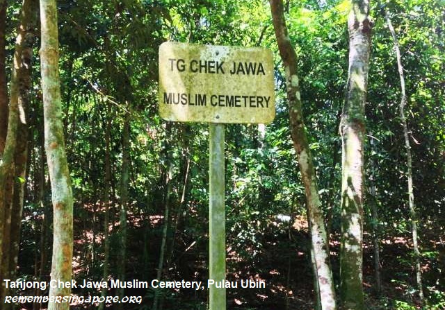
At Pulau Ubin, the burial grounds at Batu Daun, Kampong Chek Jawa, Kampong Surau, Kampong Sungei Durian and Kampong Bahru were eventually cleared. One signage, indicating the site of Tanjong Chek Jawa Muslim Cemetery, did, however, manage to survive till this day.

Exhumations

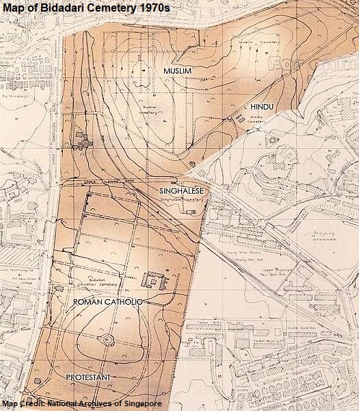
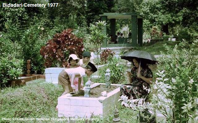
Bidadari Cemetery began as a Christian cemetery in 1908. The Muslim, Hindu and Sinhalese sections were subsequently added to the sites next to the Christian cemetery. In particular, the Muslim burial section at Bidadari Cemetery was opened in February 1910. A small mosque called Masjid Bidadari was built within the cemetery in 1932, providing religious needs until its demolition in 2007.

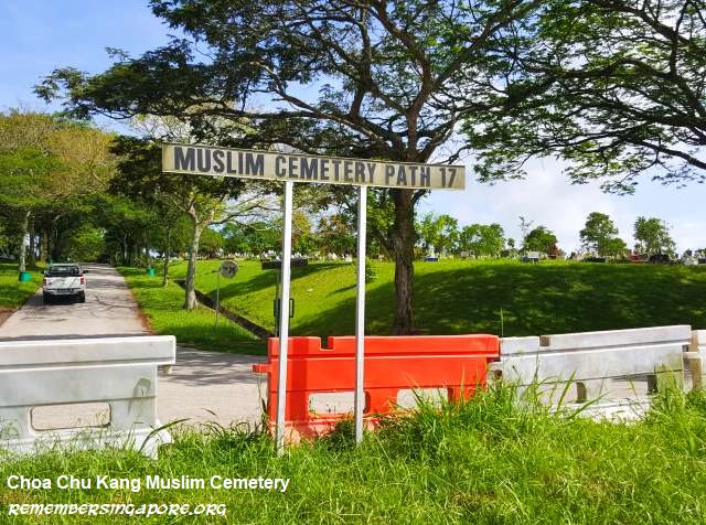
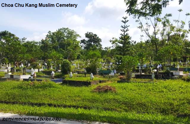
Bidadari Cemetery was closed in 1972. After two decades of sequestered state, the site came under redevelopment plans in the nineties for new Housing and Development Board (HDB) housing projects. By the mid-2000s, more than 100,000 Muslim (68,000) and Christian (58,000) graves had been exhumed. Most of the Muslim remains were reburied at the Choa Chu Kang Cemetery.
Former Minister for Labour Ahmad bin Ibrahim (1927-1962) was one of the prominent figures to have formerly buried at Bidadari Cemetery.

Choa Chu Kang Cemetery therefore remains as the only cemetery in Singapore still opened for new burials. However, this may also change in the next decade. About 35,000 Muslim graves at Choa Chu Kang Cemetery will be exhumed in the next few years, as portions of the cemetery gives way to the expansion of Tengah Air Base.
Since 2007, a new interment system has been used for Muslim grave exhumations, in order to save space by having the interred bodies reburied in a more compact method as compared to the traditional earth plots.

Under the new arrangement, the remains of eight deceased who have been claimed by their families will be buried together in one grave. Otherwise, 16 will be buried in one instead. During the exhumation, the gravedigger will seek permission from the deceased’s family members to collect the remains, after which they will be placed carefully on a piece of white linen.

Wrapped by the white linen, the remains will be cleaned, before being tied up and placed in the grave with seven other remains. The ustaz (Islamic religious teacher) will recite the Quran verses and pray with the deceased’s family members before the remains are lowered into the grave and covered with soil. A concrete lid, with grass on its surface, will be used to seal the grave.

Also read Past and Present Cemeteries of Singapore (Part 1) – Old Chinese Graveyards.

Published: 01 September 2019

Updated: 30 July 2023

Posted in Cultural, Historic, Religious | Tagged , , , , , , , , , , , , , , , , , , , , , , , , , , , , , , , , , , , , , , , , , , , , , , , , , , , , , , , , , , , , , , , , | 9 Comments