Singapore Trivia – Old Dragons of Whampoa and Toa Payoh

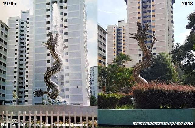
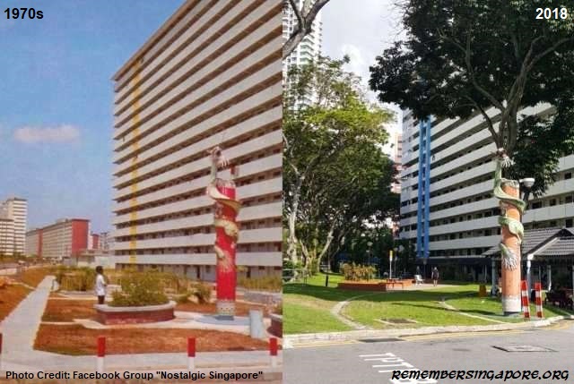
Two dragons have been standing tall at the heartlands of Whampoa and Toa Payoh for more than 40 years. Both of them were built in the late sixties and early seventies, as landmarks and identities for the upcoming housing estates and possibly also for good fengshui for the new neighbourhoods.

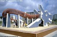
The dragon fountain at Whampoa and its surrounding flats were completed by the Housing and Development Board (HDB) in 1974. The 4.8m-tall dragon instantly became a symbolic feature in the vicinity. During its early days, the dragon fountain was also accompanied by a park, but it had to give way to the construction of the Central Expressway (CTE) in the eighties.

The scaled body of the surging dragon is made up of hundreds of red, green and pink porcelain pieces similar to those Chinese rice bowls. It used to spout water until its pump system became defective in the mid-nineties. It has remained dry since then.

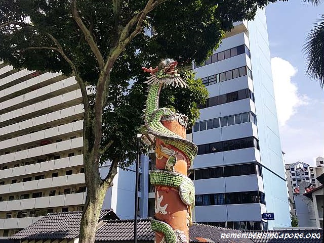
A lesser known dragon stands at the entrance of a carpark along Toa Payoh Lorong 3. Entwining a red pillar of about 4m tall, the Chinese-style dragon has been a distintive marker in front of Block 91 since the late sixties after the development of the housing estate was completed.

Over the years, the dragon and its pillar have been subjected to the constant exposure to sun and rain. Today, they appear neglected with faded colours and peeling paintwork. Nevertheless, the 50-year-old dragon will continue to guard its post, perhaps until the day arrives for the redevelopment of this old Toa Payoh estate.

Published: 19 May 2018

Posted in General | Tagged , , , , , , , | Leave a comment

The Beginning of Singapore’s Expressways

The first blueprint of Singapore’s expressway network began in 1968, when it was mapped out as part of the State and City Planning Project. The authorities recognised that expressways were the best method to provide better and faster travel in the land-scarce Singapore.

Before the completion of the Pan-Island Expressway (PIE) in 1981, it was unimaginable to drive from the Changi Airport to the end of Jurong in under 45 minutes. The road network then was made up of the major roads (Bukit Timah Road, Jurong Road, Upper Changi Road, Mandai Road, Tampines Road, Punggol Road, etc) that were marked by milestones, an old system that found its roots in Singapore since the 1840s.
Expressways would significantly improve the traffic conditions and travel time; an estimate of 1,800 to 2,000 vehicles could move along an expressway lane per hour.

Dual three-lane carriageways were the preferred initial designs, although several upgrading and widening projects in the 2000s and 2010s meant that some of the current expressways have more than three or four lanes to resolve the traffic congestion issues; for example, there are upgraded six-lane carriageways for PIE towards the Adam Flyover exit.

Today, Singapore has a total of ten expressways. They are PIE, East Coast Parkway (ECP), Central Expressway (CTE), Bukit Timah Expressway (BKE), Ayer Rajah Expressway (AYE), Tampines Expressway (TPE), Kranji Expressway (KJE), Seletar Expressway (SLE), Kallang-Paya Lebar Expressway (KPE) and Marina Coastal Expressway (MCE). The eleventh North-South Expressway (NSE) is expected to be completed in 2023.

Except for KPE and MCE, the naming of the Singapore expressways is derived from the first letter of the first two syllables followed by the first letter of the last word. Therefore, for examples, Ayer Rajah Expressway is known as AYE instead of ARE, and Bukit Timah Expressway is called BKE, not BTE (although it was initially named BTE when it was planned in the early eighties).

1. Pan-Island Expressway (PIE)
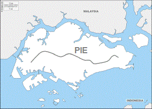
At 42.8km long, PIE is currently Singapore’s longest expressway, spanning across the island from Changi to Tuas.

It is also the oldest expressway in Singapore, having first started in its construction by the Public Works Department (PWD) in 1966 as a mean to link up the existing and new satellite towns and industrial estates between Toa Payoh and the Kallang Basin. This included the widening of Whitley Road from Mount Pleasant to Jalan Kolam Ayer and Paya Lebar Way.

The early seventies saw the continued extensions of PIE. Toa Payoh Flyover and Thomson Flyover were built in 1970 and 1971 respectively. Part of Jalan Toa Payoh became integrated with the expressway, and more than 1,700 graves at Bukit Brown Cemetery were exhumed to make way for the construction.

The second and third phase of PIE were subsequently completed in 1975 and 1980. Towards the west, the expressway was extended to Jalan Anak Bukit, and at the east side, PIE was stretched from Jalan Eunos to Changi. PIE was considered completed when the extension from Jalan Anak Bukit to Corporation Road finished in 1981. By then, it was about 35km long and had 21 flyovers and one viaduct.
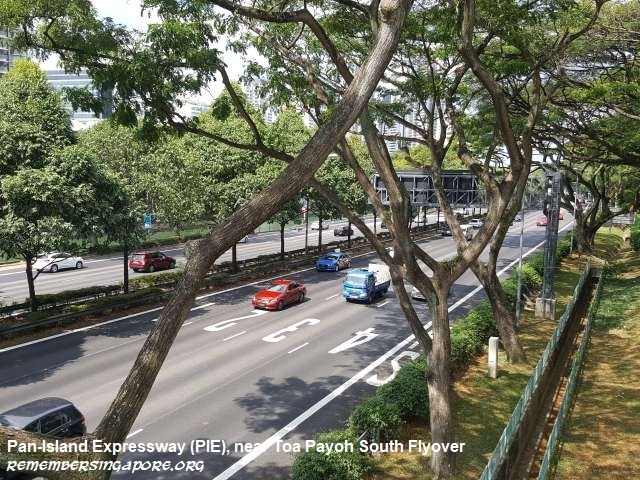
In the nineties, PIE was further extended to connect to the new KJE. It also linked up with the AYE, which itself was extended westwards to create a direct route to the newly-opened Tuas Second Link.

Currently PIE is linked to all other expressways in Singapore with the exception of SLE. It is also the expressway with the most number of flyovers – 31 in total – in Changi Flyover (linked to ECP), Upper Changi Flyover (linked to TPE), Simei Flyover, Tampines South Flyover, Bedok Reservoir Flyover, Bedok North Flyover, Eunos Flyover, Paya Lebar Flyover, Aljunied Flyover, Aljunied West Flyover (linked to KPE), Woodsville Flyover, Whampoa Flyover (linked to CTE), Kim Keat Flyover, Toa Payoh South Flyover, Thomson Flyover, Mount Pleasant Flyover, Adam Flyover, Eng Neo Flyover, Chantek Flyover (linked to BKE), Anak Bukit Flyover, Clementi North Flyover, Toh Tuck Flyover, Toh Guan Flyover, Jurong East Flyover, Bukit Batok Flyover, Hong Kah Flyover, Tengah Flyover (linked to KJE), Bahar Flyover, Nanyang Flyover, Pasir Laba Flyover and Tuas Flyover (linked to AYE).

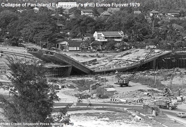
In 1979, the construction of PIE towards Changi was temporarily suspended due to the collapse of the 4.8m-tall Eunos Flyover. A crack was found in the concrete structure that eventually led to the flyover’s collapse. It took more than a year in the investigations and reconstruction before a new flyover was erected. Another similar mishap occurred in 2017 when a PIE’s viaduct near Upper Changi Coast Road collapsed, resulted in one death and 10 injuries.
Fun Trivia: PIE’s exit (26A) to Dunearn Road/Clementi Road is the only rightmost lane exit designed on a Singapore expressway.

2. East Coast Parkway (ECP)
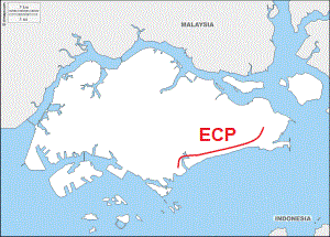
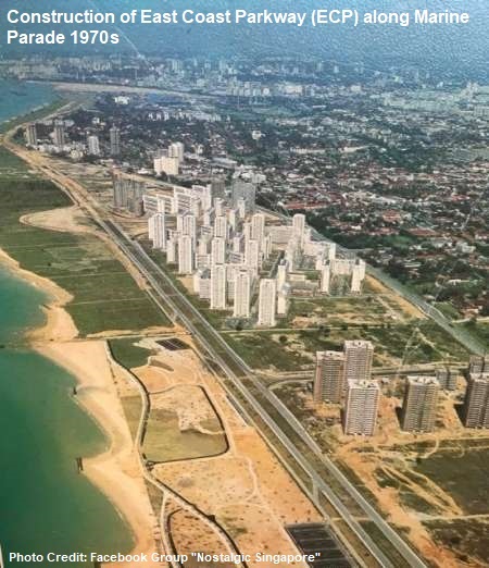
The construction of ECP began in the early seventies on the reclaimed lands of the southeastern coast of Singapore. Taking almost a decade to complete, the coastal expressway was opened in 1981, the same year as the Changi Airport.

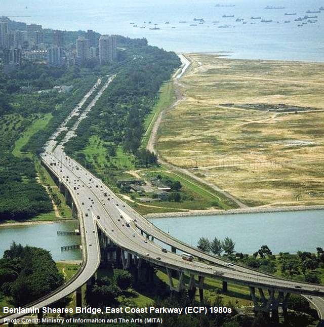
ECP is the only expressway in Singapore named a “parkway”. Its western end was originally linked, via the majestic Benjamin Sheares Bridge, to AYE near Shenton Way. In 2013, ECP is no longer directly linked to AYE after the opening of the new MCE underground tunnels.

Named after the second President of Singapore, 1.8km-long Benjamin Sheares Bridge was opened in September 1981 at a construction cost of $110 million. Being the longest and tallest bridge ever built by PWD, the splendid views of the Singapore skyline charmed many motorists so much that, when the bridge was opened, many cars stopped by the sides of the bridge for the scenery and photo takings.

The Benjamin Sheares Bridge was downgraded from part of an expressway to an arterial road after the opening of MCE.

The opening of ECP eased the increasing traffic congestion issues at the city area in the eighties. For instance, the traffic volume at Nicholl Highway had lowered by 20% during the peak hours, and Robinson Road and Cecil Street were better managed with lesser traffic jams.
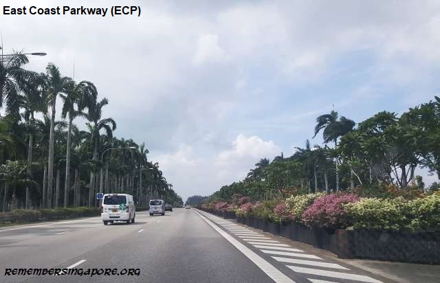
Much of ECP is flanked on both sides by mature tropical trees and palm trees. Towards Changi Airport, motorists will also pass by a scenic stretch where rows of beautiful potted plants make up the median strip. The hundreds of removable potted plants used to function as an emergency landing runway, but it had never been used or tested, and its secondary function had since been decommissioned.

Serving as a fast route from the airport to city area, the new Changi Airport and the well-landscaped ECP with colourful bougainvilla blooms and other shrubbery gave many visitors and tourists a good impression of Singapore as soon as they landed in the country.
ECP has Changi Flyover (linked to PIE), Tanah Merah Flyover, Laguna Flyover, Marine Parade Flyover, Tanjong Katong Flyover and Tanjong Rhu Flyover, running past the residential districts of Bedok South, Marine Parade, Siglap, Katong and Tanjong Rhu.

Fun Fact: In 1998, ECP became the first expressway to be tested and installed with Electronic Road Pricing (ERP) gantries.

3. Bukit Timah Expressway (BKE)
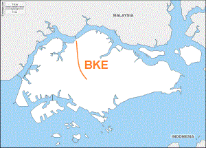
Completed in the mid-eighties, BKE runs from north to south, providing the link between Woodlands and PIE. At its northern end, it joins directly to the Woodlands Custom and Causeway. Along its 11km-long route, the expressway is connected to three other expressways in SLE, KJE and PIE.

The opening of BKE – it was initially known as BTE – at the end of 1985 provided much convenience and accessibility to the Woodlands residents who needed to get to their workplaces at the southern and western sides of Singapore. Likewise, the newly developed Woodlands got a boost as it became easier to reach the new town from other parts of Singapore.
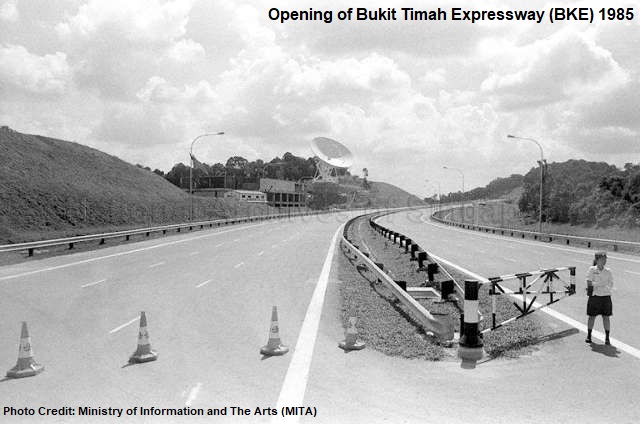
The construction of BKE began in 1983 in two stages – Woodlands to Mandai Road, and then Mandai Road to PIE. The step-by-step construction of the expressway and the changing landscape of its surroundings were, for the first time, recorded in a 30-minute filmlet.

The project also saw one of the largest land acquisitions in the eighties – more than 2.8 million square metres of private lands at Bukit Timah, Mandai and Sembawang were acquired by the government for national development. Almost half of the lands acquired were owned by the family of local tycoon and hotelier Khoo Teck Puat (1917-2004).
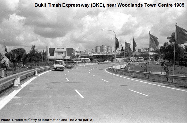
Designed with six-lane dual carriageways, the expressway has seven flyovers – Woodlands Flyover, Mandai Flyover, Gali Batu Flyover, Zhenghua Flyover, Dairy Farm Flyover, Rife Range Flyover and Chantek Flyover. In 2003, a section of BKE was converted into four-lane dual carriageway for better linkage to SLE.

Fun Fact: Spanning over BKE near Rifle Range Road is the Eco-Link @BKE, a 62m-long bridge built just for wildlife, the first of its kind in South-east Asia. With its opening in 2013, Bukit Timah Nature Reserve and Central Catchment Nature Reserve are linked once again, allowing animals to cross over to either sides.

4. Central Expressway (CTE)
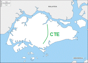
CTE connects the northern and central parts of Singapore to the city area, running through numerous new towns in Ang Mo Kio, Bishan and Toa Payoh. At the north, it is linked to SLE and TPE, and AYE at the Radin Mas Flyover at its southern end.

By the mid-eighties, Singapore had two completed expressways in PIE and ECP. In addition, the first phases of the construction of CTE, AYE and BKE had commenced. Four more expressways – Seletar Expressway (SLE), Tampines Expressway (TPE), Kranji Expressway (KJE) and Kallang Expressway (KLE) – were planned to link the major areas of activities and allow more rapid travels across the island. A total of nine expressways, at 134km long, was targeted to be part of a developed road network in conjunction with the new transport system in the Mass Rapid Transit (MRT).

Before CTE came into the picture, a Sembawang Expressway was proposed. Running from Nee Soon, via Ang Mo Kio Avenue 1, to Jalan Toa Payoh, it would then be connected to CTE, which started from Jalan Toa Payoh and ended at Lower Delta Road. The plan, however, did not materialise, as CTE was later designed and built as the main expressway between Yio Chu Kang Road and the city area.
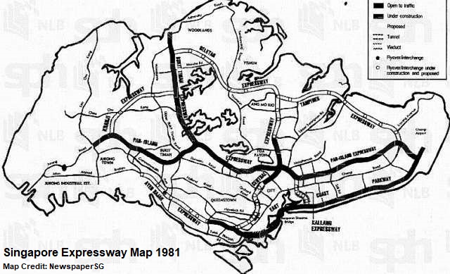
The CTE project had three phases. The first phase was to construct an expressway from Yio Chu Kang Road to Bukit Timah Road. This section of CTE was completed in the late eighties and officially opened on 17 June 1989.

Its second phase was to link to AYE at Radin Mas, starting from Chin Swee Road at the Chinatown area. The final stage of the CTE project was also the most difficult in its construction. Two tunnels, Singapore’s first expressway tunnels, under Orchard, Fort Canning, the Singapore River and Outram were built to link the first and second sections of CTE together.
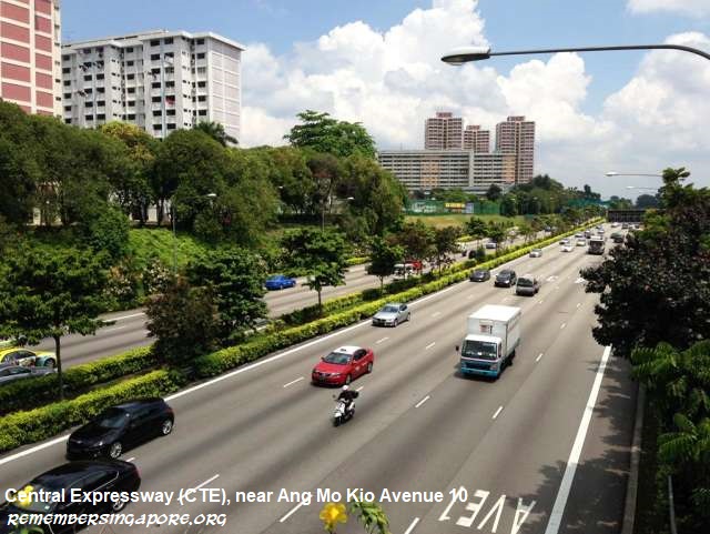
CTE was completed in 1991, reaching a total of 15.5km in length and $500 million in cost. The expressway has 12 flyovers, starting from Seletar Flyover (linked to SLE and TPE) to Yio Chu Kang Flyover, Ang Mo Kio North Flyover, Ang Mo Kio Central Flyover, Ang Mo Kio South Flyover, Braddell Flyover, Whampoa Flyover (linked to PIE), Moulmein Flyover, Kampong Java Flyover, Outram Flyover, Bukit Merah Flyover and ending at Radin Mas Flyover (linked to AYE).
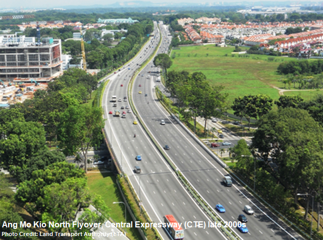
In the late 2000s, projects to widen CTE were carried out to ease the persisting congestion problems, due to the residential development in the northern and northeastern parts of Singapore.

Fun Fact: CTE was the first expressway tunnels in Singapore, and the first expressway to be charged with evening ERP (since 2005).

5. Ayer Rajah Expressway (AYE)
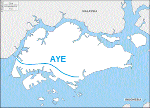
Originally named Jurong Expressway, the plan was to build another coastal expressway, similar to ECP, along West Coast. The new expressway was later named AYE instead, after Ayer Rajah Industrial Estate which was developed by the Jurong Town Corporation (JTC) in the early seventies.

The AYE project, comprising of a length of 14km at the start, was carried out in two phases – a Keppel Viaduct between ECP and Kampong Bahru Road, and the upgrading of the existing Ayer Rajah and Upper Ayer Rajah Roads to become parts of the new expressway.
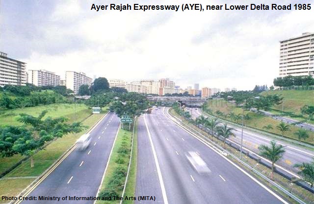
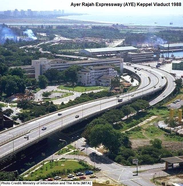
The Keppel Viaduct, standing on 60 spans, was completed in 1985 after two years of contract tenders, planning and construction. Costing $60 million, the 2.1km-long viaduct, with its dual three-lane carriageways, was built to ease Keppel Road, congested with almost 3,000 vehicles during the peak hours.

The second phase of the AYE project was the conversion of Ayer Rajah Road and Upper Ayer Rajah Road, two existing roads that laid down as the foundation routes for the expressway. Ending at Jurong Town Hall Road, the construction of AYE was by 1988 fundamentally completed. The ECP-AYE link had become the second east-west route in Singapore after PIE.
In 1994, AYE was further extended to the western side of the island to connect to the new Tuas Second Link, with Jalan Ahmad Ibrahim upgraded to become a section of the expressway. The extension project was eventually concluded in 1998, stretching AYE to a total of 26.5km in distance.

There is a total of 16 flyovers along AYE – Kampong Bahru Flyover, Radin Mas Flyover (linked to CTE), Lower Delta Flyover, Henderson Flyover, Gillman Flyover, Portsdown Flyover, Buona Vista Flyover, University Flyover, Clementi Flyover, Pandan Flyover, Teban Flyover, Corporation Flyover, Jurong Hill Flyover, Pioneer Flyover, Benoi Flyover and Tuas Flyover. In addition, AYE also has an underpass (Tuas West Underpass) and another viaduct (Tuas Checkpoint Viaduct).
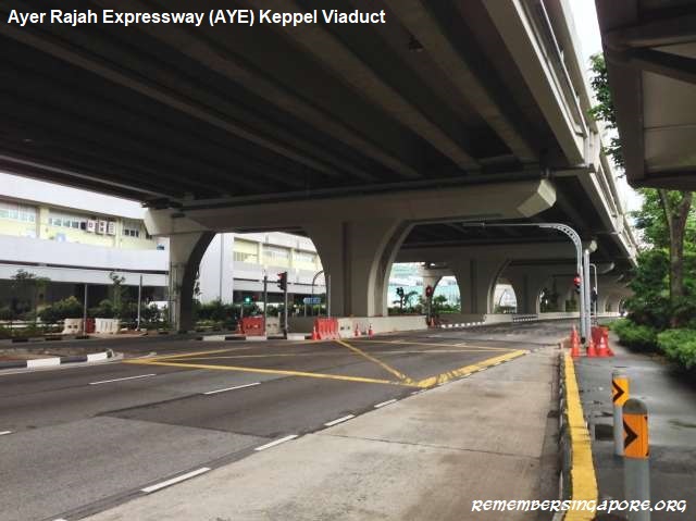
Fun Fact: The Keppel Viaduct, with Keppel Road running underneath it, was the first two-tier road system in Singapore.

6. Tampines Expressway (TPE)
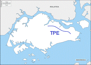
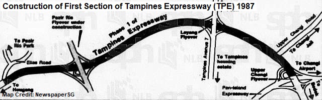
Tenders were called in 1986 to build the first phase of TPE, which at the start stretched from PIE at the eastern side of Singapore to Elias Road.

The project included the conversion of a 4km-long section of Tampines Road into an expressway of dual three-lane carriageways, and the building of a large interchange that linked Loyang Avenue, Upper Changi Road East and Tampines Avenue 7.

In September 1987, TPE became Singapore’s sixth expressway when its completed section was opened to traffic. The same year saw its second phase of construction kicked off – the continuation of the expressway westwards from Elias Road to Lorong Halus. The second extension was completed and opened by May 1989.
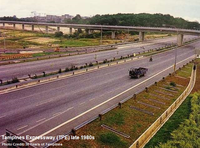
The third stage of TPE, linking between Lorong Halus and CTE, finished in 1995, although the 8km-long final section was opened only a year later. Overall, it took nine years and $125 million to build the 14.5km-long TPE.

The construction of TPE coincided with the development of Tampines New Town in the eighties. When it was fully completed in the mid-nineties, TPE, however, was the least utilised expressway, as it cut through the largely rural northeastern parts of Singapore. TPE’s usage rate only increased after the new towns of Sengkang and Punggol became more developed in the late nineties.
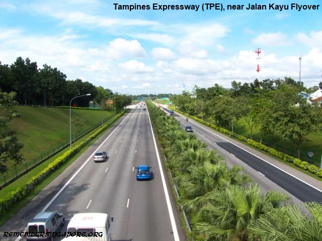
In 2008, TPE was linked to KPE near Lorong Halus, when the new underground expressway opened after six years of construction. Currently, there are 11 flyovers along TPE – Upper Changi Flyover (linked to PIE), Loyang Flyover, Pasir Ris Flyover, Api Api Flyover, Tampines Flyover (linked to KPE), Punggol East Flyover, Punggol Flyover, Punggol West Flyover, Seletar Aerospace Flyover, Jalan Kayu Flyover, Seletar Flyover (linked to CTE and SLE).

Fun Fact: Api Api Flyover was named after the nearby Sungei Api Api. The river itself was named after Api Api (mostly Avicennia alba), a type of tropical mangrove growing along the river banks that attracts fireflies. Api means fire in Malay.

7. Kranji Expressway (KJE)
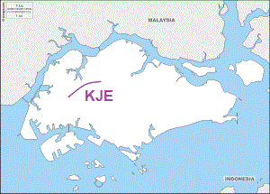
The construction of KJE began in 1990, as part of the government’s plan to develop the northwestern part of Singapore into vibrant residential and industrial districts.

At 8.4km long, the construction took about five years; some kampongs at old Choa Chu Kang such as Kampong Cutforth, and several long dirt tracks had to make way for the construction of the expressway. KJE was eventually inaugurated in March 1995.

KJE, linking between BKE and PIE, provided a more convenient and direct route for the residents of Choa Chu Kang, Bukit Batok, Jurong and Bukit Panjang to commute between Woodlands and the western side of Singapore.

KJE currently has five flyovers – Gali Batu Flyover, Yew Tee Flyover, Choa Chu Kang East Flyover, Choa Chu Kang West Flyover, Lam San Flyover and Tengah Flyover.

Fun Fact: KJE is one of the first roads in Singapore to be built with anti-skid surfacing.

8. Seletar Expressway (SLE)
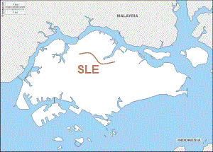
Built in two phases, from 1992 to 1998, the 12-km SLE links with TPE and BKE at both ends, and also CTE at Yio Chu Kang area.

The first phase of the SLE project was carried out between Yio Chu Kang Road and Upper Thomson Road, whereas the second phase was more complicated, as it included the construction of the expressway from its interchange with BKE to Upper Thomson Road via Woodlands and Mandai. The final stage of SLE was eventually wrapped up in 1998, and the new expressway had an official opening on 22 February by the Minister of State John Chen.
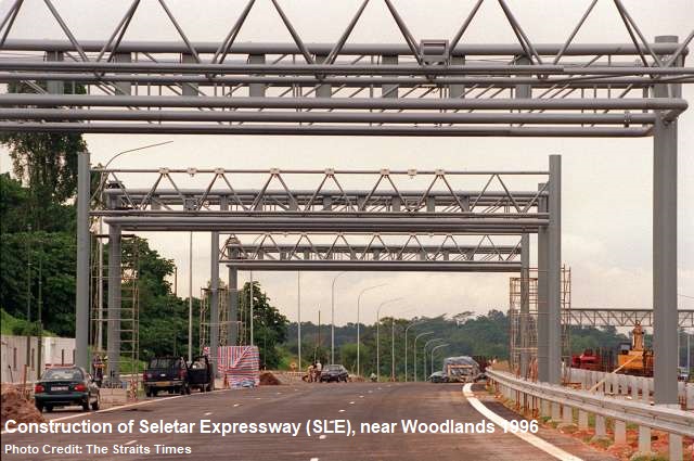
There are seven flyovers for SLE – Woodlands South Flyover, Marsiling Flyover, Ulu Sembawang Flyover, Upper Thomson Flyover, Lentor Flyover, Seletar Flyover and Yio Chu Kang Flyover

The completion of SLE in 1998 meant that the loop was closed at the northern part of Singapore, and the country’s expressway network was considered fully connected. This provided greater convenience for the residents of Woodlands, Sembawang and Yishun.

Fun Fact: The construction of SLE resulted in the largest clearance of roads. Lorong Gambas, Lorong Handalan, Lorong Lentor, Lorong Selangin, Lorong Hablor and many other roads and dirt tracks were expunged.

9. Kallang-Paya Lebar Expressway (KPE)

When Singapore’s ninth expressway KPE was opened in September 2008, it smashed several records. At 9km, it was the longest underground road in Singapore as well as Southeast Asia. It was also the most challenging and expensive road project undertaken by the Land Transport Authority (LTA), topping $1.7 billion in total construction cost.

KPE was actually made up of Kallang Expressway (KLE) and Paya Lebar Expressway (PLE), two expressway concepts that were mooted by the government in the late sixties and mid-eighties respectively. KPE itself was planned as early as 1991, but the massive project only kicked off in 2001 after the government acquired lands at Geylang, Airport Road and Upper Paya Lebar Road.
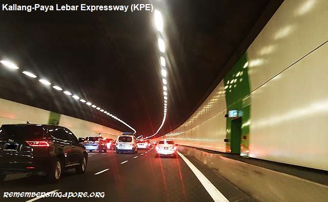
Due to its underground tunnels, KPE is fitted with several facilities, such as a 24/7 operation control centre to monitor the traffic conditions, heat detectors, fire alarms, carbon dioxide sensors and ventilation exhaust systems. KPE is 12km long, inclusive of 3km surface roads and 9km underground tunnels. It is linked to three existing expressways – TPE at the north, PIE, and ECP at its southern end.

Fun Fact: KLE was supposed to be a 3km-long link that began from PIE near Sims Avenue and Geylang Road, and soared over Nicholl Highway, Mountbatten Road and Fort Road to link up with ECP in the south. It would be the shortest expressway in Singapore if it was built.

10. Marina Coastal Expressway (MCE)
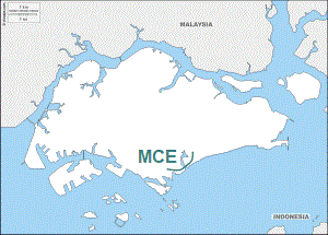
MCE’s construction began in 2008 as one of LTA’s most ambitious projects. At $4.1 billion, it is currently Singapore’s most expensive expressway. The dual five-lane expressway, 5km long with a 3.6km underground tunnel, was officially opened in December 2013.

Functioning as a link between ECP and AYE, the expressway has the widest and deepest underground road tunnel in Singapore. During construction, almost 3 million cubic metres, about the size of 1,200 Olympic swimming pools, were excavated. Part of MCE is a 420m-long section under the Marina Bay Channel, the first such underground sea tunnel built for vehicles in Singapore.
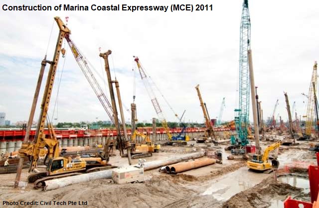
The completion of MCE also downgraded the Benjamin Sheares Bridge from an expressway viaduct to an arterial road.

Fun Fact: The word “coastal” was added to the name MCE to better reflect its route along the southern coast of Singapore in the Marina area.

11. North-South Expressway (NSE)
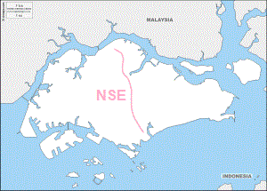
NSE’s role is to provide residents and motorists living in the north with a high speed and time-saving link to the city area, at the same easing CTE’s congestion issues. Its planned connections to the SLE, PIE and ECP are also expected to enhance the overall efficiency of Singapore’s expressway network.

The 21.5km-long expressway will also become the first integrated transport corridor in Singapore, designed with continuous bus lanes, for express bus services between Sembawang, Woodlands, Yishun, Ang Mo Kio and the city area, as well as designated cycling routes that are connected to the Park Connector Networks (PCN).

The newest expressway is expected to be completed in 2023, at a recorded construction cost of $7 billion.

Published: 29 April 2018

Posted in General, Historic | Tagged , , , , , , , , , , , , , , , , , , , , , , , , , , , , , , , , , , , , , , , | 1 Comment

Roads Named after Cargo Boats, and the Vanished Charcoal/Firewood Trade at Tanjong Rhu

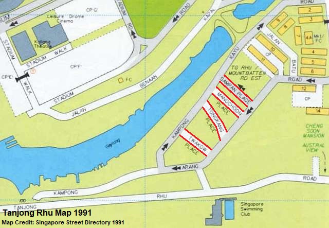
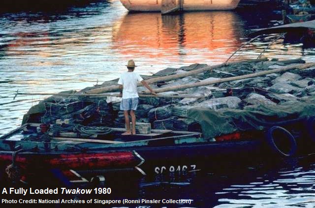
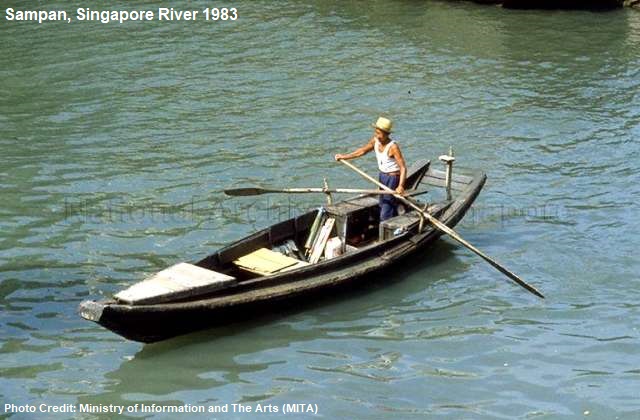
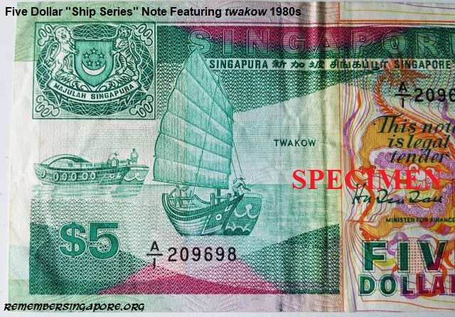
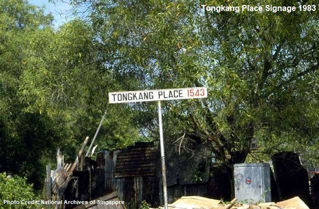
The Tanjong Rhu area once had four roads of interesting names – Twakow Place, Tongkang Place, Sampan Place and Mangchoon Place. They were named after the local cargo boats that plied the rivers of Singapore for decades. The boats, also known as bumboats, lighters or flat-bottomed barges, were mainly used for transportation of traded goods.

Operated largely by the local Chinese and Indians, the designs of the twakows and tongkangs were typically in bright colours with the striking painting of an “eye” at the front of the boats. They also came with rubber tyres installed around their wooden bodies acting as protective fenders. The sampans, on the other hand, were simple skiff-like wooden boats used by Malay fishermen or for short-distance transportation of passengers.

Named after a Chinese boat, Mangchoon Place, was well-known for its small-boat building industry between the mid-sixties and mid-eighties. The boat building businesses originated from Beach Road, where they owned by several generations of skillful tradesmen from Kinmen (or Quemoy), Taiwan. The industry continued to flourish after their relocation to Mangchoon Place in the sixties – at its peak, there were more than 20 boat builders at Mangchoon Place. By the late eighties, however, there was only a handful left.

The four parallel roads of Twakow Place, Tongkang Place, Sampan Place and Mangchoon Place were bounded by the main Kampong Kayu Road and Kampong Arang Road, whose names mean wood and charcoal in Malay. The wood here refers to firewood, which, like charcoal, was widely used by Singapore households for cooking before the seventies. These two items were the main shipments from Malaysia and Indonesia. Charcoal, in particular, was delivered from the main supply centre at Selatpandjang of East Sumatra.

There was also a short Jalan Batu – batu means stone in Malay – that lies between Kampong Kayu and Kampong Arang Roads.

Before the fifties, most of the charcoal and firewood imports went through the jetties at Beach Road. After the reclamation of Beach Road, the goods were delivered straight to Sungei Geylang, where the twakows and tongkangs berthed along the river banks for the unloading.

During its heydays, there were more than 20 charcoal importers at Tanjong Rhu, where they imported hundreds of tons of charcoal each month. The charcoal were then sold in bulk to wholesalers who in turn supplied to a large retail network in Singapore. The booming charcoal business in the vicinity led to Tanjong Rhu nicknamed “dan zhui ho” (charcoal river) by the local Hokkiens and Teochews, due to the polluted Sungei Geylang blackened by the charcoal ashes.

Custom-made in Singapore, the tongkangs was 300-strong in the fifties, actively plying between Singapore and the neighbouring countries. In the sixties, the number dropped to 200, affected by the Konfrontasi (1963-1966) and halt in the trade with Indonesia. Although some tongkangs were diverted for Thailand trades, many others fell into disrepair and were abandoned.

The import trade of charcoal and firewood continued to decline and never recovered to its previous levels, even after the end of Konfrontasi hostilities. This was largely due to the steady urbanisation and public housing development of the country, resulting in more households switched to electricity and gas for their cooking. By the mid-seventies, the number of tongkangs at the Singapore rivers numbered less than 60.

In the seventies, a team of tongkang crew members would be paid $250 to $300 each for a round trip to Indonesia. A longer voyage to Thailand would cost more; about $300 to $400 per crew member.

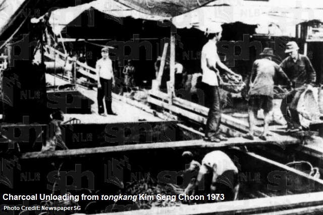
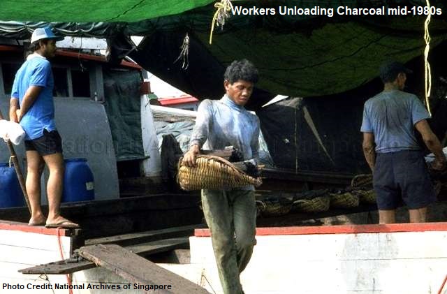
The shore labourers were paid much lesser, about 60 cents per katis of charcoal they unloaded. The work was tedious and physically demanding, as each unloading work started at 6 in the morning, and lasted until 5pm. During the unloading, the labourers had to use changkuls to heap the charcoal into wicker baskets. The loaded baskets were then carried ashore by other labourers via a wooden plank.

The charcoal were distributed into gunny sacks and loaded onto the lorries. It was a collective team effort, and the hard-earned money was shared among each group of labourers. On average, each of them earned about $11 a day.

Besides than charcoal, firewood and piling logs importers, Tanjong Rhu also had other factories and godowns of different trades. One of which was Kim Teck Leong, a factory that supplied cables, ropes and marine hardware. At Tongkang Place, a Ng Guan Seng manufacturing house specialised in wooden and cardboard boxes.

Until the late seventies, the manufacture and repair of sampans and other lighter vessels remained a niche industry along the Geylang River. Several specialised workshops, together with their neighbouring paint and lubricant suppliers, held on to their businesses until the vicinity was eventually redeveloped in the mid-eighties due to the urban renewal projects.

Tanjong Rhu’s network of boat- and fuel-named roads reflected the unique blend of cultures and languages in Singapore. The names of Sampan (舢板), Tongkang (舯舡), Twakow (大䑩) and Mangchoon (万春) originated from the Chinese language and dialects, while arang and kayu were Malay words. Sampan, derived from the Chinese’s “three wooden boards”, first appeared as an English word in the 17th century. It then made its way, together with tongkang, into the Malay language, referring to boat and barge respectively.

At the vicinity also existed a boys’ school named Tanjong Rhu School, which was founded in 1950 and stood between Kampong Arang Road and Tanjong Rhu Road. The same year also saw Tanjong Rhu Girls’ School established at Meyer Road. In the sixties, Tanjong Rhu Girls’ School moved in to share the premises with Tanjong Rhu (Boys’) School.

In 1984, both Tanjong Rhu Boys’ and Tanjong Rhu Girls’ Schools were merged to form Tanjong Rhu Primary School. The primary school ceased its operations in 1989, and had its former site taken over by Dunman High School in 1995.

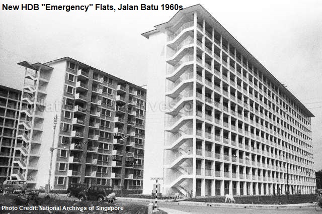
The small Tanjong Rhu housing estate, along Mountbatten Road, was developed in the sixties by the Housing and Development Board (HDB). By 1969, the new blocks of emergency flats were ready for residents to move in. In the mid-eighties, several blocks (Blk 10 to 14) in the housing estate were converted from one-room emergency units to three- or four-room flats in a major HDB upgrading project.

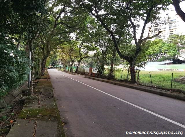
Twakow Place, Tongkang Place and Mangchoon Place were eventually expunged in the early nineties, leaving Sampan Place as the sole survivor today to tell the story of Tanjong Rhu’s forgotten charcoal and firewood trade.

Published: 25 March 2018
Posted in Cultural, Historic | Tagged , , , , , , , , , , , , , , , , , , , | 3 Comments

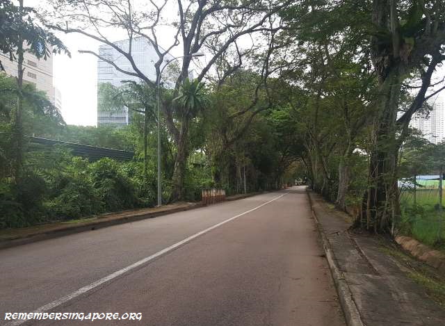
Closure (Partial) of Tanglin Halt Close

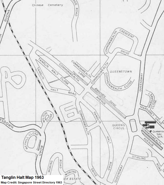
The loop made up of Tanglin Halt Road and Tanglin Halt Close was once the witness of the rise of Singapore’s earliest light industrial development program.

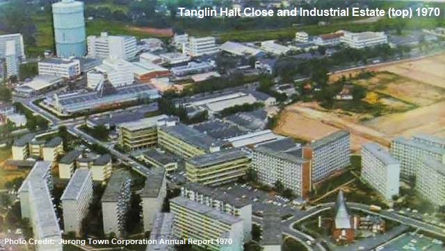
When the iconic 10-storey Tanglin Halt flats were built in the early sixties (they were recently demolished in 2017), a nearby light industrial estate was proposed. It was aligned with the government’s industrialisation plans, where large and heavy industrial estates were developed mainly at the rural Jurong area, while light and medium industrial estates built at high-density housing districts or fringe of the country’s central area. Both plans aimed in reducing Singapore’s reliance on entrepot trade as well as tackling the high unemployment rate.

In 1964, the $1.5-million project was launched at Tanglin Halt, serving as a test bed for Singapore’s light industrialisation program, at the same time providing ample job opportunities for the nearby residents. Managed by the Jurong Town Corporation (JTC), similar light industrial estates were also established at Redhill and Kampong Ampat. The successes of these pioneer industrial estates led to identical setups at Ayer Rajah, Kallang Basin, Telok Blangah and Toa Payoh in the late sixties and early seventies.

Forming a loop and linked to the main Commonwealth Avenue and Commonwealth Drive, Tanglin Halt Road and Tanglin Halt Close were extended and constructed respectively to provide accessibility to the new Tanglin Halt Industrial Estate.

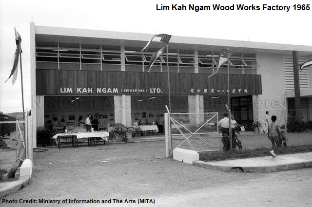
Local and foreign investors were invited to set up factories at the new industrial estate, and within a few years, it became home to numerous companies of different trades, such as Celbuildings (specialised in steel framed buildings), Daiwa (prefabricated steel structures), Nippon Paint (paint), Diethelm (aluminium works), Lee Kah Ngam (wood works), Great Malaysia Textile (textile), Unitex (garment), Federal Match (matchsticks) and Besley & Pike (envelopes). There was also Singapore’s first polyvinyl chloride (PVC) pipe manufacturing factory, set up by Sekisui Malaysia Company.

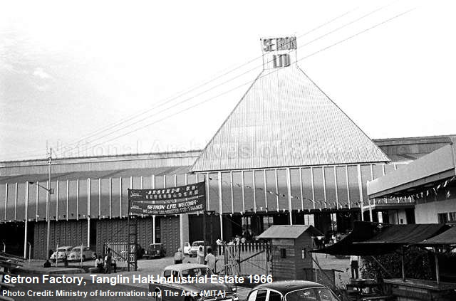
One of the better-known names at Tanglin Halt Industrial Estate was local television manufacturer Setron (Singapore Electronics), which had established its new factory in April 1966. By the late sixties, the company was producing some 1,000 TV sets in their monthly outputs. In the same period, Roxy Electric Industries joined in the competition with their production of Sharp televisions.

Another famous name was Van Houten Chocolate, which in 1966 had collaborated with the local Sheng Huo Enterprise Ltd to start a chocolate factory at the industrial estate. The smell of cocoa in the air was perhaps one of the fond memories of Tanglin Halt’s early residents.

The golden era of Tanglin Halt Industrial Estate lasted about 20 years, between the mid-sixties and mid-eighties. By the late eighties, the industrial estate was a shadow of its former self, after the companies and factories shifted out to other newer or refurbished industrial estates such as the Ayer Rajah Industrial Estate.

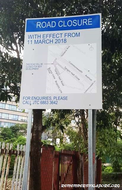
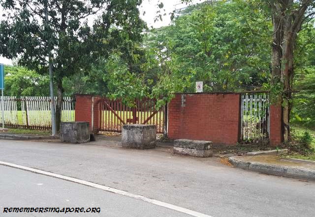
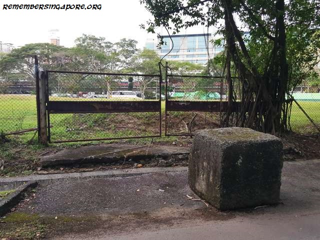
With the buildings demolished and land vacated, the loop of Tanglin Halt Road and Tanglin Halt Close became underutilised, and was used only by motorists as an alternative to Commonwealth Avenue. On 11 March 2018, a section of the loop was closed, marking the end of a former busy road with a forgotten glorious industrial past.

Published: 12 March 2018
Posted in General | Tagged , , , , , , , , , , , , , , | 6 Comments

A Tale of Towers and Pagodas

Between the late sixties and mid-seventies, four lookout towers, including one pagoda, were built in Singapore. Two of them are located at the western side of Singapore (Jurong Hill and Chinese Garden), while the other two are at Toa Payoh and Upper Seletar Reservoir.

The towers were not only aesthetic additions to the designated parks and their landscaping. In the seventies, they also came with a little known purpose – to allow foreign VIPs to ascend to the highest points at the vicinity so they could have a clear view of the rapid development of the country and its infrastructures since independence. This helped to boost their confidence and attracted foreign investments to Singapore.

Upper Seletar Reservoir Lookout Tower (since 1969)

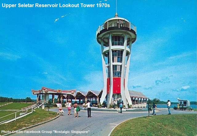
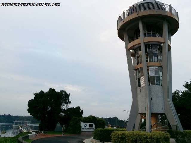
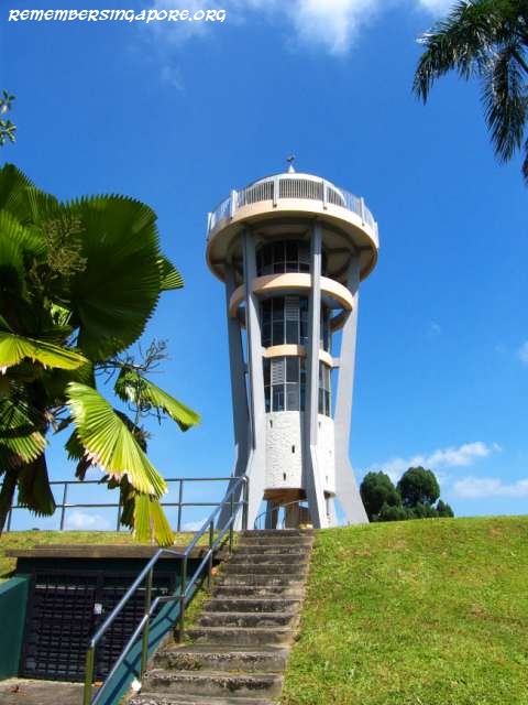
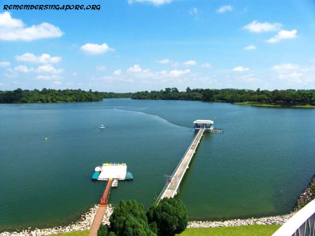
The iconic lookout tower at Upper Seletar Reservoir, designed in a futuristic rocket shape, was built in 1969 by the Public Works Department (PWD). Coincidentally, that year was marked by the remarkable achievement of Apollo 11 spaceflight. It was the first time human beings landed on the Moon.

The reservoir, originally named Seletar Reservoir, was first constructed in 1940 as Singapore’s third reservoir, but it had only a maximum impounding capacity of 150 million gallons of water.

In 1967, the Public Utility Board (PUB) launched a $27-million project to expand the reservoir with dams and ancillary works, which would increase its impounding capacity to almost 5,300 million gallons – more than 35 times its previous capacity.

Upon its completion in 1969, Princess Alexandra (born 1936), cousin of Queen Elizabeth II, who was in Singapore for its 150th anniversary celebrations, was invited for the reservoir’s inauguration. The Seletar Reservoir and Sungei Seletar Reservoir were renamed Upper and Lower Seletar Reservoir in 1992 respectively.

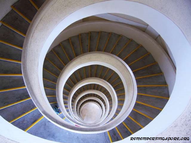
At 18m tall, the lookout tower, designed with a circular stairway for visitors to climb to the top, offers a breathtaking panoramic view of the reservoir and its luscious surrounding greenery. In the seventies, the reservoir and its tower were favourite venues for dates and picnics. They remain popular today, functioning as stopovers for breaks among joggers and photo-takings for the newly-weds.

Jurong Hill Observatory Tower (since 1970)

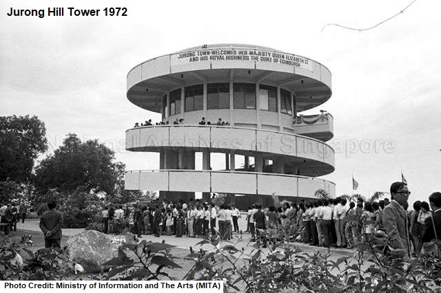
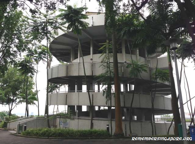
The 18m-tall three-storey spiral Jurong Hill Tower was of the same height as the Upper Seletar Reservoir’s tower. Built on top of the 60m-tall Jurong Hill, it was part of the Jurong Town Corporation’s (JTC) projects that were launched in the late sixties.

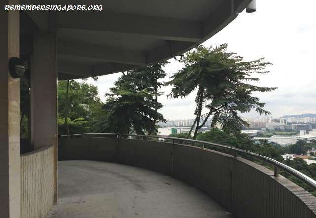
The project, costing more than $200,000, aimed to turn Jurong Hill, originally known as Bukit Peropok, into a lush garden for visiting VIPs, Jurong workers and the public to have a panoramic view of the rapidly developing Jurong industrial area.

Due to the visits of many heads of state, foreign dignitaries, investors and other VIPs – many of them were also invited to plant trees at the “Garden of Fame” beside the tower – Jurong Hill became popularly known as the VIP Hill in the early seventies.

The notable foreign VIPs to Jurong Hill included Queen Elizabeth II, Japanese Crown Prince Akihito, US Vice President Spiro Agnew and Canadian Prime Minister Pierre Trudeau.

In May 1970, the Jurong Hilltop Restaurant was opened, becoming the new Jurong Town’s first restaurant. The luxury restaurant, fully conditioned and equipped with a bar counter, was situated at the mezzanine floor of the tower and had a seating capacity of 200.

The restaurant was later converted into one that specialised in Indonesian and Japanese cuisines.

Toa Payoh Town Gardens Viewing Tower (since 1974)

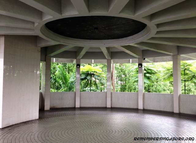
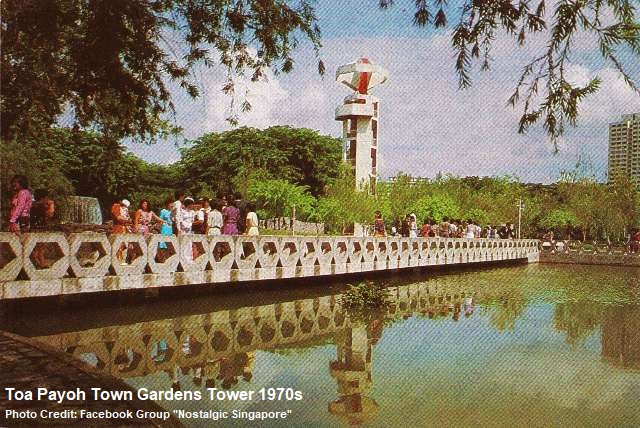
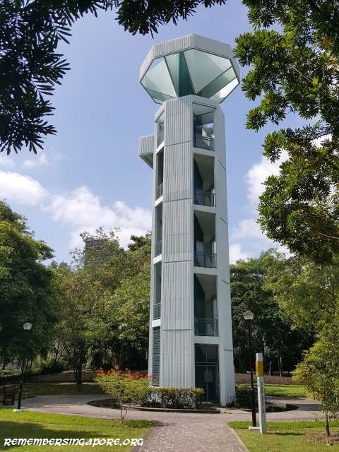
The Toa Payoh Town Garden, now known as Toa Payoh Town Park, and its 26.8m-tall, eight-storey tower were first constructed in 1972. The $1.4 million project was made up of impressive landscaping, with pavilion platform, stone bridges and several terrazzo tables and stools by the ponds. In the early days, it also had a children’s playground and even a tea kiosk providing light refreshment.

The garden and tower were built by the Housing and Development Board (HDB). Although it was officially opened in the mid-seventies, the garden was completed earlier, in time for the Southeast Asian Peninsular Games (SEAP), in 1973. During the mega event, the athletes were living in the SEAP Games Village (HDB point blocks) just opposite the garden.

Occupying a size of 4.8 hectares along Toa Payoh Lorong 6, the Toa Payoh Town Garden was, in the seventies and eighties, a popular venue for family picnics and wedding photoshoots. When it was completed, it was the largest single landscape area within a HDB new town.

Like the Upper Seletar Reservoir Tower, the design of the Toa Payoh Town Gardens Tower was influenced by the excitement of man’s landing on the moon and space exploration in the late sixties and early seventies. With its top shaped like a spacecraft, the tower was once the tallest viewing point at Toa Payoh. However, the public can no longer access to the top of the tower today.

Chinese Garden Cloud-Piercing Pagoda (since 1975)

The massive Chinese Garden project was the brainchild of former Deputy Prime Minister Dr Goh Keng Swee (1918-2010). Built at the former site of large swampy marshes, the project was kicked off by JTC in 1968, and took almost seven years in completion.

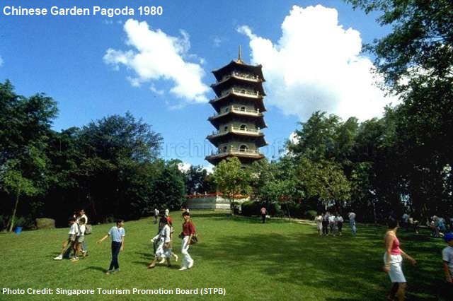
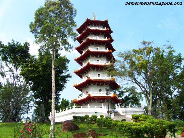
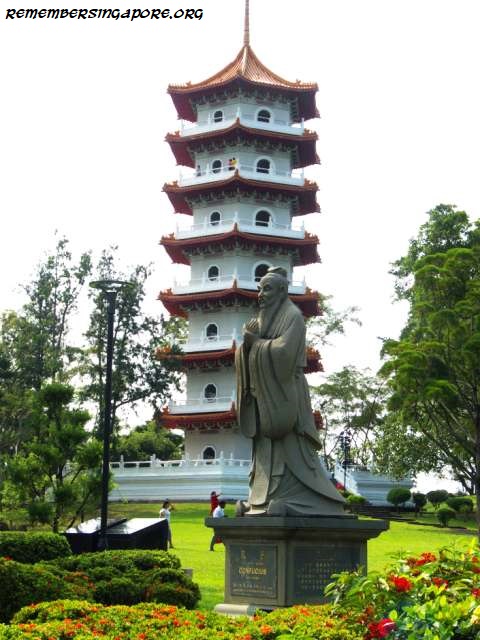
One of the landmarks at Chinese Garden is the seven-tier hexagonal-shaped Ru Yun Ta (Cloud-Piercing Pagoda), modeled after the Lingku Pagoda at China’s Nanjing.

At the start of the pagoda’s construction, the workers faced several difficulties. For example, the base hill’s height had to be reduced to 10m for stabilisation without expensive piling. The space for the construction works was also limited, and verticality of the pagoda had to be constantly checked.

Pagodas in ancient China were often built in Buddhist temples for the storage of human bones and ashes.

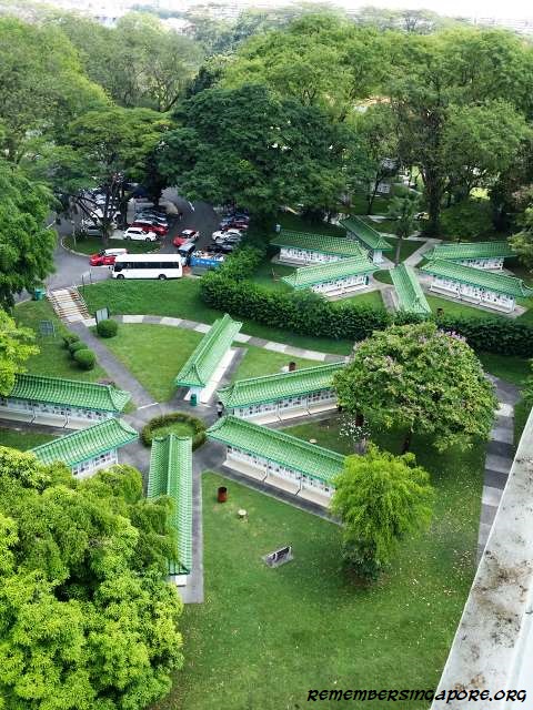
There are other pagodas in Singapore – the Tang Dynasty City pagoda was demolished after its closure in 1999, while the pagoda at Mount Vernon is used as a columbarium.

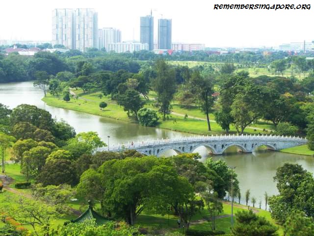
As for the Chinese Garden Pagoda, its 44m height allows visitors to have a full 360-degree view of Chinese Garden and its other features, such as the iconic 13-arch White Rainbow Bridge. At the top of the pagoda, one can also see the Japanese Garden, Jurong Lake and Jurong Town.

In 2015, the National Heritage Board launched its research studies on the four above-mentioned heritage lookout towers, in order to understand and record the historical and architectural significance of these landmarks in accordance with the development of Singapore during the sixties and seventies.

Other Towers, Pagodas

Other towers in Singapore include the lookout towers at Tanjong Rhu (since 1990s) and Yishun Pond Park (since 2011). The Tanjong Rhu Lookout Tower, in particular, was popular in the early 2000s with its Cosy Bay restaurant and bar. The eatery, however, was closed in 2008, but the lookout tower remains.

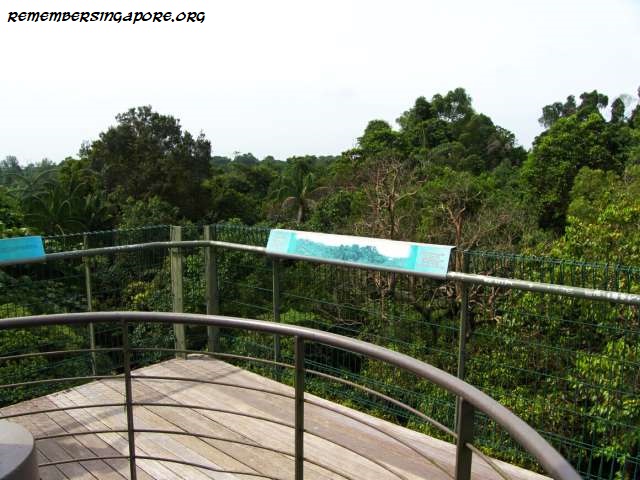
The Jelutong Tower at MacRitchie Reservoir has been frequently used by nature lovers as one of their trekking stopovers. The 7-storey tall observation tower, largely made of steel and wood, allows visitors to have an unimpeded view of the vast areas of forests at the reservoir. It also comes with information plaques introducing the different types of birds living at the vicinity.

Named after one of the tallest trees at MacRitchie Reservoir, the Jelutong Tower was constructed in 2003 at a cost of $190,000.

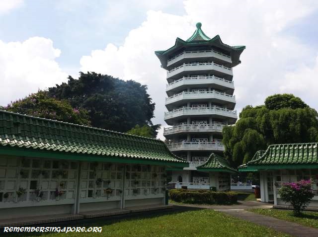
The nine-storey, green-roofed Mount Vernon pagoda was built in 1987 by PWD. Functioning as a vertical columbarium at the Mount Vernon sanctuary, it was later taken over and managed by the Ministry of The Environment. Climbing to the top of the pagoda allows one to have a bird’s eye view of the tranquil Mount Vernon-Bidadari area.

Tallest Tower

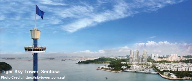
At a height of 110m, the Tiger Sky Tower, located at Sentosa’s Imbiah zone, is currently Singapore’s tallest observatory tower. Introduced in 2004, the tower, initially called Calsberg Sky Tower, has an enclosed gondola that can fetch up to 72 passengers to the tower top, offering them a breathtaking panoramic view of Sentosa, Singapore and parts of Malaysia and Indonesia.

Published: 19 February 2018
Updated: 20 October 2018
Posted in General, Historic | Tagged , , , , , , , , , , , , , , , , , , , , | 1 Comment

Vanished Traditional Teochew Games

The older Teochew folks in Singapore may have known the game called ngeow cher kay chow kia (老鼠嫁女儿). It was an old Teochew game said to have brought over to Singapore from China during the pre-war era. The name of the game literally means “the rat marries off its daughter”.

The Rat Marries off its Daughter

To play the game, the players would have to place their bets on one of the four drawings on a 30cm by 30cm paper board. The banker would then dig into a small sack containing four small rectangular pieces of drawings, tucked inside a matchbox, that corresponded to those on the paper board. The drawing on the tile pulled out by the banker would decide the winner, and after the payout, the game continued.

On the four drawings were frog, crabs, fighting fish and houseflies, accompanied by a Teochew jingle that went:

chwee goi ta boh taw (“the frog carried the sack”, 水鸡担布袋)
chan hoi lai xiaw haw (“farm crabs send the gifts”, 田蟹来相贺)
sua mun kia chye kee (“fighting fish bears colourful banners”, 斗鱼撑彩旗)
hoe seng poon tee tee (“houseflies blow the trumpet”, 苍蝇吹(口地)(口地 ))

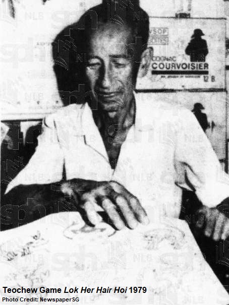
Ngeow cher kay chow kia and another Teochew game lok her hair hoi were some of the traditional games exhibited in 1979 by the National Museum to mark the International Museum Day.

Teochew Snakes and Ladders

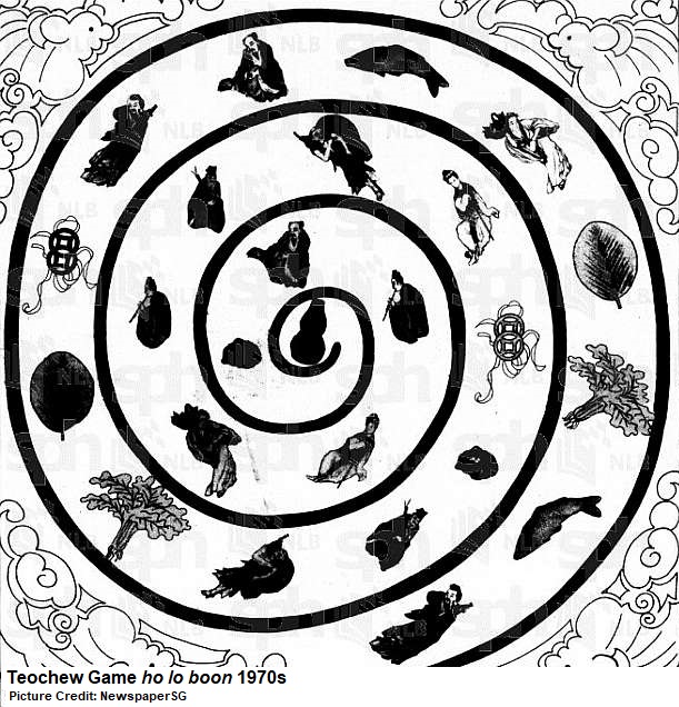
Another vanished Teochew game was ho lo boon (ho lo means gourd in Teochew), popularly played in local Teochew families, especially during the Chinese New Years, between the fifties and seventies.

The objective of this game was to be the first to reach the “home”, which was represented by the ho lo (gourd) symbol. Sometimes, the player would have to roll the exact number on the dice to achieve this.

Ho lo boon was like the Chinese version of the popular Snakes and Ladders game, where two or more can play the game. A dice would be required, and each player had a counter to move on the chart board, typically made of yellow paper, that had many symbols such as the Eight Immortals Crossing the Sea.

Whenever a player’s counter hit a symbol, he could jump it to a higher corresponding one. If he overhit the home (eg threw a four on the dice when there was only three steps left to reach the “home”), the player’s counter would have to reverse the extra steps and possibly “fall down” to a lower corresponding symbol.

This was one of the favourite games among the local Teochews, especially during the Chinese New Years, in the sixties and seventies, when they played the game with some small stakes in money, drinks or meals.

Published: 19 February 2018
Posted in Cultural, Historic | Tagged , , , , , , , | 1 Comment

Our Favourite Games of Yesteryears

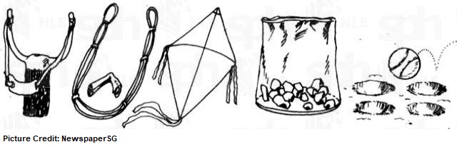
Large open spaces, some creativity, lots of stamina, and simple improvised materials using sticks, stones, tin cans. All these added to the recipe for games that provided hours of fun and joy for the kids of the past. Catching, police and thief game and hide-and-seek had ruled the playgrounds long before the electronic games conquered the kids’ world.

There were also the “lastic” wars. Popular among the boys who would arm themselves with elastic bands and multiple paper missiles, and take joy in aiming at each other. Sometimes, the targets were switched to wary cats or birds on the trees, or that poor old unsuspected bakut man who was peddling his feather dusters, brooms and other household items in the neighbourhood.

Girls, on the other hand, loved to play “long long“, a variation of hide-and-seek, where the hider attracted the seeker’s attention by shaking a cigarette tin filled with pebbles.
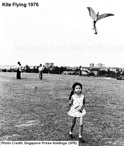
Soon, the kite season would come, and the kids would be busy making their layang-layang (kites in Malay). Some mischievous ones would use their mothers’ precious pestles and mortars to pound the glass into powder in order to make glass strings so that they could cut off their rivals’ kites.

What other games were popular in the sixties, seventies and eighties?

Gasing

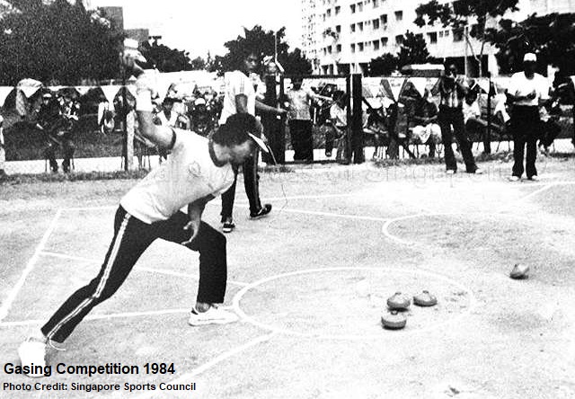
Gasing was a top spinning game that was once extremely popular in Singapore and Malaysia, especially among the Malay communities. Typically made of hardwood, the spinning top, also called gasing, comes in different variations, sizes, weights and shapes – the most popular being the egg-shaped, heart-shaped and saucer-shaped.

The history of gasing goes back to the Malacca Sultanate (1400-1511), when it was said to be the favourite game among the rice farmers. In Singapore, kampongs used to play and compete against each other, but by the late seventies, the game’s popularity had begun to dwindle. In 1979, the Singapore Gasing Federation was established in a bid to revive the interest in this traditional game.

Gasing courts (different sizes of 5m by 5m and 9m by 9m) were built in new towns such as Clementi and Eunos, and championships were held in the eighties. In most competitions, gasing pangkah was played, where the player had to hit his opponent’s top and knock it out of the circle and stop it from spinning. Another type of challenge was gasing un – to keep the top spinning for as long as it could.

Horselegs

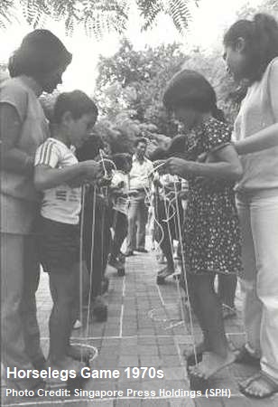
Known as kaki kuda or tapak kuda in Malay, the Horselegs game was played by challenging one’s balance while standing on empty tin cans.

This simple traditional game was once popular in the sixties and seventies among the kids, who would play in a rhythmic bout of dance with lip a-chanting and feet a-tapping. It gradually disappeared when the kampongs were replaced by the new towns and public flats after the late seventies.

In 1979, the Horselegs game was part of Singapore’s 46 traditional games exhibited in the National Museum Young People’s Gallery.

Bola Tin

The game of bola tin required two teams to play, namely the keepers and throwers. A stack of empty condensed milk tin cans, any quantity between 10 and 20, formed a pyramid at the centre between the two teams.

Behind a drawn line roughly ten steps away from the stack of tin cans, a thrower would try to knock them down with a ball. Each thrower was allowed with two tries. Once the stack of tin cans was hit, both teams would scramble for the ball.

The keepers would try to rebuild the pyramid, and, given the chance, throw the ball as far as they could. The throwers, if they had gotten the ball, would aim at any of the keepers, who would be disqualified once they were hit.

When the throwers succeeded in hitting all the keepers, they would win the game. On the other hand, the keepers would win if they finished rebuilding the pyramid before all of their members were forced out of the game.

Hantam Bola

Another bola game was the popular hantam bola typically played among the boys.

Literally means hitting or walloping with a ball in Malay, the game was similar to the modern Dodgeball. Usually played in a large field, the “thrower” would try to hit the others with a tennis ball, while the rest of the players would be running away and avoiding getting hit. The player who was hit would become the “thrower” himself.

The name hantam bola actually appeared much earlier, in the early 20th century, during cricket games, when a popular jingle “kaptan kita Tuan Berchie. Hantam bola banyak tinggi” was sang to applaud the skills of a famous cricketer.

The longevity of hantam bola lasted well into the nineties, when many primary and secondary students were seen playing the game in their school fields during recess periods.

Trivial: The “Court Martial” was an elaborated version of hantam bola. Armed with stones, each player would have to dig a small hole in the field, and then took turns to roll the tennis ball into the hole. If the ball fell into the hole, the thrower had to retrieve it and try to hit the others who would be running away.
Anyone who was hit would put a stone into the hole he had dug. Once it reached three stones, the losing player would be “court martialled”, where he had to stand still and let the other players hit him three times with the ball.

Bola Lubang

Bola lubang was another ball throwing game played by several players. Each player would have a hole dug in the ground. The first player would throw a ball, from a distance, towards the holes; if it entered one, he would quickly have to retrieve the ball and throw against the running player who “owned” that hole. If hit, that player would be out of the game. If missed, the next player would be the “thrower”.

Hopscotch

The children’s pavement game was said to have originated from the Roman Empire era, and became popular in England in the 17th century. After the Second World War, the game made a comeback in London, and its popularity soon spread to Malaya and Singapore.

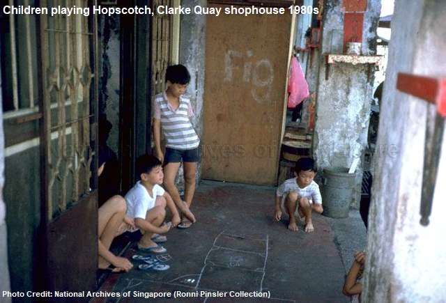
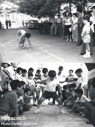
Hopscotch was often called teng teng locally. The game was played by drawing nine numbered squares on the ground – either scratched out on dirt grounds or with a chalk on concrete floors – and using pebbles or stones to “reserve” the squares. Due to the airplane-like outline of the square diagram, it was also known as the Aeroplane game.

In the game, each player would have to hop, skip and turn around, throwing his or her stones onto the squares to “occupy” them. According to the rules, the players could not hop onto an “occupied” square or stepped onto the outlines of the diagram. At the ninth square, often in the shape of a semi circle instead, the player would have to turn around and pick up the stone without seeing it. The first player to complete the game would be the winner.

A more challenging version, called Snail Hopscotch, was also played by the local kids in the seventies. In this version, pebbles or stones were not used. The player would have to hop on one foot through the “snail” until he came to the centre semicircle marked “rest”, where he could place his two feet on the ground.
The player continued the game by hopping in the reverse direction out of the “snail”. Upon completion, he could write his initials on chosen square. In his next turn, he could rest in that square with two feet. However, for the other players, they had to hop over that “reserved” square. They would have to win their own squares.

Goli

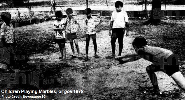
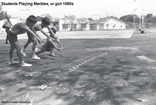
Marbles, or goli, was one of the favourite games among the boys. One of the common ways to play marbles was to draw a circle on the dirt ground, where all the players’ marbles were placed in it, and a straight line drawn several steps away. Each player would then stand behind the line and use his marble to hit the group of marbles inside the circle. If the player hit the marbles, he could win and keep those that fall out of the circle.

The marbles came in different designs and sizes; the most popular ones were the transparent types. In the eighties, there were also the solid clay marbles and stainless steel ones (called tee zee in Hokkien), where the boys found joy in smashing their rivals’ marbles into pieces.

The goli game also came in different variations, some even involved gambling elements, in the later years. For example, instead of marbles, Panini stickers, coins or even dollar notes were placed as stakes in the drawn circle. The player who managed to hit them out of the circle with his marble would pocket the winnings.

Congkak

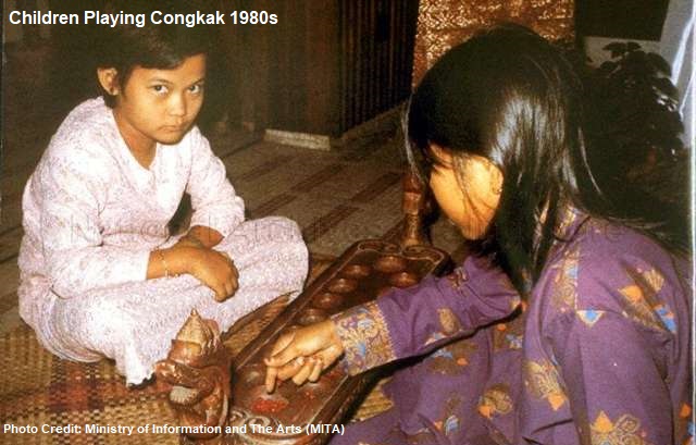
Congkak, or jongkak, was a traditional game usually played by two people, using tamarind seeds and a rectangular board that had a central partition, seven holes on each side and a receptacle at each end. The holes were known as “huts” and the receptacles were “storehouses”, where the players could fill with as many seeds as possible.

At the start of the game, the player would sit opposite of each other, where they each had seven “huts” and a “storehouse”. Each “hut” would be filled with seven tamarind seeds, while the “storehouse” was left empty.

The first player started the game by scooping the seeds from his extreme right “hut”, and deposited them, one in each “hut”, in a clockwise direction. The last seed would be dropped into his “storehouse”. Then he continued by scooping the seeds from any of his “huts” and dropped them in the same manner, including his opponent’s “huts”. During the game, he could deposit the seeds in his “storehouse” but bypassed his opponent’s “huts”.

The game carried on until his last seed was dropped into an empty “hut”. If so, he could take all the seeds from the opposite side of that empty “hut” and transferred them to his “storehouse”. It would then be the opponent’s turn to play.
During the game, any empty “huts” when the player’s turn was over would be considered a burnt “hut”. A crumpled piece of paper would be put inside, and no seeds could be deposited in it. At the end of the game, the player with the most seeds in his “storehouse” would be the winner.

Kaunda-Kaundi

The kaunda-kaundi was another old traditional Malay game. It was simply played using two hibiscus stems – one long and one short. The shorter stem would be placed, at an angle, on a piece of wood. Each player would use the long stem to hit the shorter stem twice – first to make it bounce up into the air, and again to hit it as far as he could.

Meanwhile, the opponent would try to catch the short stem before it landed on the ground. If he managed to do that, then the first player would lose. Otherwise, the winner would be the one who hit the short stem furthest.

Kuti-Kuti

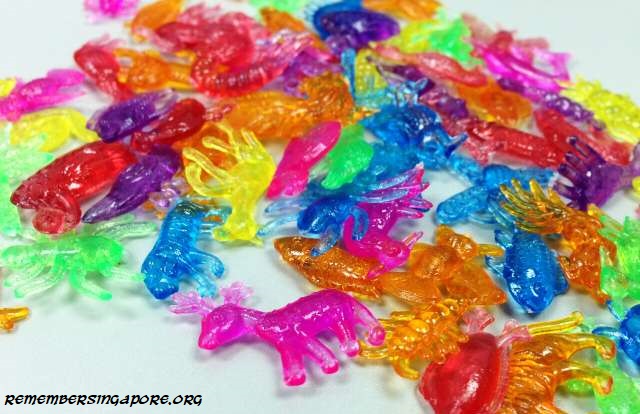
Kuti-kuti was an old flipping game said to have been played by local kids since the 1940s. At the beginning, the game was played using circular discs. By the seventies and eighties, it had evolved into a flipping game using colourful plastic pieces in the shapes of different animals such as elephant, deer and fish.

The rules for kuti-kuti were simple. The player would take turns to flip his plastic pieces over his opponent’s. If his piece landed on top of his opponent’s piece, he would win and claim it as his own. If not, the turn would be passed over to his opponent. The game ended when one party won all the pieces.

There were several variations of kuti-kuti, when players used bottle caps or erasers that were printed with flags of different nations.

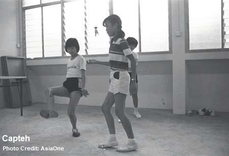
Capteh

It would take good balance and quick reaction to play capteh. Using a shuttlecock or a band of feathers attached to a round rubber base, each player would have to kick the capteh as many times as he could, without it touching the ground.

The player would be allowed to have his kicking foot touched the ground only once every kick. The one who had the most kicks would be the winner.

Capteh has been promoted and played recently in 2016 as one of the Sports Hub Community Play Day activities at the new National Stadium.

Encang Kuda

Also known as keleret, Encang kuda, or horseback in Malay, was a piggyback riding game in which two players played as “jockey” and “horse”. At the start of the game, both “jockey” and “horse” would throw their stones at a pre-drawn straight line on the ground. The one whose stone was nearer to the line got to ride the other player on the back.

The “horse” would then pick up the two stones and handed them to the “jockey”, who would throw one stone and let the “horse” throw the second. If the “horse” accepted the challenge and hit the stone, he would be the winner. If the “horse” rejected the challenge, the “jockey” would have to hit the stone himself. If he succeeded, the “horse” would need to continue piggyback him. The game ended if he missed, and restarted with a second round.

Five Stones

Played in many Asian countries, the five stones game, as its name implies, was played using five small pieces of granite pebbles. In Singapore, after the sixties, it was played using five small pyramid-shaped cloth bags filled with rice, sand or seeds.

Popular among the girls, two or more could play the five stones game. The game began with all the five stones on the ground. The first player would have to throw the first stone up in the air, pick up the second stone, and catch both with the same hand. Then she would throw the third stone up in the air and catch all three stones. This continued until she had all five stones in one hand.
The second round was slightly more challenging. The player would have to hold on to two stones after throwing one up. Similar rule applied to the difficult third round and fourth round, except that the player had to grip three and four stones respectively at one go.

There was another level where the player needed to throw a stone up and quickly exchange the stones in her hand and the ones lying on the ground. If, at any one time, the stone fell onto the ground without her catching it, it would be considered a miss for the first player, and the turn would be passed to the second player. Whoever could complete the sequence successfully win the game.

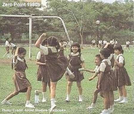
Zero Point

Zero point was another girls’ favourite game. The game typically involved skipping over the elastic rope that was made up of many rubber bands linked together.
At least three girls were needed to play the zero point – two holding the elastic rope on each end, and one carrying out the challenges. One of the common rules would be skipping over the rope held by the two girls at their knee, waist, shoulder and head levels.

The zero point game was particularly popular in schools in the eighties and nineties. While the boys played marbles or hantam bola on the field, the girls would play zero point along the corridors.

Hoop Wheeling

The hoop wheeling was a game played by competing teams or individual players.

Each player would be using a stick to push and roll an aluminum rim forward over a designated distance. The aluminum rim had a groove along its circumference that guide the stick.

If the aluminum rim fell along the way, the player had to stop and re-balance the rim with his stick to continue. The first player to reach the finishing line would win the game.

Hoop wheeling was often played in kampongs and later in schools during carnival events. Speed and a good sense of balance and control were keys in winning the game.

Galah Panjang

The popular traditional Malay game was typically played on a dirt field, where grid lines were drawn, or a badminton court. At least eight players – four attackers and four defenders – would be required to play galah panjang.

To start the game, the attacking players would have to be always within the boundary, where they could launch their offense individually or as a group, depending on their strategy. The leader of the defending team would guard the centre line whereas his members guarded each parallel line respectively.

The attackers would then try to breach the defensive lines without being touched by the defenders. He or she would be out of the game if touched. If at least one attacker managed to break through the defenders’ line, the attacking team would win the game, and the roles between the teams swapped.

Other Games

The other games played by the kids of the sixties, seventies and eighties included Broken Telephone, Rounders, Statues and Tick Tock (Tic Tac Toe).
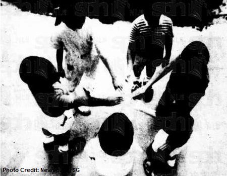
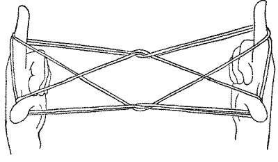
The Cat’s Cradle string game, in particular, was popular in schools in the eighties.

Most of these traditional games had faded away by the eighties, due to the rapid disappearance of kampongs and the rise of electronic games in arcade and computers. In the early eighties, the People’s Association (PA) taught children at the community centres how to play the traditional games, and even held various game competitions at the national level.

In 1984, the Singapore Broadcasting Corporation’s (SBC) Children and Educational Unit also launched a TV programme called O-Bay-Som (name inspired by the local children’s team selection orh-yah-beh-yah-som in a game) to introduce the traditional games to the new “Computer Age” generation.
The efforts, however, did little in stopping the traditional games from gradually fading away into history.

Trivia: While we had o-bay-som (literally means black and white in Hokkien. Players with palms facing down would be grouped together, the other team would be those with palms facing up) or lom-chiam-pas (similar to scissors-paper-stone) for team selection during a game, the Indonesian kids used the Elephant, Man and Ant. For the Thais, Mai San Mai Yao was preferred, where players picked sticks of different lengths to determine their teams.

How many of the traditional games do you remember?

Published: 27 January 2018

Posted in Cultural, Nostalgic | Tagged , , , , , , , , , , , , , , , , , , , , , , , , , , , , , , , , , , , , , , , , | 4 Comments

Sloane Court Hotel and other Former Hotels of Singapore

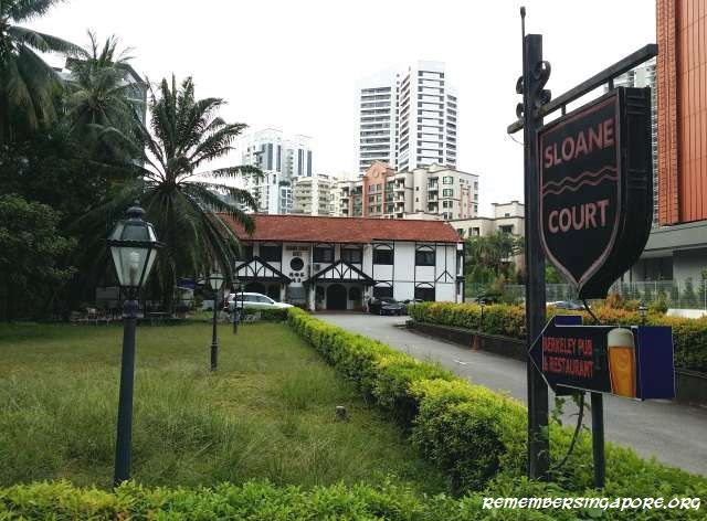
Located along Balmoral Road at the prime district 10 vicinity, Sloane Court Hotel became the latest hotel in Singapore to end its business. It was recently acquired by Tiong Seng Holdings and Ocean Sky International for $80 million; its site is expected to be developed into a 12-storey, 80-unit condominium.

The humble hotel, which began in 1962, was initially plain-looking, as it was used as a 26-room boarding house exclusively for British soldiers and their contractors. However, when the British armed forces pulled out of Singapore in the early seventies, the hotel had to open up to a bigger market for its business to survive.

Some of its guests in the seventies included Indonesian and Thai businessmen, and Japanese engineers, who were hired to come to Singapore to develop the Jurong industrial estate.

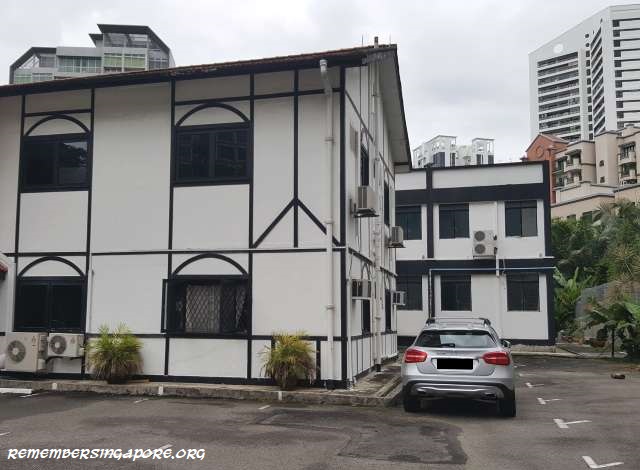
In the late seventies, the hotel’s Hainanese owners, a Chiam family, decided to give the hotel’s facade a facelift. They sought opinions from Stanley Foster, a family friend and Englishman who had opened a smokehouse named Fosters at the Cameron Highlands. The Chiams eventually chose the Tudor style due to its timeless and classic nature, and it became the iconic feature of the hotel until now.

Stanley Foster also helped the Chiam family in naming the new-look hotel Sloane Court. Inspired, the Chiams went on to open two more Tudor-style houses serving food and drinks – Pavilion and Tangle Inn – although both did not survive past the eighties.

Beside the Tudor-style colonial building, another attraction of Sloane Court Hotel was its Berkeley Restaurant, which served traditional Western cuisine in Hainanese style. Some of the restaurant’s best-known specialties were its English Porterhouse steak, Penang-style Inche Kabin chicken and English devilled chicken, which was cooked in mango chutney with a touch of white vinegar.

The caterers managing Berkeley Restaurant also owned other eateries in the eighties – the Captain’s Cabin at Serangoon Gardens and Balmoral Steak House at Holland Road.

The hotel was later renovated to expand to 32 rooms, and its old English charm continued to attract many guests, among them European tourists, especially the British, and Singaporeans who had studied or lived in Britain, well into nineties. Its relatively low room charges and short distance away from the booming Orchard Road shopping belt also played a big part in its positive occupancy rate.

Singapore’s first hotel was started as early as 1839, 20 years after the founding of Singapore. Opened by a British businessman called Gaston Dutronquoy, the hotel, known as London Hotel or Dutronquoy’s Hotel, was located between High Street and Coleman Street, and had rooms, restaurants, theatre and a photography studio.

The Colonial Hotels

Singapore experienced a tourism boom in the late 19th century and 20th century. Many hotels, particularly the luxury ones, were built during this period. Some have flourished till this day, such as the Raffles Hotel (since 1887) and Goodwood Park Hotel (since 1929), which have cemented their legacies as Singapore’s iconic landmarks.

Other colonial hotels did not survive as long, and many had their businesses wounded up after decades of operation. Some of the renowned examples were Adelphi Hotel (1850s-1973), Grand Hotel de l’Europe (1857-1932), Hotel de la Paix (1865-1914), Bellevue Hotel (1901-1951), Caledonian Hotel (1904-1910s), Hotel van Wijk (1905-1931) and the old Sea View Hotel (1906-1964).

Before its closure in 1973, Adelphi Hotel was the oldest hotel in Singapore, claiming a history that had spanned more than 120 years. Today, that honour belongs to the Raffles Hotel, which just celebrated its 130-year establishment in 2017.

There were hundreds of hotels, large and small, established in Singapore since the 19th century. Some were well remembered and had left their marks in the history, while many others were forgotten.

Below were some of the iconic ones that were demolished in the past 30 years (the list of former hotels is not in any order).

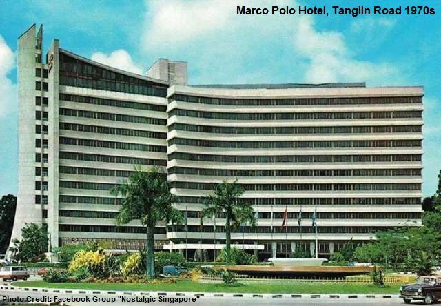
Marco Polo Hotel, Tanglin Road (1968-1999)

Located at the junction of Tanglin Road and Grange Road, Marco Polo Hotel, or officially Omni Marco Polo Hotel, was a famous 10-storey 300-room hotel landmark built in 1968. It was owned by the Goodwood Group, and was first known as Hotel Malaysia when it was completed.

Well-known for its luxurious furnishings and high quality services, the hotel, by the eighties, was voted as one of the best hotels in the world. It became a top choice hotel for many foreign leaders and international celebrities during their stays at Singapore.

Many locals as well as tourists would also remember the iconic fountain at Tanglin Circus that formed a picturesque scene with the hotel. The fountain was built and commissioned in 1966 by the Public Works Department (PWD), but was demolished a decade later in 1977.

In the mid-eighties, the ownership of the hotel changed hands and Hotel Malaysia was renamed Omni Marco Polo Hotel in 1989. The owners, however, had to fold up the hotel business in the late nineties after its finances were badly affected by the Asian Currency Crisis. In 1999, Marco Polo Hotel officially walked into history, when it was demolished and replaced by a luxury condominium named Grange Residences.

Katong Park Hotel, Meyer Road (1953-2002)

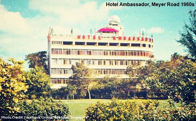
Opened in 1953, the former landmark at Katong Park had many names – Embassy Hotel, Hotel Ambassador, Duke Hotel, and eventually Katong Park Hotel – before it made way for a condominium in the early 2000s.

First called Embassy Hotel, the hotel was officially opened on 26 April 1953 as a modern building that had air-conditioned rooms and other modern facilities. Also boasting to be the largest hotel in British Malaya after the Second World War, it had splendid views of Katong Park and the seafront.

The following decades saw the hotel’s ownership changed hands several times, first in 1960 when it was rebranded as Hotel Ambassador. The hotel was badly affected by the Konfrontasi crisis in late 1963, when Indonesian saboteurs set off explosions at Katong Park, causing its windows to be shattered by the strong blasts.

In 1982, Hotel Ambassador was renamed again, this time as Duke Hotel. The hotel was then sold and reopened as Katong Park Hotel in 1992. Like Marco Polo Hotel, Katong Park Hotel was dragged down by the Asian Currency Crisis. Its operations ran into deficit, and had to call it a day in 1998. A condominium called View@Meyer was built at its site in 2006.

Copthorne Orchid Hotel, Dunearn Road (1969-2011)

The six-storey Copthorne Orchid Hotel was first started in 1969 as Orchid Inn by local magnate and chairman of Hong Leong Group Kwek Hong Png.
The hotel would later be renamed Novotel Orchid Inn before becoming part of the group’s Copthorne Orchid hotel chain in Singapore and Malaysia.

The hotel’s reddish facade was a once familiar sight along Dunearn Road. It had been frequently patronised by both local and foreign celebrities, and among the hotel’s long serving staff, the most popular topic was perhaps the marriage of Hong Kong star Chow Yun Fat and his Singaporean wife Jasmine Tan, who once worked at the hotel as a receptionist.

In 2011, Copthorne Orchid Hotel was closed after more than four decades of existence. It was subsequently demolished and replaced by a luxury freehold condominium called The Glyndebourne.

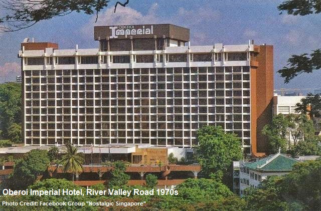
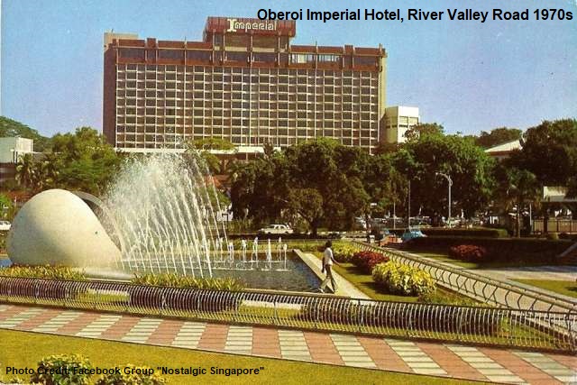
Oberoi Imperial Hotel, Jalan Rumbia (1971-1999)

Located at Jalan Rumbia, off River Valley Road, and just a short distance away from the iconic National Theatre, the former Oberoi Imperial Hotel started in the 1950s as a residential block to house the British military officers. It underwent extensive renovations in the late sixties and was converted into a luxury hotel that was officially opened in 1971.

The 13-storey hotel had more than 500 rooms, coffee houses, a swimming pool, lounge and three restaurants serving Chinese, Indian and international cuisine. Popular in the seventies and eighties, the hotel boasted a list of distinguished guests that included Tonga’s King Taufa’ahau Tupou IV.

The hotel was sold to the Hind Group in 1977 for about $37 million, and was renamed as Imperial Hotel. In the late nineties, the group announced plans to redevelop the hotel. By 1999, the hotel was demolished, and in its place, a new luxury condominium called The Imperial was erected in the early 2000s.

MayFair City Hotel, Armenian Street (1950-2000s)

The former Mayfair City Hotel (also known as Mayfair Hotel in its early days) was housed in two Art Deco-style shophouses at Armenian Street. The hotel was four-storey tall; its ground level was occupied by a restaurant, lounge and bar, while the second to fourth level were made up of 26 air-conditioned rooms that had two beds, bath tubs, teak furniture and radio relay speakers.

When the hotel was opened in 1950, it was fully booked by the Qantas Empire Airways-British Overseas Airways Corp (QEA-BOAC) to accommodate its crews. The hotel’s popularity peaked in the sixties, but by the seventies, it was no longer considered a luxury hotel. In 1971, its rooms ranged between $30 and $40 per night as compared to the $45 rate and above charged by other luxurious hotels.

In 1976, the hotel suffered from poor occupancy rate and had to close down, although its cocktail lounge and restaurant remained opened for business. Three years later, the hotel made a comeback under a new management team. The hotel then operated till the late-2000s. This time, it was shut down for good, and its premises was converted into a foreign worker dormitory. The shophouses were subsequently vacated in 2011 for renovation projects.

Great Southern Hotel, Eu Tong Sen Street (1936-1994)

The Great Southern Hotel, or popularly known as Nam Tin (Southern Sky in Cantonese), was a well-known landmark along Eu Tong Sen Street. Completed in 1936, the boutique hotel was the holder of many records, including the tallest building at Chinatown, and the first Chinese hotel to be equipped with a lift.

Housed in a building owned by Lum Chang Holdings, the Cantonese-themed Great Southern Hotel was largely catered to rich Chinese from China and Hong Kong. The elaborate hotel was six storeys tall, and featured shops at its ground level and a Chinese restaurant on its fourth floor. There was a tea house at its rooftop garden, and its fifth level was previously home to the famous Southern Cabaret nightclub.

The fifties and sixties were arguably the hotel’s golden era, when its popularity and high standards, particularly in its entertainment and services provided, earned a fine reputation as the “Raffles Hotel of Chinatown”.

In 1994, the Great Southern Hotel was converted into a department store called Yue Hwa Chinese Products, after the hotel was sold to Indonesia-born Hong Kong businessman Yu Kwok Chun (born 1951) for $25 million. The preservation of the hotel’s facade and unique features helped its owner win the Urban Redevelopment Authority’s (URA) Architectural Heritage Award in 1997.

Sea View Hotel (new), Amber Close (1969-2003)

The old Sea View Hotel, a nearby hotel of the same name, was a famous hotel in the first half of the 20th century, being dubbed as Singapore’s leading hotels along with Adelphi Hotel and Raffles Hotel. The hotel, located off Meyer Road, ceased its operation in 1964.

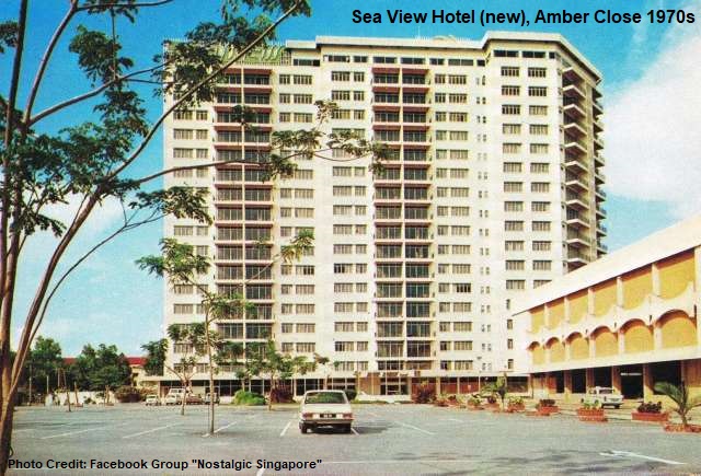
The new 18-storey Sea View Hotel was opened at Amber Close five years later in 1969.

Some of the memorable features of the new Sea View Hotel, well remembered by its former guests and the Katong residents, was its coffee lounge serving delicious Western food dishes and the unobstructed view of East Coast, before the land reclamation, at its highest floors.

Sea View Hotel was eventually closed down in 2003. Amber Close was expunged, and the site was redeveloped into a condominium named The Seaview.

Boulevard Hotel, Cuscaden Road (1973-2000)

Located at Cuscaden Road, the hotel was known as Cuscaden House Hotel before it was bought over in 1973 by Khoo Teck Puat (1917-2004), a well-known local banker and hotelier, and, at one point, Singapore’s richest man.
The hotel was renamed Hotel Malaysia (there were two Hotel Malaysia in Singapore in the late seventies and early eighties) in 1975, and again to Boulevard Hotel in 1983 after a series of renovation works.

The Hong Leong Group bought the property for $410 million in 1997, and subsequently demolished the hotel in 2000 for the development of the Cuscaden Residences condominium.

Garden Hotel, Balmoral Road (1971-2009)

The Garden Hotel, designed like a courtyard with gardens and fitted with air-conditioned rooms and a large swimming pool, began its business in 1971 at a construction cost of $3 million. It was situated along Balmoral Road, just opposite of Sloane Court Hotel.

The hotel was bought over by the Chua family of the Cycle and Carriage in 1981, when they spent $25 million in an acquisition from Vun Lee Pte Ltd. In 1999, property developer City Development Ltd purchased the property for more than $100 million. The Garden Hotel continued to operate until 2009, when it was closed to make way for the development of luxury condominium Volari at Balmoral.

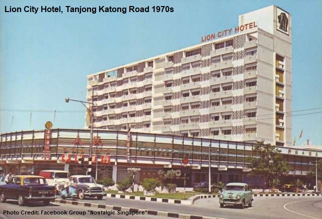
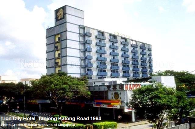
Lion City Hotel, Tanjong Katong Road (1968-2011)

Owned and operated by the family of Wee Thiam Siew, a local property tycoon, the 10-storey 166-room Lion City Hotel was opened at a cost of $4.2 million in 1968 at the junction of Tanjong Katong and Geylang Roads. The hotel caught up with the fast-growing tourism industry after Singapore’s independence, when there was a period of hotel shortage to meet the increasing demands.

On 2 August 1968, the Lion City Hotel had a grand opening officiated by Dr Goh Keng Swee, then-Minister for Finance. Modernly designed, the hotel, at its highest floor, offered a panoramic view of the city area. Its rates in the late sixties and early seventies stood at $30 and $40 per night for single room and double room respectively. A deluxe suit would cost $90.

In 2011, UOL Group bought Lion City Hotel and the adjoining former Hollywood Theatre, which had stopped screening movies since the nineties, for $313 million. Today, the site of the former hotel was occupied by OneKM Mall.

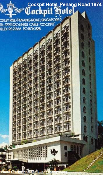
Cockpit Hotel, Penang Road (1972-1997)

Completed in 1972, the Cockpit Hotel was built at the former site of another luxury hotel called Hotel de L’Europe (not the same Hotel de L’Europe of the 19th and early 20th century).
The Hotel de L’Europe, established in 1947, became known as the Cockpit due to the frequent stays of the Dutch airline KLM crews and passengers.

Indonesian businessman Hoo Liong Thing started the new 13-storey 230-room Cockpit Hotel in 1972, but the hotel changed hands several times, first in 1980 and again in 1983.

It was sold a final time in 1996 to property developer Wing Tai, which ceased the hotel operation a year later. The building was then left vacated for a long period of time, leading to numerous paranormal stories about the “abandoned” hotel.

Today, a condominium called Visioncrest Residence stands at its site.

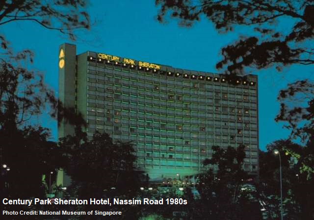
Century Park Sheraton Hotel, Nassim Road (1979-2004)

Located at Nassim Road, one of Singapore’s most expensive districts and near the Orchard Road shopping belt, the Century Park Sheraton Hotel was opened in 1979 as a luxury hotel.

The 465-room hotel was owned by the All Nippon Airways (ANA), which bought the property for $59 million in 1977 as part of the international Sheraton hotel chain. For years, the hotel was famous for its luxurious furnishings, Europa Ridley nightclub and the Cafe-in-the-Park coffee house.

Century Park Sheraton Hotel was renamed as ANA Hotel in 1990, and lasted until 2004. Capitaland, after its acquisition of the hotel, demolished and replaced it with Nassim Park Residences.

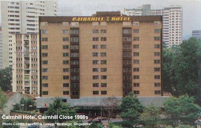
Cairnhill Hotel, Cairnhill Close (1979-1999)

Famous for its Coffee Garden and buffets in the eighties, the Cairnhill Hotel, at Cairnhill Close, began in the late sixties as Regency Hotel which was converted from a block of luxury flats. However, the construction of the hotel was incomplete due to financial issues, and remained so for the next decade.

It was not until 1979 when Tan Kim Hai, a Malaysian property developer, acquired the property and injected funds for the hotel to be fully built. Named Cairnhill Hotel, the newly-completed hotel was 11 storey tall and had more than 180 rooms.

Cairnhill Hotel was taken over by Wing Tai Holdings in 1996. It survived for another three years before the hotel was closed for good. The building was then torn down and replaced by a condominium named The Light at Cairnhill.

Singapura Forum Hotel, Orchard Road (1962-1985)

The $5.5 million Singapura Forum Hotel was one of the first hotels to be established at Orchard Road, and also the first hotel in Singapore to be managed by an international hotel chain – the Intercontinental Hotels group. The hotel, located at Orchard Road towards the Tanglin area, was opened in 1963, just one day after the formation of the Federation of Malaysia.

Forums and workshops by private organisations were regularly held at the eight-storey 200-room hotel, but the hotel’s profits in the early seventies were affected due to the intense competition with other new luxury hotels in the vicinity.

In 1972, Ng Teng Fong, a well-known property magnate, bought over the hotel. Initially wanted to demolish and replace it with shopping complexes, he instead sold it to a Dubai-based investment company in 1982 for $178 million.

Singapura Forum Hotel was eventually shut down in July 1983. It was replaced by Forum Galleria shopping and office complex that was opened in 1986. Even though they had long gone, the hotel’s popular Sentosa Restaurant and Pebbles Bar were still well-remembered by its former guests.

New 7th Storey Hotel, Rochor Road (1953-2008)

Despite its name, the New 7th Storey Hotel was actually nine storey tall. When it was completed in 1953, it was briefly the tallest building at the Rochor vicinity, and many taxi drivers and motorists used it as a landmark for their directions.
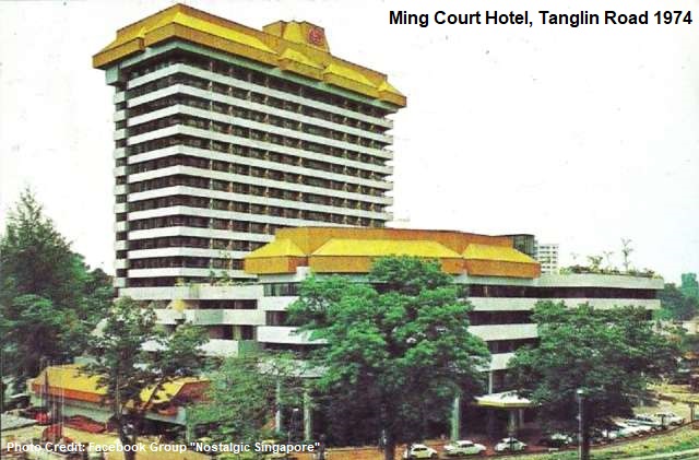
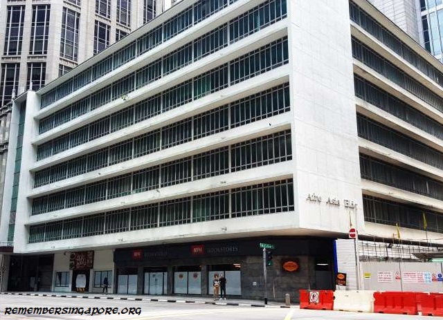
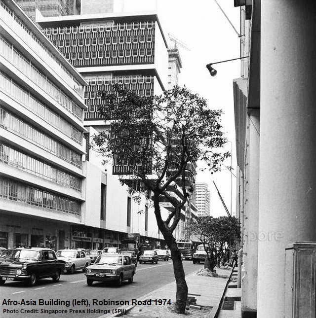
The New 7th Storey Hotel, founded by Wee Thiam Siew, began as a high end hotel, frequently patronised by European guests for stays in Singapore as well as British officers for tea parties.

But the hotel’s status declined by the late nineties, when it gradually became a budget hotel for backpackers.

In 2008, the half-century old New 7th Storey Hotel was demolished to make way for the new Downtown Line’s Bugis MRT Station.

Reborn Hotels – A New Lease of Life

Instead of demolition and redevelopment, some of the older hotels were sold, renovated and rebranded as new hotels. These include:

Ming Court Hotel (1970-1991), Tanglin Road, present-day Orchard Parade Hotel
Hotel New Hong Kong (1971-1979), Victoria Street, present-day Hotel Grand Pacific
Merlin Hotel (1971-1981), Beach Road, present-day Plaza Parkroyal Hotel
Apollo Hotel (1971-2004), Havelock Road, present-day Furama Riverfront Singapore
Paramount Hotel (1983-2010), Marine Parade Road, present-day Village Hotel Katong
Crown Prince Hotel (1984-2005), Orchard Road, present-day Grand Park Orchard
Dai-Ichi Hotel (1985-1999), Anson Road, present-day M Hotel

Published: 11 January 2018

Posted in General, Historic | Tagged , , , , , , , , , , , , , , , , , , , , , , , , , , , , , , , , , , , , , , , , , , , , , , , , , , , , , , , , , , , , , , , , , , , , , , , | 30 Comments

Changes in the City – Afro-Asia Building

One of the oldest office buildings at the Central Business District (CBD), the Afro-Asia Building will be demolished and replaced by a new 19-storey tower that is expected to cost $320 million in construction. The current Afro-Asia Building, owned by Afro-Asia Shipping Company (AAS), was built in the 1950s.

The Afro-Asia Building was designed in typical post-war modernism with a heavy emphasis in reinforced concrete and glass. At seven storey tall, it towered over rows of shophouses and other buildings, most of them only three storey tall, along Robinson Road when it was completed in the fifties.

By the late seventies and early eighties, the CBD area experienced a property boom with Raffles Place “competing” with Shenton Way in the development of new office building projects. Within a few years, new skyscrapers such as the Raffles Tower, OUB (Overseas Union Bank) Centre, Chartered Bank Building and HSBC (Hong Kong & Shanghai Bank) Building were built.

In 1982, the office space rental at Raffles Place’s buildings and towers reached a high range of $80 to $100 per square metre. The office buildings located at the fringes of Shenton Way and Robinson Road, such as International Plaza and Afro-Asia Building, began to pale in comparison, as they charged at a lower range of $40 to $60 per square metre.

Several unions had made their headquarters at the Afro-Asia Building in the seventies and eighties, including Singapore Bank Employees’ Union and National Trades Union Congress (NTUC). Other tenants were largely made up of banks, shipping and trading companies.

One of the better known tenants of Afro-Asia Building was MPH Bookstores, opened at the first level of the building in 1976. The book publishing company has a long history – it was first established in Malacca and moved to Singapore in 1890. Initially known as the Methodist Publishing House, it changed its name in 1927 to Malaya Publishing House, and Malaysia Publishing House after 1963.

Affected by the redevelopment of its landlord, the bookstore’s Robinson Road branch was closed in March 2017. This was after the closure of its iconic century-old flagship store at Stamford Road in 2002.

There was also a restaurant beside MPH Bookstores. It was once occupied by Pizza Hut between the mid-eighties and nineties. One of the largest Pizza Hut outlets in Singapore then, the popular fast food restaurant, patronised by many office workers during the lunch times, had a 150-seating capacity that cost $600,000 in renovation, including a $40,000 conveyor-belt oven that churned out pizzas in half the time compared to other outlets.

Beside the Afro-Asia Building, other office buildings at Robinson Road that were built during or before the 1950s included the Sindo House, Ramayana Building, AIA (American International Assurance) Building, Denmark House and Finlayson House. Most of them had been demolished or redeveloped. The former Telecoms Building (later Ogilvy Centre; present-day Hotel So Sofitel Singapore), constructed in the 1920s, is currently one of the oldest buildings along Robinson Road.

Published: 17 December 2017

Posted in General | Tagged , , , , , , , , , | Leave a comment

A Final Look at the Old Woodlands Town Centre

The Old Woodlands Town Centre was closed on 30 November 2017, after 37 years.

The small town centre, with six blocks of low-rise flats (1A-6A), was situated only 500m away from the causeway. Hence, for decades, the Old Woodlands Town Centre acted as the bustling transition town between Singapore and Malaysia, where its booming businesses such as the money exchangers, retail shops and eateries benefited from the large number of travellers and workers commuted daily between the two lands.

In the eighties, almost three-quarter of the shops’ regular customers were Malaysians. Dozens of large and small departmental stores and shops were established, one of which was the Welcome Department Store that sold a wide variety of products in men’s and women’s fashion, toys, houseware and electrical appliances. The biggest player was Emporium, while other smaller department stores included Aik Cheong Department Store and Yee Lian Department Store.

The history of Woodlands’ development began in the early seventies. In the 1970 HDB report, Woodlands was expected to be Singapore’s frontier town for the Malaysian visitors. By the mid-seventies, the Housing and Development Board (HDB) began planning for the building of the Woodlands Town Centre. A section of the dual-carriage Woodlands Road was converted in the late seventies into a single lane Woodlands Centre Road that formed a boundary loop around the new town centre.

The first phase of the Woodlands New Town construction was kicked off in the late seventies, but the progress was slow due to the low demand in its flats. The Woodlands New Town, however, was completed in 1980 at a construction cost of $10 million.

The new town centre was well-furnished and self-sufficient with rows of retail shops, coffeeshops, air-conditioned supermarket, cinemas, library and a HDB area office. The Woodlands branch of the Post Office Saving Bank (POSB) was also opened at the main Block 2. With the completion of the new town centre, HDB was hoping that it could prove to be an attraction for residents to move to Woodlands.

Other amenities were gradually added in the early eighties. The street hawkers were resettled at the town centre’s new hawker centre. In 1981, the Woodlands Bus Interchange at Woodlands Town Centre was completed. Designed with 17 berths, it provided, at the start, five bus services in 169, 178, 181, 204 and 208.

The bustling businesses at Woodlands Town Centre, however, had turned it into a magnet for all sorts of crimes. Snatch thefts and housebreaking were so rampant that some residents branded the place as a “black spot”. But the town centre was struck by its most serious case in 1984 when an arsonist burnt down two shophouses, causing the death of 10 people, many of them died of asphyxiation. It was the worst fire-related tragedy in Singapore since the 1972 fire at Robinson’s that claimed nine lives.

Beside the negative headlines of the crimes happening at the Woodlands Town Centre, its hawker centre was also subjected to constant criticisms. In 1987, the hawker centre was even dubbed as the “dirtiest in Singapore”. It took HDB and the Woodlands Town Centre Merchants’ Association a great deal of effort to educate the stallholders, cleaners and customers to improve the cleanliness of the hawker centre.

In 1988, the HDB, Ministry of the Environment and the Parks and Recreation Department even stop cleaning Woodland Town Centre for a day to demonstrate to its residents and visitors how bad the surroundings would be affected by inconsiderate littering.

The new Bukit Timah Expressway was opened in 1985, connecting the Woodlands Town Centre to the Pan-Island Expressway (PIE) and providing much needed convenience and accessibility to the northern residents of Singapore.

The same period also saw the completion of the Woodlands Town Garden, located opposite of the Woodlands Town Centre. The $8.5-million park was designed with ponds, Chinese pavilions, Malay-style huts, arch bridges, a watch tower and a floating restaurant. An underpass across the Woodlands Centre Road linked the 12.8-hectare park and Woodlands Town Centre together.

The Old Woodlands Town Centre was also a short distance away from Kampong Fatimah, previously one of the last kampongs in Singapore. In 1989, the residents of the idyllic kampong – with its wooden houses on stilts and crude plank bridges linking the houses together – had to be resettled, and its site was acquired by Singapore from the Malaysian government for the extension of the Woodlands Immigration Complex.

In 1992, with the opening of the new Woodlands Mass Rapid Transit (MRT) Line and underground bus interchange at Woodland Square, it became the new town centre for Woodlands. The “old” Woodlands Town Centre gradually lost its importance as the new town’s administrative centre. With minimal upgrading, the old town centre would largely remain the same for the next 25 years.

The fate of the old Woodlands Town Centre was finally sealed in the 2010s, when it was announced that its site would be acquired for redevelopment, as part of the extension project for the Woodlands Checkpoint to ease traffic congestion, improve lane clearance and enhance overall security. In 2012, the town centre’s blocks of low-rise flats were chosen under the Selective En-bloc Redevelopment Scheme, and by late November 2017, the residents and shopowners had vacated the place and the town centre closed.

Published: 09 December 2017

Posted in General | Tagged , , , , , , , , , , , , , , , , | Leave a comment