I guess every Singaporean has a story to tell in one way or another… of the place he or she was born and raised. Each story is a unique memory. I’m no exception. My hometown was Ang Mo Kio. If the life expectancy of a Singaporean male is around 79, I’d have spent almost one third of my life living in Ang Mo Kio.
Ang Mo Kio and My Family
My parents moved to Ang Mo Kio in 1979 when I was 3-plus. Previously, we lived in a rental flat at Toa Payoh. The successful balloting came as a delightful surprise as Ang Mo Kio was then an upcoming new town. Costing $13,000, our three-and-a-half room flat was located in a favourable location along Ang Mo Kio Avenue 10, where there were convenient amenities such as hawker centre, wet market and schools within short walking distance.

Most of my peers, including me, grew up living in HDB flats. Not for my parents though, who had lived in kampong during their younger days. My father grew in a humble Hakka village off Old Holland Road, while my mother was from Chia Keng, a Teochew kampong that was formerly located near the present-day Yio Chu Kang Stadium and was demolished in the mid-eighties. Imagine their delight when they moved into a new unit with ready supply of water, electricity and modern sanitation.
Ang Mo Kio… Tomato or Bridge?
For years, there were misconceptions that the name of Ang Mo Kio was derived from the Hokkien term for tomatoes. However, no tomato farms were ever grown in this vicinity.
Thus, the more likely origin of the name came from the bridge purportedly built by the British Government Surveyor John Turnbull Thomson (1821–1884) at the junction of Upper Thomson Road and Ang Mo Kio Avenue 1. Upper Thomson Road was also named after him. Another saying was that there were nine, instead of one, bridges in Ang Mo Kio. They were built by the British military, and therefore being termed “ang mo kio“, which means “Caucasian’s bridge” in Hokkien.
The final explanation was that there were actually two major bridges in the old swampy Ang Mo Kio. One was a wooden bridge and the other was made of concrete. The locals called the bridges as “pang kio” (“wooden bridge” in Hokkien) and “ang mo kio” (“ang mo” here refers to “ang mo huay“, which means “concrete” in Hokkien).
Whether it was one, two or nine bridges, they, along with the swamps, farmlands and villages, had long vanished in the development of Ang Mo Kio New Town.
Ang Mo Kio Districts and Avenues
The earliest plan to build a residential estate at Ang Mo Kio began in 1971. It was initially intended for the small car repair shop owners who had been relocated from the city area. By 1973, it was decided to develop Ang Mo Kio into a new town with self-sufficient facilities. It would be the seventh housing estate in Singapore built by the Housing and Development Board (HDB).

Ang Mo Kio was designed with six neighbourhoods with streets that run perpendicular to each other. As such, it was the first new town in Singapore to be designed in metric dimensions.
There is a total of ten main avenues in Ang Mo Kio. The avenues in odd numbers (Avenue 1, 3, 5 and 9) run from east to west in ascending order, whereas the even-numbered avenues (Avenue 2, 4, 6, 8, 10 and 12) run from north to south.
However, Ang Mo Kio Avenue 7 is missing in the map, which logically should be parallel between Avenue 5 and 9. Did the town planners make a mistake last time? Ang Mo Kio Avenue 7 was mentioned in some history context but its exclusion remains a mystery till today. There is also no Ang Mo Kio Avenue 11 because Yio Chu Kang Road is already running parallel to the north of Ang Mo Kio Avenue 9.
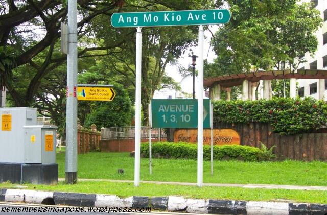
The smaller streets in Ang Mo Kio, on the other hand, are numbered according to the clusters of flats they lead to. Ang Mo Kio Street 52, for example, runs through the neigbourhood with the block numbers began with 500-plus, where Ang Mo Kio Street 44 leads to the 400-plus-numbered flats. This concept is also used in other new towns such as Bishan and Jurong East/West.
The six neighbourhoods in Ang Mo Kio are categorised as Kebun Baru/Mayflower (with blocks numbered 100- and 200-plus), Teck Ghee (block 300-plus), Chong Boon (block 400-plus), Cheng San (block 500-plus), Yio Chu Kang (block 600-plus) and Town Centre (block 700-plus).
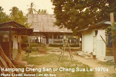 Cheng San, in particular, was named after Kampong Cheng San, also known as Cheng Sua Lai (青山内, “Green Hills Interior” in Hokkien), a dominant village that existed in the area between the fifties and seventies. It was made up of many clusters of Hokkien and Teochew villages, as well as some Malay and Indian families. A long track known as Cheng San Road once cut through the vegetation and farmlands in old Ang Mo Kio to link between Upper Thomson Road and Serangoon Gardens.
Other villages included Jio Sua (石山, “Stone Hill”) and Kow Tiow Kio (九条桥, “Nine Bridges”). Jio Sua was an early Hokkien village existed from the late 19th century till the mid-seventies. It was located at present-day Ang Mo Kio Town Garden West and was likely to named after a red sandstone that was found in the vicinity. Farming and quarrying were the main activities then.
Named after the nine bridges built by the British to link Lorong Kinchir over the Kallang River, Kow Tiow Kio was a settlement along present-day Ang Mo Kio Avenue 1 that housed mainly Hokkien, Teochew and Hainanese families. The villagers engaged in vegetable and fruit farming, pig rearing and rubber and coconut plantations. They were resettled in the seventies to Sin Ming, Toa Payoh and other parts of Ang Mo Kio.
There was another smaller village, known as Lak Xun (六巡), located between Track 14 and 16 (both were defunct today) of Yio Chu Kang Road.

Amoy Quee Camp is the only military camp based in Ang Mo Kio. Formerly a British army camp, its name was derived from Kampong Amoy Quee that once dominated this area. The name of the kampong itself arose from the nickname given to the British and Australian soldiers by the locals.
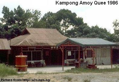 During the pre-independence days, the military personnel living at the Serangoon Gardens would drive through the kampong as a shortcut to the Seletar and Sembawang camps. Their reckless drivings sometimes killed the villagers’ chicken and other livestock. The angry locals thus nicknamed the Caucasians as “ang moh kwee” (“red-haired devils” in Hokkien).
There is also a small housing estate located along Yio Chu Kang Road, considered part of Ang Mo Kio New Town. It is the Teachers’ Housing Estate, completed in 1968 by the Singapore Teachers’ Union (STU). The project aimed to provide affordable housing for the teachers. More than 250 terrace houses were built and priced at around $24,000, which was still a large amount for the teachers then. Eventually only 70% of the houses were sold to teachers.
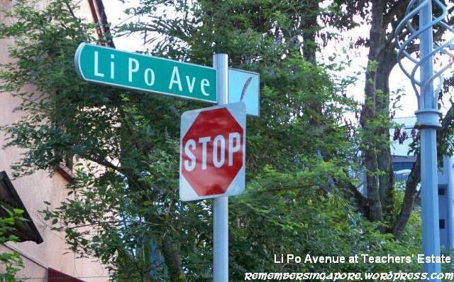
An interesting trivia about Teachers’ Estate is that all its roads are named after famous poets and philosophers.
Some examples are Li Po Avenue, Tu Fu Avenue, Tung Po Avenue (named after ancient Chinese poets Li Bai 李白, Du Fu 杜甫 and Su Dong Po 苏东坡), Iqbal Avenue (named after Muslim poet Muhammad Iqbal) and Omar Khayyam Avenue (named after Persian poet Omar Khayyam).
Ang Mo Kio and My Schools
My ten years of primary school and secondary school life were spent within Ang Mo Kio. Make it twelve if I included the kindergarten. Unlike today, there were few or no nurseries or pre-education classes in the early eighties. Kids spent most of their time playing with masak-masak (“cooking” in Malay but it generally means “playing with toys” in Singlish context) instead of learning violin, piano or ballet. The financial means of a middle class family then could hardly afford these courses anyway.
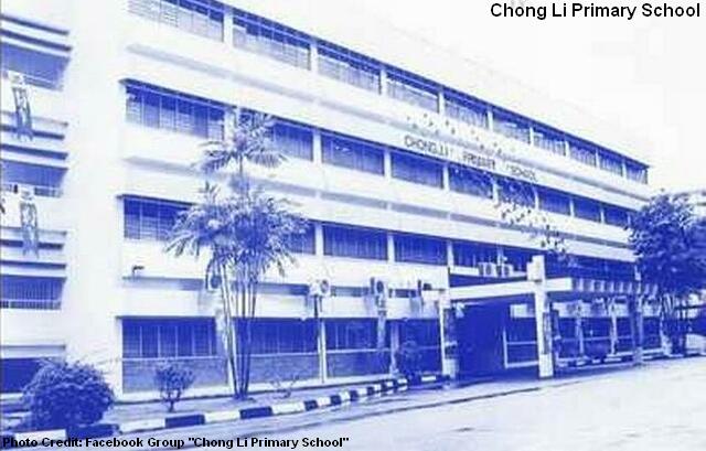
My primary school, Chong Li Primary School, used to stand side by side at Ang Mo Kio Avenue 44 with Chong Boon Primary School and Anderson Secondary School, which was also my secondary school.
Anderson Secondary School was formerly located at Steven Road, before moving to Ang Mo Kio in 1984. A decade later, it was shifted to another site at Ang Mo Kio Street 53. By 2000, Chong Boon Primary School was merged with Da Qiao Primary School, while my primary school also vanished after its 2003 merger with Teck Ghee Primary School. The large premises are now occupied by Chong Boon Secondary School.
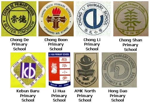
Other primary schools in Ang Mo Kio that had also vanished were Li Hua Primary School (formerly Lee Hua Chinese School, 1970s-2000), Ang Mo Kio North Primary School (1981-2000), Chong De Primary School (1982-1998), Hong Dao Primary School (1982-2000), Chong Shan Primary School (1982-2001) and Kebun Baru Primary School (1983-2002). Meanwhile, Ai Tong Primary School was located at Ang Mo Kio Avenue 3 between 1981 and 1992.

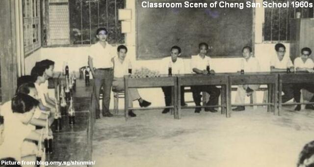
The current primary schools in Ang Mo Kio include Da Qiao Primary School (formerly Tai Keou School, founded in 1936 at North Bridge Road. Relocated to Ang Mo Kio in 1982), Jing Shan Primary School (formerly Cheng San School, established in 1945 at Kampong Cheng San), Ang Mo Kio Primary School (since 1978), Mayflower Primary School (since 1979), Townsville Primary School (since 1982) and Anderson Primary School (since 2000).
The days of primary school had got to be the best moments in my life. Those were the happy memories in playing gor li (marbles) and hantam bola during recesses, exchanging Panini stickers with classmates, catching guppies in nearby longkang and doing projects in order to earn that Zoologist science badge. We also had school excursions at Sentosa (riding the monorail) and Haw Par Villa (which gave me nightmares for many nights).
Ang Mo Kio Town Centre
Ang Mo Kio Town Centre, or fondly known as Ang Mo Kio Central/Centre, is a bustling self-sufficient neighbourhood since its development in the late seventies. Also one of the largest town centres in Singapore, it was built on a low-lying location in-between small hillocks on the eastern and western flanks. The hilly parts of Ang Mo Kio are still visible today at Ang Mo Kio Town Garden East and Ang Mo Kio Town Garden West.
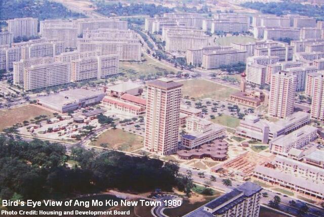
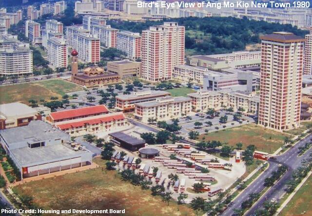
In the eighties and early nineties, residents from the neighbouring Bishan, Yishun and Sembawang would flock to Ang Mo Kio to shop, dine and catch movies, because the shopping facilities in their respective housing estates were not fully developed yet.
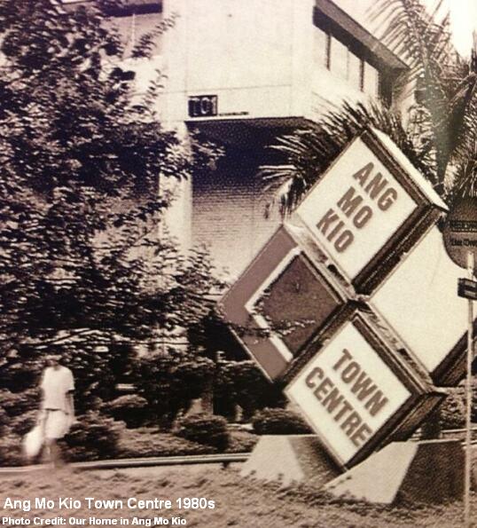
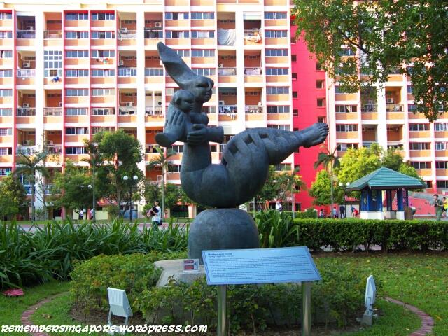
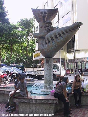
Beautifully lit up at nights, the large fountain was perhaps the most famous landmark of Ang Mo Kio Town Centre in the eighties. Its water, however, was drained away sometime in the nineties, leaving the fountain emptied and unmaintained. Slowly forgotten over the years, it was eventually demolished.

The Oriental Emporium dominated the local retailer sector in the eighties. Being one of the largest and upcoming housing estates in Singapore, Ang Mo Kio was unsurprisingly chosen by the departmental giant for the location of one of its outlets. It had a grand opening at the town centre on the 28th March of 1980. Selling a large variety of products, Oriental Emporium became one of Singaporeans’ favourite shopping destination in the eighties.

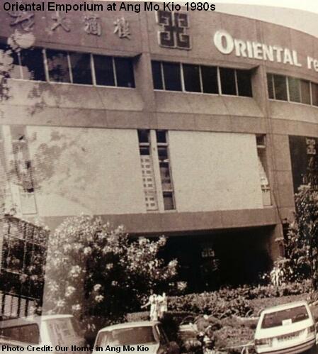
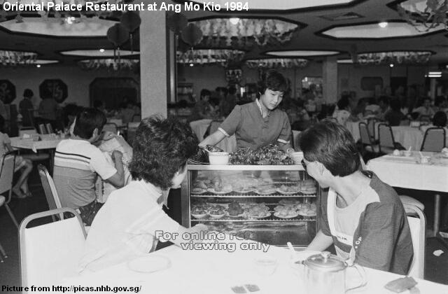
Owned by the Emporium Holdings Group, the former Oriental Palace Restaurant was also a popular venue in Ang Mo Kio for the hosting of wedding and birthday celebration dinners. To enjoy yum cha (morning tea in Cantonese) at the restaurant on a Sunday morning was a treat then; something that I looked forward to if my parents had a lucky strike in 4D.
One of the my favourite places at the Ang Mo Kio Town Centre during my childhood was the children’s traffic garden. It was like a mini version of the Road Safety Park at East Coast. Beside small bicycles, there were the more popular battery-powered “motorbikes” and “cars” for kids. I could not remember the cost of each ride. It was probably 50c for a 10-minute ride.
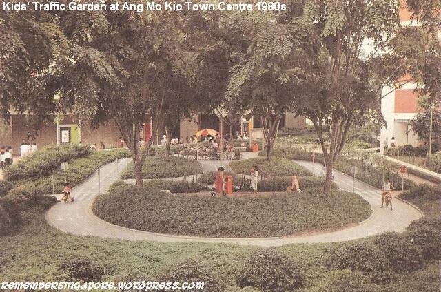
After the traffic garden was demolished, the vendor still operated his business elsewhere at the town centre. The kids were then free to roam around in their miniature vehicles. Such vendors could still be seen today at other places such as the Bukit Merah Town Centre.
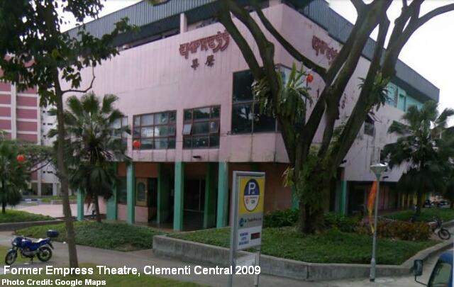
There used to be four cinemas at the Ang Mo Kio town centre. The earliest was the Ang Mo Kio Cinema, but it was gone by the mid-eighties and its premises was converted into the Big Mac Centre today.
The other three cinemas, Broadway, Jubilee and New Crown/New Town, had found their ways into Ang Mo Kio heartland in the eighties and nineties. Owned by Cathay, Eng Wah and other cinema operators, they provided cheap and convenient access to the popular Hong Kong and Hollywood movies for the residents and students.

I could not remember how many Stephen Chow and other Hong Kong movies I had watched at those cinemas. Broadway Cinema was located just opposite the Ang Mo Kio Central Market and Food Centre, which served delicious satay beehoon, carrot cake, Hokkien mee and other local delights.
There was also a popular second-hand book store beside the Ang Mo Kio Central Food Centre that had been around for some twenty years. However, it was shut down for good after the renovation of the hawker centre a few years back.
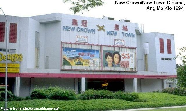
During my school days, I used to patronise the arcade game shop at the building which housed the New Crown/New Town cinema. The Korean buffet restaurant Seoul Gardens used to run its business at its premises too. After the cinema ceased its operation, the entire building was painted red and became known as the New Crown Building. It was then demolished in mid-2012.
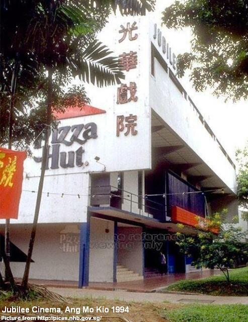
Jubilee Cinema was the smallest of the trio in the nineties. Its building was easily identifiable with the large Pizza Hut logo. Located next to it was (and still is) the large S11 kopitiam, ensuring the late night movie-goers would not go home with hungry stomachs. The building is now a little shopping mall called Jubilee Square.

The Ang Mo Kio Public Library was officially opened in August 1985 after four years of planning and two years of construction. Formerly known as Ang Mo Kio Branch Library, it was the fifth branch library to be built in Singapore. Before the completion of Ang Mo Kio library, a small mobile library was temporarily set up at Block 528 for the residents. Otherwise, the residents had to travel to the Toa Payoh library for books and other materials.
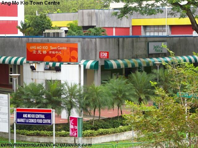
Filled with many retail shops, the Ang Mo Kio Town Centre was the favourite destination for me to hang around after school. I could spend hours walking around hunting for cassettes (and music CDs in the later times), comics, shoes and “friendly” versions of PC games. Or playing Virtua Striker at the arcade. Or simply enjoying a frosted mug of root beer float at the A&W restaurant with friends.
Ang Mo Kio Bus Interchange and MRT
Feeder bus service 261 that loops around my old home has got to be the most frequent bus service in Ang Mo Kio. However, in the eighties and early nineties, it was the only bus service within short walking distance from my flat. It was only many years later before they added Service 55 which linked up Hougang, Ang Mo Kio and Bishan.
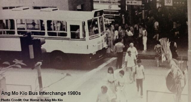
The old Ang Mo Kio Bus Interchange was opened in 1980 and expanded in 1983 to cater for the growing population in the new town. The feeder buses would stop before the traffic light (shown in the photo above) at the bus interchange for the commuters to alight. Lasted more than twenty years until 2002, the old interchange was then shifted to a temporary location near the Ang Mo Kio Public Library while the new Integrated PT (Public Transport) Hub was constructed. The new air-conditioned interchange was finally opened in April 2007.
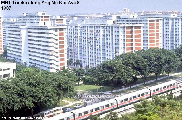
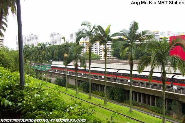
An underpass link was constructed between the old bus interchange and the Ang Mo Kio MRT Station when the latter was opened in November 1987. The first section of the North-South Line consisted of only five stations (Toa Payoh to Yio Chu Kang) over six kilometers. In the following year, 15 more stations were opened, allowing the Ang Mo Kio residents to travel conveniently to Yishun, Orchard and City Hall.
HDB Flats in Ang Mo Kio
In 1973, the blocks, numbered 213-216, were the first ever flats to be completed in Ang Mo Kio. Three years later, the new town’s first market and hawker centre were added to Block 226. Soon, the first community centre, kindergarten, primary and secondary schools in Ang Mo Kio were also established in the same neighbourhood.
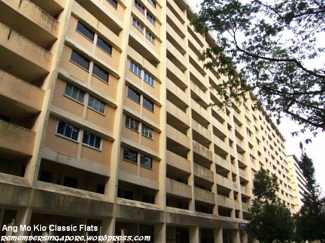
The design template of such classic HDB slab blocks and point blocks had been duplicated at new towns built in the late seventies and early eighties, including Ang Mo Kio, Bedok and Clementi.
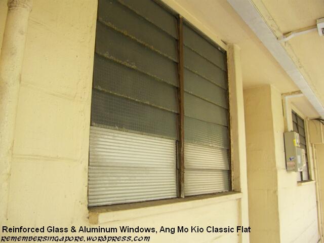
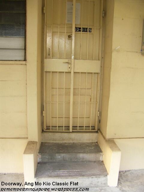
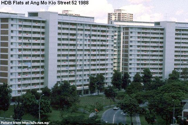
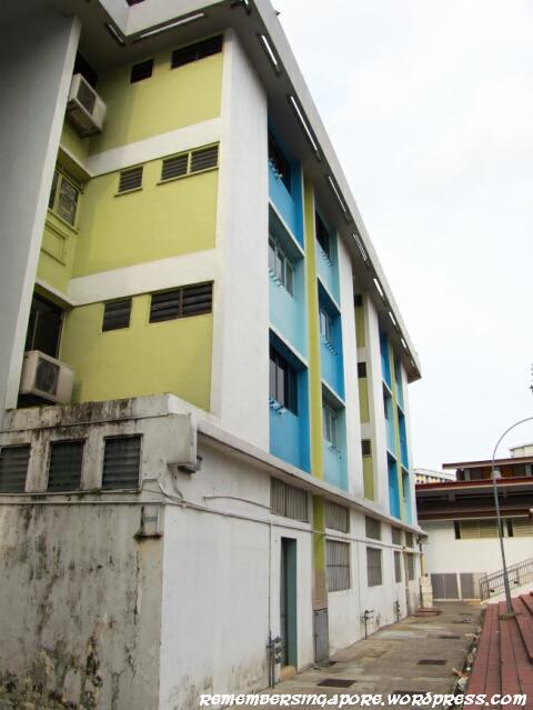
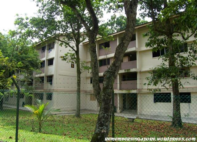
The photos here show an en-bloc HDB flat along Ang Mo Kio Avenue 1. The blocks have been emptied since early 2012. The design were similar to my old Ang Mo Kio flat at Avenue 10, with its recognisable reinforced glass and aluminum window panes, small double-stepped doorway and symmetrical metal door grilles.
The slab block design typically consists of rows of two-room or three-room, three-and-a-half room and four-room units. The four-room units are usually located at both ends of the long common corridors. Before the upgrading scheme, the lifts of these flats do not stop at every level.
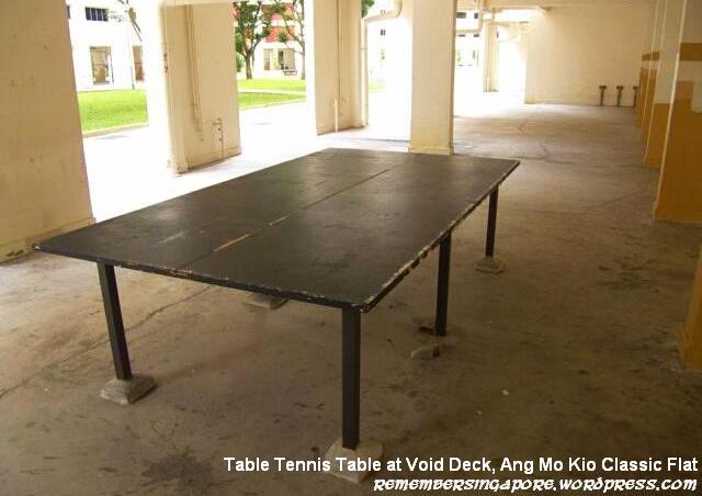
Void decks are multi-functional spaces for the residents living in the HDB flats, which can be used to hold Malay weddings or Chinese funeral wakes. For the kids, a void deck is also ideal for a game of football, despite the no-football sign. The mounted table tennis tables served as a free facility for ping-pong lovers; it also served as a “playground” when someone creatively invented the game of “crocodiles” using the table tennis table.
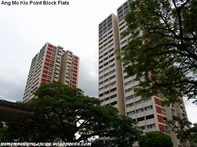
For approximately every ten slab blocks in each neighbourhood, there is a point block made up of five-room units.
In 1981, a circular block of flats was constructed by the HDB at the end of Ang Mo Kio Avenue 1. It was an experimental attempt to break through the design of the classic slab and point blocks. Nicknamed the “Four Leaf Clover Flat” due to its shape from the top view, it has 96 five-room units with interior curved walls. Even the water tanks at the rooftops are customised to suit the circular shapes.
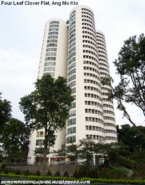
When it was launched, each unit cost more than $110,000, significantly higher than other five-room flats during the early eighties. The reviews were mixed, as the residents found the curved designs impractical, having to spend more on renovations and customised furniture. The HDB stopped building such designs since then, thus making the “Four Leaf Clover Flat” the one and only circular flat in Singapore.
Ang Mo Kio Hawker Centres and Wet Markets
There is a total of nine hawker centres in Ang Mo Kio; the most in a new town in Singapore. The first hawker centre and market began at Block 226 along Ang Mo Kio Avenue 1. As the new town expanded with addition of housing districts, more hawker centres were built to cater for the growing population.
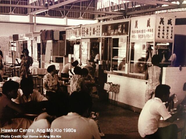
The nine hawker centres and wet markets within Ang Mo Kio are: Ang Mo Kio Central Market and Cooked Food Centre, Cheng San Market and Cooked Food Centre, Chong Boon Market and Food Centre, Kebun Baru Market and Food Centre, Mayflower Market and Food Centre, Teck Ghee Court Market and Food Centre, Teck Ghee Square Market and Hawker Centre and Yio Chu Kang View Market and Food Centre.
The Sembawang Hill Food Centre along Upper Thomson Road is also listed within the administration of Ang Mo Kio constituency.
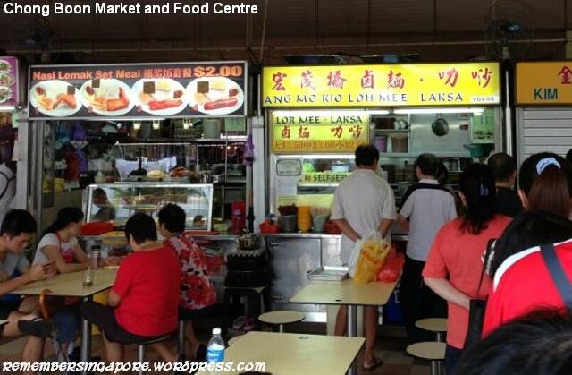
There are many good food found in Ang Mo Kio. Many of the stallholders have been operating here for more than twenty years. The laksa, Teochew fish ball noodle (Chong Boon hawker centre), Hokkien mee (Teck Ghee Square and Cheng San hawker centres), bak chor mee (Ang Mo Kio central kopitiam), Penang prawn noodle (Ang Mo Kio central S11), satay beehoon (Ang Mo Kio Central hawker centre) and roti prata (Mayflower kopitiam) are some of my favourites.
Ang Mo Kio Places of Worship
Masjid Al-Muttaqin is the only mosque in Ang Mo Kio, and is the fifth mosque in Singapore to be completed under the Mosque Building Fund Scheme.
In the seventies, a place of worship was essential for the Malay Muslim residents who were resettled in Ang Mo Kio. Most of them were previously from the kampongs at Jalan Kayu, Buangkok and Tongkang Pecah (present-day Fernvale, Sengkang), who had to travel to Upper Serangoon and Thomson Road for their religious activities.
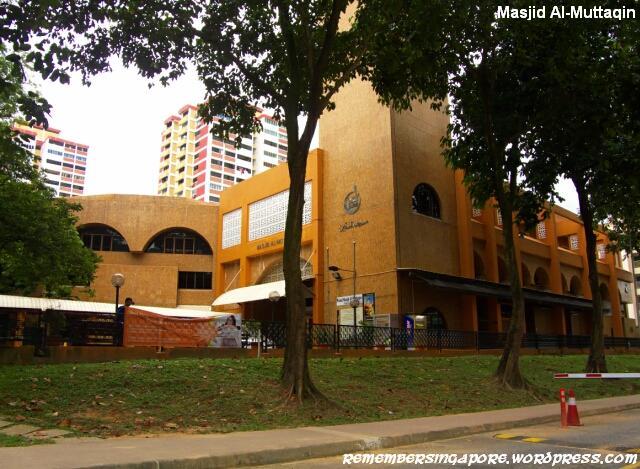
After two years of fund-raising by the devoted Muslims, it was decided that the new mosque was to be built at a 3,000 square meter site along Ang Mo Kio Avenue 6. At a cost of $1.8 million, it was officially opened in September 1980 with an accommodation of 2,700 worshippers. It has since became a distinctive landmark at the Ang Mo Kio Town Centre.
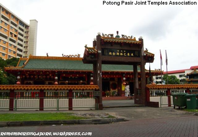
There are many Chinese temples in Ang Mo Kio, one of which is the Potong Pasir Joint Temples Association. As its name suggests, the temple originates from Potong Pasir. It is made up of five Chinese temples that were formerly located at Kampong Potong Pasir. Due to the development of Potong Pasir in the seventies and eighties, the five temples decided to join as one. The association was established in 1982, and was shifted to Ang Mo Kio Street 44 five years later.
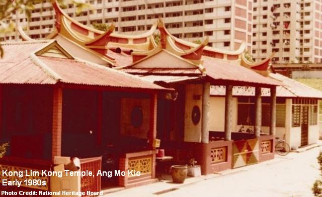
Another combined temple is Ang Mo Kio Joint Temple. It comprises three older Chinese temples that joined together as one in 1978. One of them was Kong Lim Kong Temple (檺林宫), who has its roots traced back to the late 19th century at Fujian province of China. The other two were Leng San Giam (龙山岩) and Kim Eang Tong (金英堂), established in the fifties and sixties at Cheng Sua Lai and Jio Sua respectively.
The third and fourth joint temple are Liuxun Sanhemiao Temple (六巡三合庙) and Chu Sheng Temple (聚圣庙) respectively. The former is made up of three kampong temples, Hong San Chin Huat Temple Association (凤山堂进法殿全盛宫), Sam Ann Fu (三安府) and The Longxuyan Jinshuiguan Temple (龙须岩金水馆), that once served the Lak Xun village. Chu Sheng Temple, completed in 1981, houses three old temples from Yio Chu Kang, namely Ji Fu Gong (集福宫), Hua Tang Fu (华堂府) and Long Quan Yan (龍泉岩).
The history of Swee Kok Guan Temple (水沟馆葛岸馆庙) went back to the early 20th century, when it was set up by the Chinese immigrants of the surname”Ang”. The temple began at Buona Vista, before moving to Holland Road and Choa Chu Kang. In the late sixties, there were three Swee Kok Guan temples in Singapore; the other two were located in Yio Chu Kang and Sembwang. In 1977, all three temples were combined to form one Swee Kok Guan Temple at Ang Mo Kio Street 61.
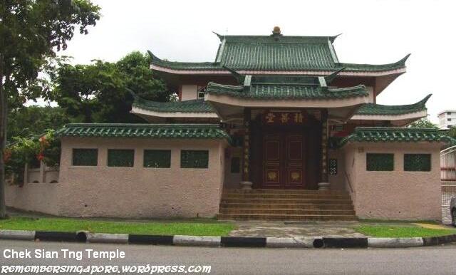
Chek Sian Tng (积善堂) at Ang Mo Kio Street 44 is a temple devoted to Avalokitesvara Bodhisattva (观音). Its history went back to the early 20th century, and was located at Kramat Road until the early eighties, before it found its home at Ang Mo Kio in 1984. Chek Sian Tng is also a temple specially for female devotees who wish to commit an ascetic life.
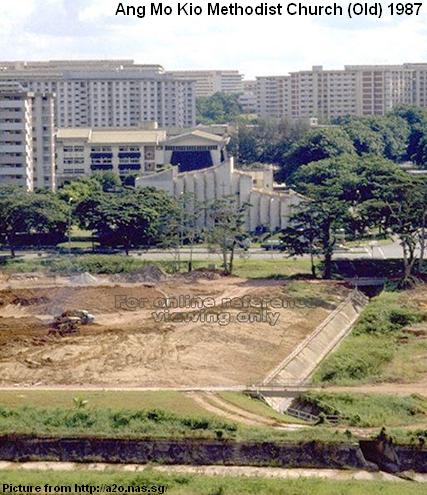 The services of Ang Mo Kio Methodist Church was originally held in 1976 in a rented house at Mayflower housing estate. As the number of its followers grew, it decided to build its own building together with two other Methodist conferences (Paya Lebar Chinese Methodist Church and Emmanuel Tamil Annual Conference). The church was completed at Ang Mo Kio Avenue 1 in 1981, and was upgraded several times over the years.
The barren ground in front of the church shown in the photo has been developed into Bishan-Ang Mo Kio Park.
Other churches in Ang Mo Kio are St. Thomas Orthodox Syrian Cathedral (built in 1983), Bethesda Hall at Ang Mo Kio Avenue 4 (1984) and First Evangelical Reformed Church at Yio Chu Kang Road (1994).
 Catholic Church of Christ the King, the only Catholic Church in Ang Mo Kio, was opened in September 1982 at a cost of $3 million. In the seventies, the Catholics living in the vicinity of Ang Mo Kio had to travel to Upper Thomson (Church of Holy Spirit) or Serangoon Gardens (Church of St Francis Xiavier) to call their parish.
In 1999, its old building was demolished and replaced by the current church.
Community Centres and the Swimming Complex
The first ever community centres in Singapore were the Serangoon and Siglap Community Centres, both opened in May 1953. The initial objectives were to encourage participation in grassroots activities and to promote grassroots leadership. Today, there are as many as 105 community centres or clubs in Singapore.

Ang Mo Kio has five community centres, namely Ang Mo Kio CC, Cheng San CC, Kebun Baru CC, Teck Ghee CC and Yio Chu Kang CC. The first community centre in Ang Mo Kio, however, began in the mid-seventies at a humble corner of Block 226B, along Ang Mo Kio Street 22.
Opened in December 1978, the original Teck Ghee CC was located at Ang Mo Kio Avenue 1. In 1991, the former Chong Boon CC at Ang Mo Kio Avenue 10 was renamed as Teck Ghee CC after Teck Ghee became part of Ang Mo Kio Group Representation Constituency (GRC).
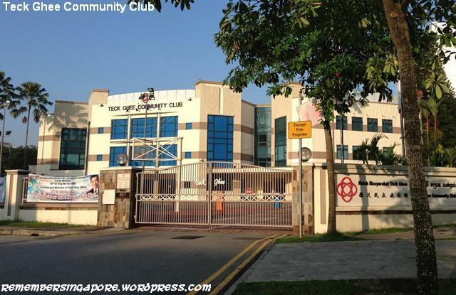
Chong Boon CC itself was originally housed in a small room at the void deck of Block 408 of Ang Mo Kio Avenue 10. A nearby venue was later chosen to build a new $3 million building with modern facilities such as basketball, tennis and squash courts, library and multi-purpose rooms. At its groundbreaking ceremony in September 1982, various religious leaders were invited to bless the project. The new community centre was officially opened in 1983.
An interesting trivia about Teck Ghee CC is that in 2008, actress Gong Li received her pink identity card (IC) at a citizenship ceremony held at the community centre.

Like Teck Ghee and Chong Boon CC, Ang Mo Kio CC and Kebun Baru CC were also built in the late seventies and early eighties respectively. Meanwhile, Yio Chu Kang CC and Cheng San CC have their histories traced back to the fifties and sixties.
I have forgotten how much time I had spent playing basketball at these community centres.
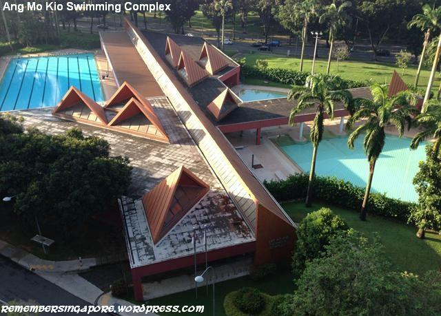
 The construction of Ang Mo Kio Swimming Complex by the HDB in 1982 was welcomed by the residents of Ang Mo Kio, who otherwise had to travel to Toa Payoh if they wanted to enjoy a dip in the water.
The prominent red-tiled swimming complex with triangular roofs, situated off Ang Mo Kio Avenue 1, even won the Singapore Institute of Architects’ Architectural Design Award in 1986.
Ang Mo Kio’s Dragon and Merlions
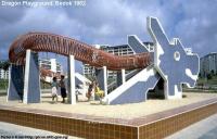
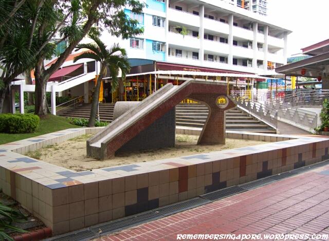
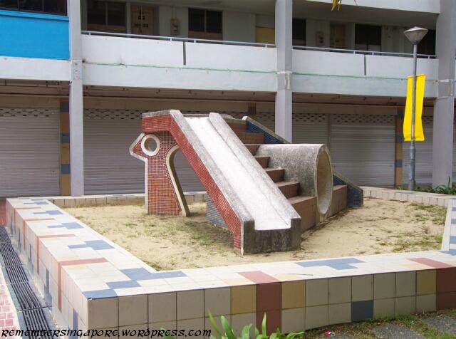
One of four remaining dragon playgrounds in Singapore can be found standing at the junction of Ang Mo Kio Avenue 3 and Avenue 10, with its sand box refurbished with rubber mats and its metal body repainted.
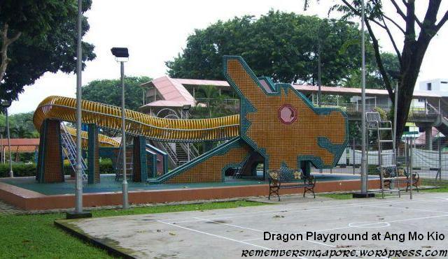
There used to be many sand-based playgrounds scattered around Ang Mo Kio during the eighties. After 1993, these old playgrounds were slowly replaced by the newer and safer plastic playgrounds.

At the entrance of the carpark to the blocks of 216-222 stand a pair of Merlions. They were built by the Ang Mo Kio Residential Committee in 1998 at a cost of $13,000. The pair was almost forced to be removed because of the infringement of copyrights, due to the fact that the Singapore Tourism Board (STB) owns all intellectual properties of Merlion.
In the end, the Ang Mo Kio Merlions managed to stay on, and have become the iconic features along Ang Mo Kio Avenue 1.
The Gardens of Ang Mo Kio

Ang Mo Kio Town Garden East is the new town’s first town garden. Built in the late seventies, it was formerly part of Kampong Cheng San. Rubber trees and nutmeg groves used be grown all over the small hill. Today, some old rubber trees still stand in Ang Mo Kio Town Garden East, witnessing the tremendous changes in its surrounding environment in the past few decades.

Ang Mo Kio Town Garden West, on the other hand, was developed in the eighties at the hillock on the other side of the town centre.
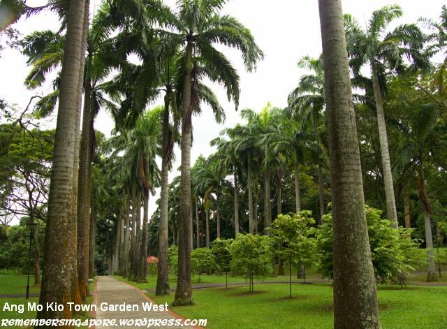
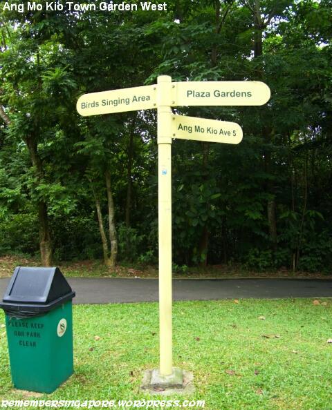
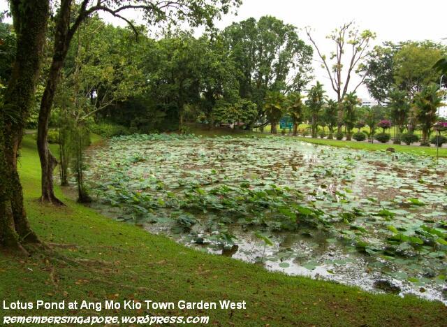
It was designed and developed by a Japanese contractor company at a cost of $2.7 million. The fascinating part about Ang Mo Kio Town Garden West is that it still contains the secondary forest and its original vegetation and terrains. Certain stretch of the former Cheng San Road was also incorporated into its current footpaths.
National Day Parade, Chingay and VIP Visit
Between 1975 and 1983, the National Day Parade was held in alternate years between centralised and decentralised locations. The centralised locations referred to the National Stadium and Padang, while the decentralised locations were the residential neighbourhoods such as Ang Mo Kio, Toa Payoh, Redhill and Queenstown.
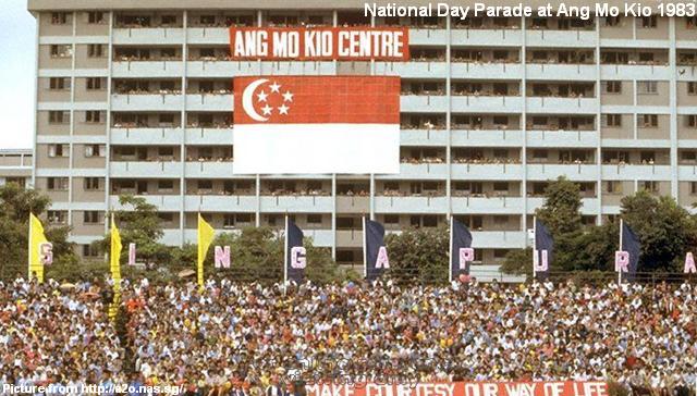
The Ang Mo Kio residents were delighted when the National Day Parade in 1983 was chosen to be held at Ang Mo Kio. That was the last time the National Day Parade was held at a decentralised site. In the nineties, some of the mobile column of military trucks and tanks would drive past Ang Mo Kio as part of their routes through the heartlands.

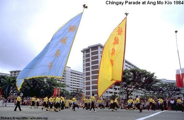
Chingay was another annual parading event celebrated by Singaporeans. I remember as a kid, I waited enthusiastically by the roadside to watch the likes of lion and dragon dances, and beautifully decorated floats (mounted on top of those old trucks) drove past.
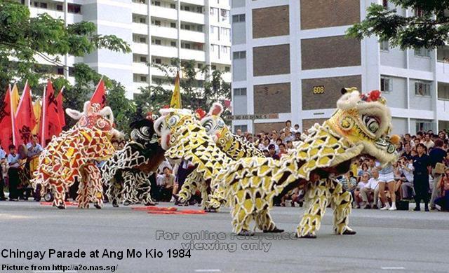
Chingay, literally means “art of masquerade” (妆艺) in Hokkien, was originally a street celebration of the Chinese New Year festivals with the addition of the celebrating the birthdays of Chinese Taoist deities. Its local history went back to the 19th century, but the annual event, deemed as financially extravagant and culturally backward, was abolished in 1906.
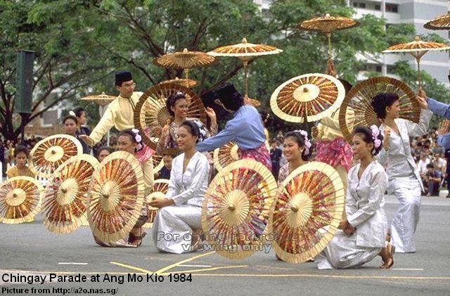
When the firecrackers were banned in Singapore in 1972, there was unhappiness among the local Chinese, as it dampened the festival mood of the Chinese New Year celebrations. As an alternative, former Prime Minister Lee Kuan Yew proposed the revival of Chingay in Singapore. Hence, the first Chingay parade was held successfully in 1973, and subsequently it was organised annually at Toa Payoh (1974), Marine Parade (1978) and Ang Mo Kio (1984). In the late seventies, Chingay had evolved into a multicultural event with the participation of the Malay and Indian cultural performance groups.
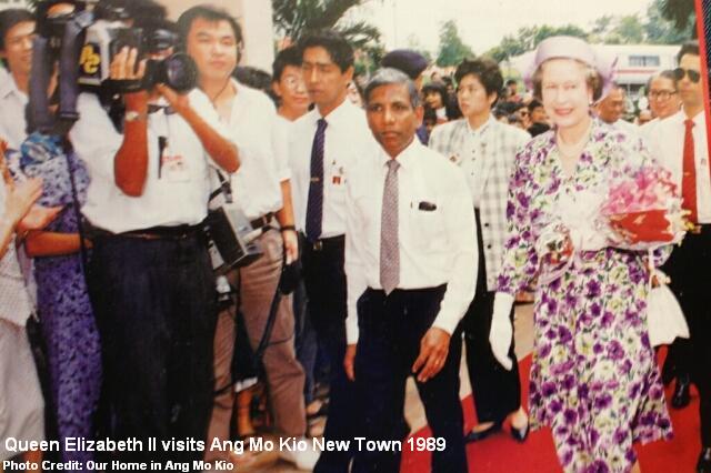
Like Queenstown, Ang Mo Kio also has a VIP block. It is Block 710 at the Ang Mo Kio Town Centre, where foreign dignitaries visited during their tour to Singapore’s model housing estate in the eighties. In 1989, on her second visit to Singapore, Queen Elizabeth II was brought to Block 710 to enjoy a panoramic view of Ang Mo Kio.
In 2004, I moved to Sengkang after living in Ang Mo Kio for 25 years. I still returned there every now and then; for a haircut, a game of basketball, or simply enjoy a meal at the hawker centres or kopitiam I am familiar with.
Editor’s Note: This article is specially dedicated to all the current and former residents of Ang Mo Kio. 😉
Published: 12 December 2012
Updated: 28 December 2012


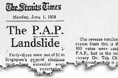

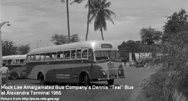
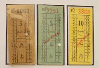 In 1951, two of the companies Soon Lee Bus Company and Ngo Hock Bus Company joined to form the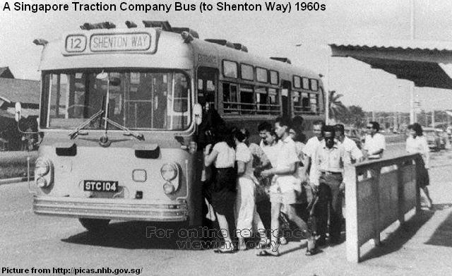
 The three companies were identified by the colours of blue, red and yellow respectively for their fleets of buses, while STC buses were painted green. In operation wise, ABC ran in the western parts of Singapore, while ABS took charge of the east. UBC was given the northern routes whereas STC continued their operations in southern Singapore.
 By late 1971, STC could not continue their operations due to massive losses, and had its business taken over by the other three bus companies. Hundreds of buses owned by STC were parked at the National Stadium waiting for collection by ABC, ABS and UBC. The three companies themselves, however, were pushed by the Singapore government for an eventual merger in November 1973 to form the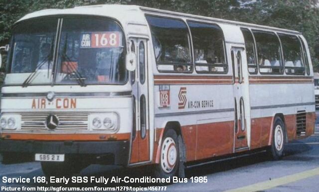

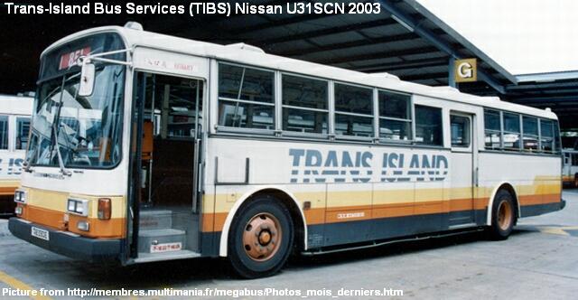
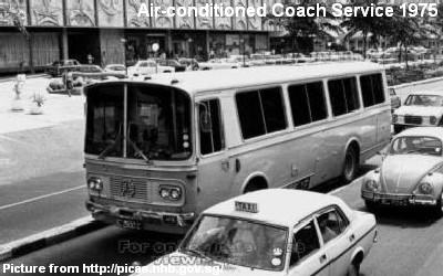 Started in June 1975, the Air-Conditioned Coach Service ran on every morning and evening to pick up commuters, at a dollar each, from large private estates to the CBD. The CBD Bus Service, on the other hand, was introduced in 1978. It charged a flat rate of 50c to ferry commuters from Orchard’s Tomlinson Road to the World Trade Centre. Since 1984, the Mini Air-Conditioned Service operated 26 buses in six bus routes travelling from the private and public housing estates to the CBD during peak hours. The cost per passenger varied between $1.20 and $2.00.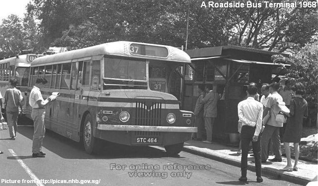
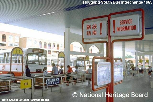
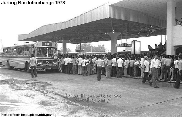
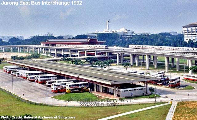
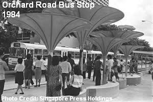 In 1978, the Jurong Bus Interchange became Singapore’s first bus interchange. The early bus interchanges were mainly shared by the SBS, TIBS, SSB and Scheme B bus operators. Until the completion of the Woodlands Bus Interchange in 1996 by the Mass Rapid Transit Corporation (MRTC), all the early bus interchanges were designed and built by the Housing and Development Board (HDB), which was also the main architect of bus stops and other facilities for the public transport.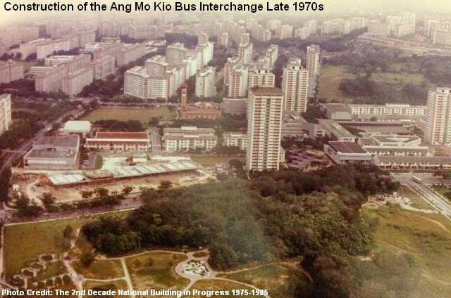
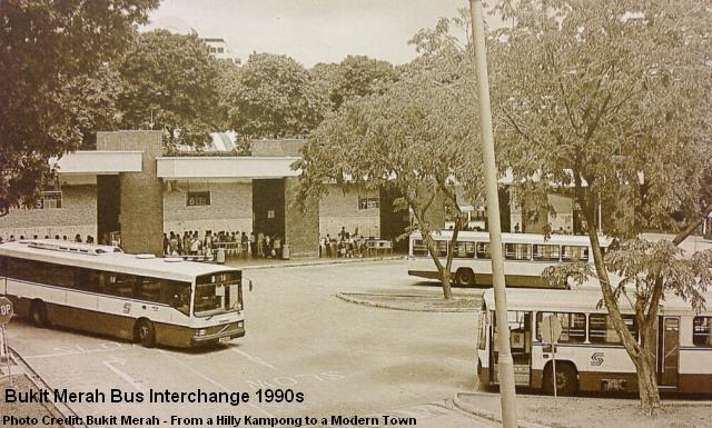
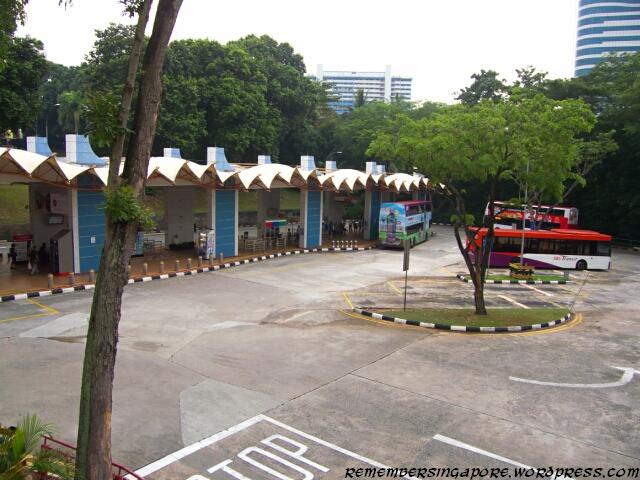
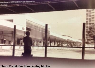 The new interchange reopened in 1983, and continued for almost 20 years before it was shifted to a temporary location near the Ang Mo Kio Library in 2002. The former interchange used to have a fleet of feeder services (Service 26x) that went around the new town. Some services had been terminated, with only four remaining today.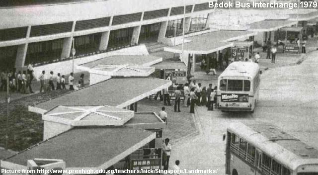

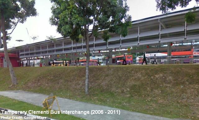
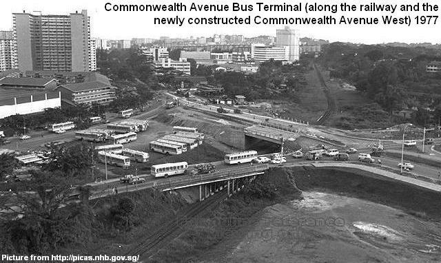
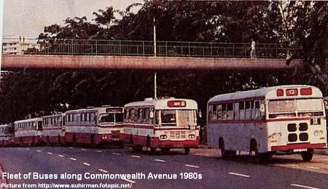
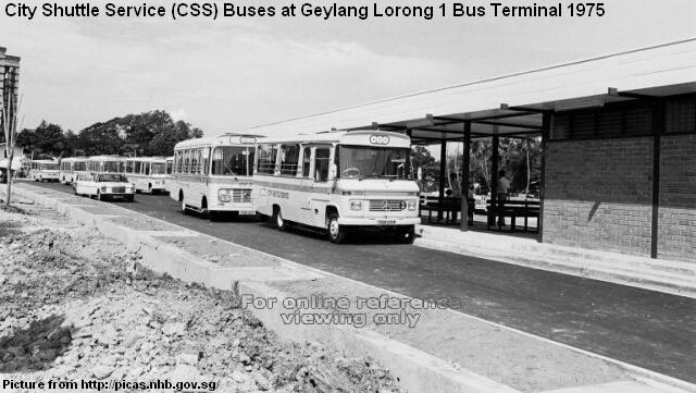


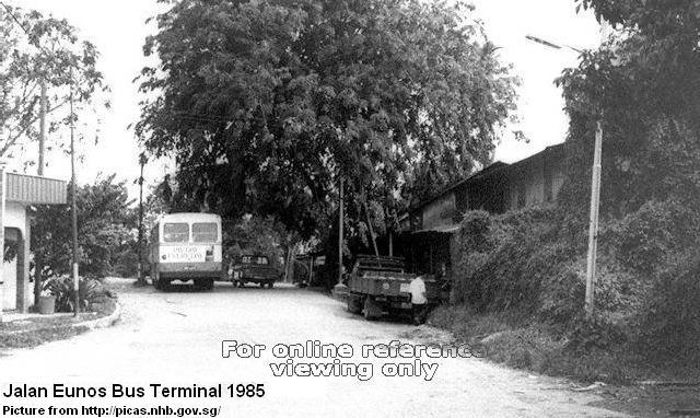
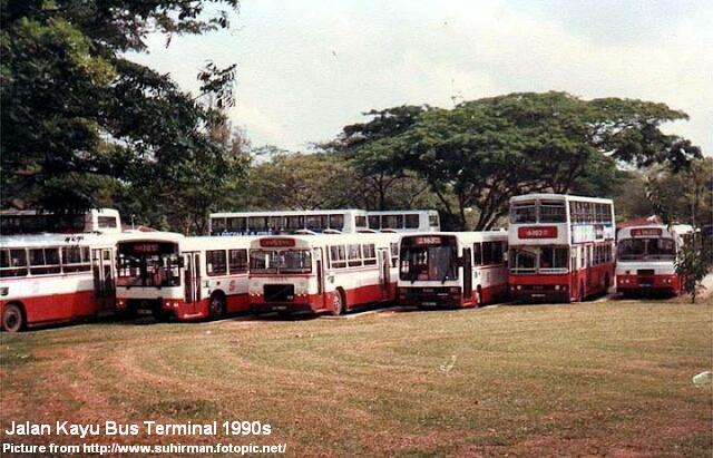
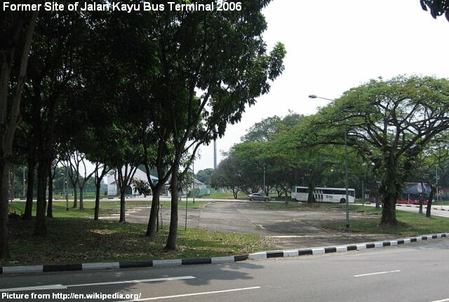
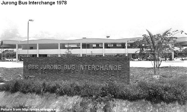
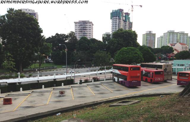

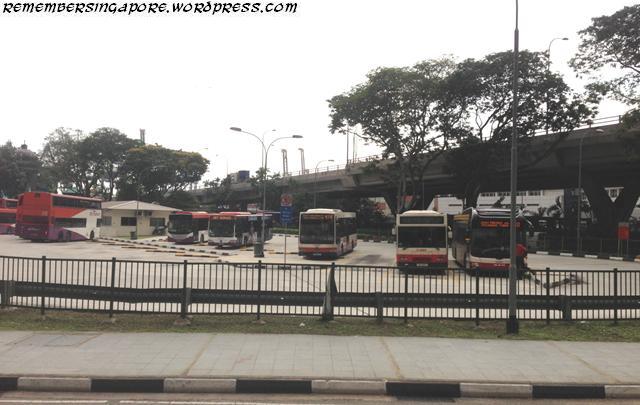

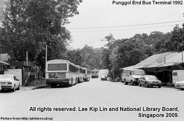
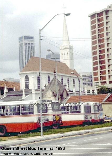
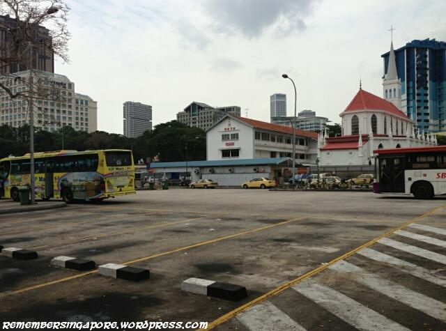
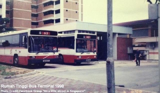
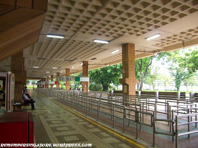
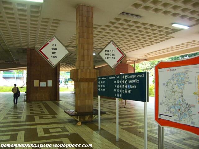

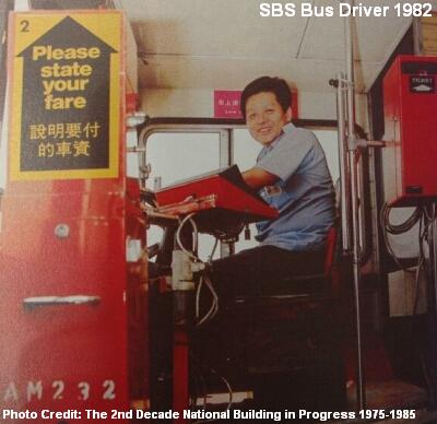 Somapah Bus Interchange was converted to Somapah Bus Terminal in 1983 after the airport services were withdrawn, replaced by the new SBS Changi Airport Bus Plan. Another trunk service 10 was terminated in 1986, leaving the bus terminal with only four services. By 1989, Somapah Bus Terminal was officially shut down. Service 11 was stopped while the remaining three bus services (12, 14, 155) were relocated to Pasir Ris, Changi Village and Marine Parade respectively.





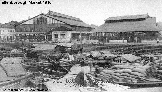
 In 1890, the Municipal Authorities bought the land and built a new cast-iron market which had extensions and wings added over the years. Its iconic six metre tall fountain, made in Scotland, was brought over from Telok Ayer Market in 1902. The fountain accompanied Orchard Road Market for some eighty years before it was shifted again to Raffles Hotel.


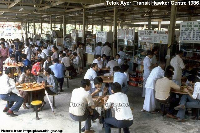
 The popular Simon Road Market was built in August 1948, initially at the nearby Lim Ah Pin Road before moving to Simon Road, or fondly known as “ow gang lark kok jio” (Hougang sixth milestone).
 When Simon Road Market was first set up, it was met with poor response by the public. A series of publicity campaigns was carried before things improved. From then on, vegetable farmers from Potong Pasir and fishermen from Kangkar and Serangoon River would bring their products to Simon Road Market every morning for sale.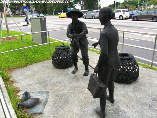
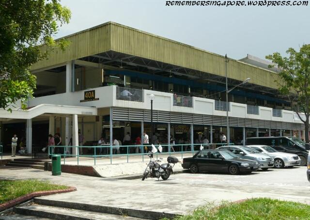
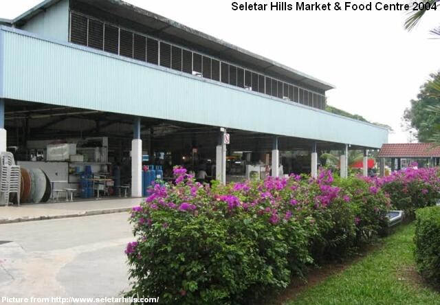
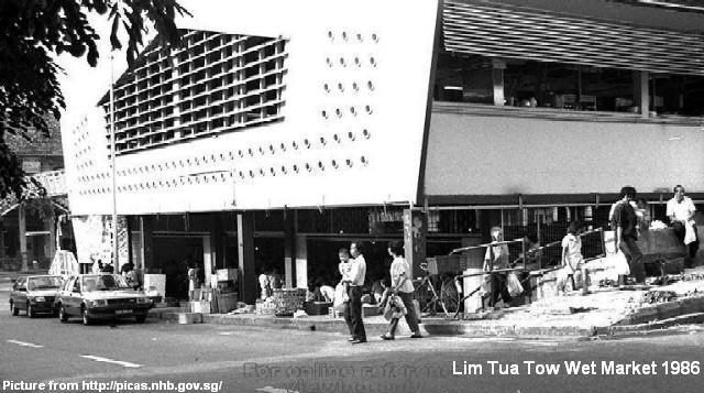
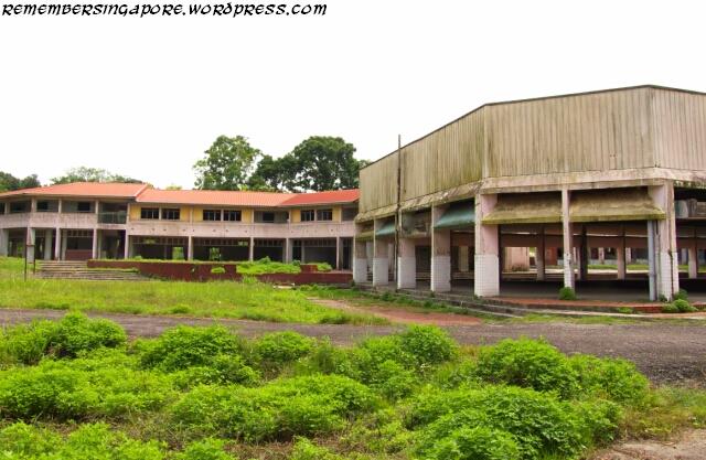
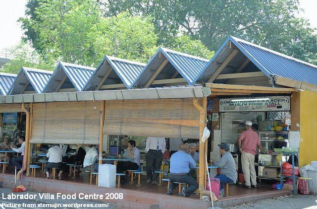
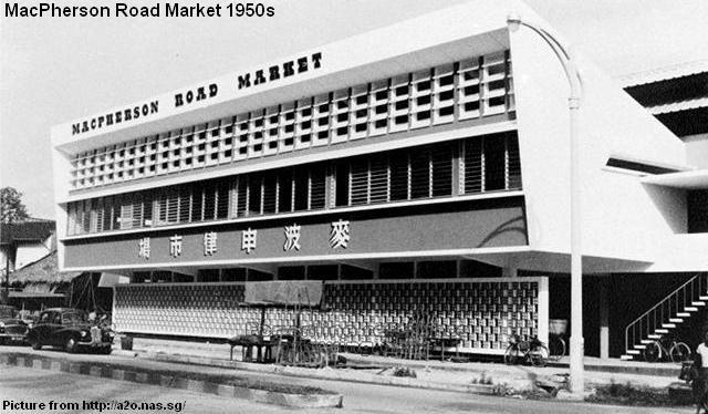
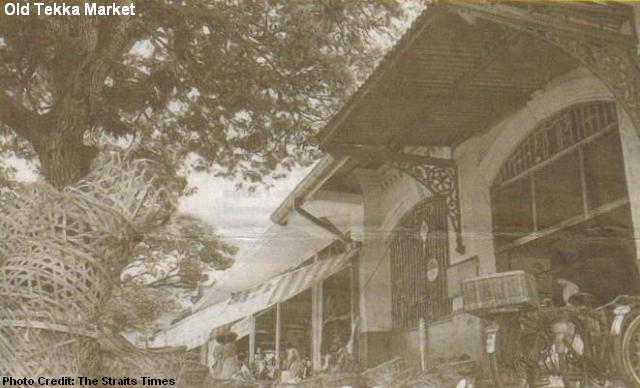
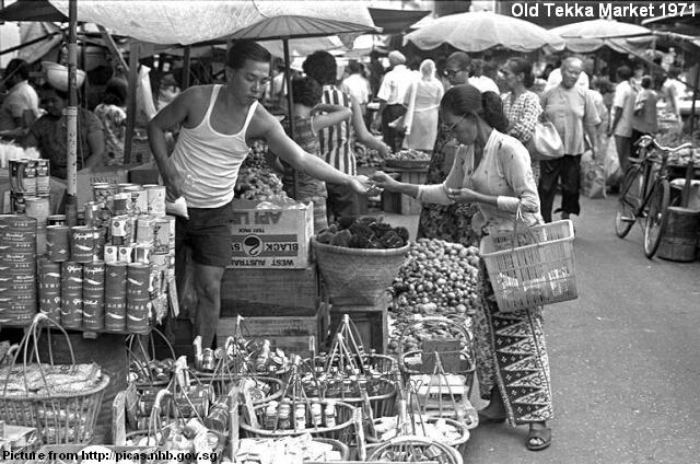
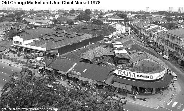
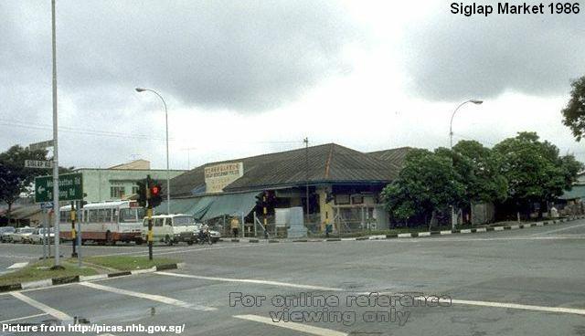
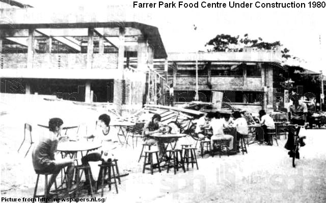
 Some hawker centres do make a comeback.